Property Record
1437 Harmony Ct, Itasca, IL 60143

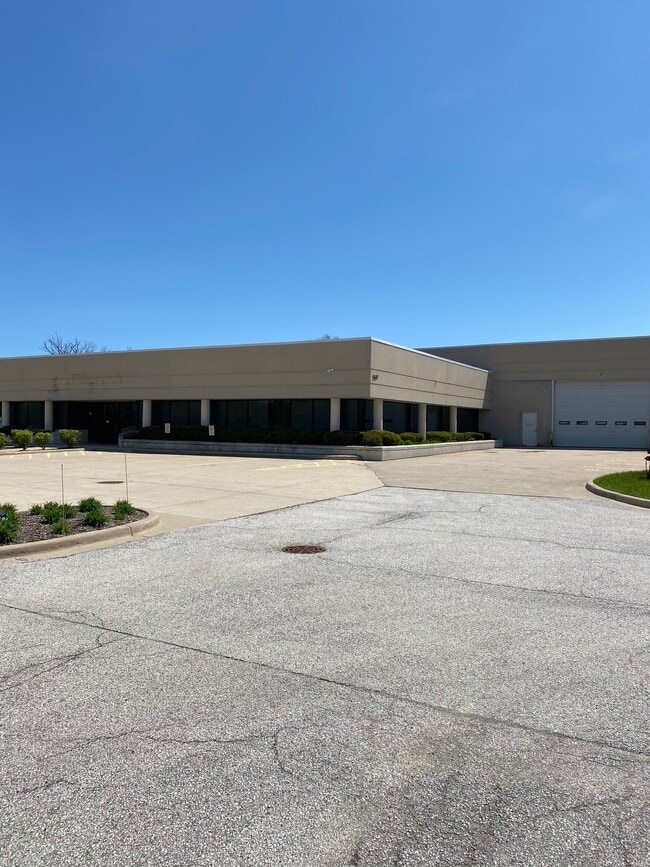
Property Detail
1437 Harmony Ct
03-09-101-023
CONCRETE CONCEPTS RESUB ALL
Industrialgeneral
DuPage
I
Illinois
AE The base floodplain where base flood elevations are provided. AE Zones are now used on new format FIRMs instead of A1-A30 Zones.
5
2024
1.14 AC
2024
O'Hare
840101
Chicago
15,700 SF
Chicago-Naperville-Elgin, IL-IN
NEARBY LISTINGS FOR SALE OR LEASE
DEMOGRAPHICS near 1437 Harmony Ct
1 mile
3 mile
5 mile
2024 Total Population
8,084
75,046
192,023
2029 Population
8,100
75,451
193,123
Pop Growth 2024-2029
+ 0.20%
+ 0.54%
+ 0.57%
Average Age
42
42
41
2024 Total Households
2,930
28,216
71,445
HH Growth 2024-2029
+ 0.14%
+ 0.42%
+ 0.48%
Median Household Inc
$96,287
$91,404
$90,126
Avg Household Size
2.70
2.60
2.60
2024 Avg HH Vehicles
2.00
2.00
2.00
Median Home Value
$334,010
$331,921
$330,619
Median Year Built
1967
1971
1973
Nearby Places
Map Layers
Map Styles
 Street
 Aerial
Transit
 Traffic
 Biking
Places
Listings with unknown addresses are not visible on the map
- Restaurants
- Banks
- Shops
- Fitness
- Groceries
PUBLIC TRANSPORTATION
COMMUTER RAIL
Itasca Station (Milwaukee District West Line - Northeast Illinois Regional Commuter Railroad (Metra))
Drive
Walk
Distance
Itasca Station (Milwaukee District West Line - Northeast Illinois Regional Commuter Railroad (Metra))
4 min
1.6 mi
Wood Dale Station (Milwaukee District West Line - Northeast Illinois Regional Commuter Railroad (Metra))
Drive
Walk
Distance
Wood Dale Station (Milwaukee District West Line - Northeast Illinois Regional Commuter Railroad (Metra))
4 min
2.0 mi
AIRPORT
Chicago O'Hare International
Drive
Walk
Distance
Chicago O'Hare International
18 min
10.9 mi
Chicago Midway International
Drive
Walk
Distance
Chicago Midway International
38 min
22.6 mi
Freight Ports
Port Milwaukee
Drive
Walk
Distance
Port Milwaukee
103 min
84.4 mi
SALE & LEASE HISTORY
LISTING DATE
SALE/LEASE

Nov 25, 2019
For Sale
May 09, 2020
For Lease
Nearby Properties
Address
Land Use
TOTAL SIZE
Lot Size
Zoning
Address
Land Use
TOTAL SIZE
Lot Size
Zoning
Address
Land Use
TOTAL SIZE
Lot Size
Zoning
310,751 SF
15.04 AC
Address
Land Use
TOTAL SIZE
Lot Size
Zoning
333,258 SF
9.48 AC
Address
Land Use
TOTAL SIZE
Lot Size
Zoning
108,216 SF
7.87 AC
Address
Land Use
TOTAL SIZE
Lot Size
Zoning
189,290 SF
9.51 AC
Address
Land Use
TOTAL SIZE
Lot Size
Zoning
410,822 SF
14.26 AC
Address
Land Use
TOTAL SIZE
Lot Size
Zoning
208,000 SF
10.35 AC
Address
Land Use
TOTAL SIZE
Lot Size
Zoning
18.91 AC
Address
Land Use
TOTAL SIZE
Lot Size
Zoning
Address
Land Use
TOTAL SIZE
Lot Size
Zoning
132,699 SF
6.74 AC
Address
Land Use
TOTAL SIZE
Lot Size
Zoning
179,780 SF
8.12 AC
I
Address
Land Use
TOTAL SIZE
Lot Size
Zoning
457,762 SF
23 AC
M
Address
Land Use
TOTAL SIZE
Lot Size
Zoning
58,373 SF
11.22 AC
Address
Land Use
TOTAL SIZE
Lot Size
Zoning
17.67 AC
Address
Land Use
TOTAL SIZE
Lot Size
Zoning
74,664 SF
3.19 AC
Address
Land Use
TOTAL SIZE
Lot Size
Zoning
Address
Land Use
TOTAL SIZE
Lot Size
Zoning
17.73 AC
Address
Land Use
TOTAL SIZE
Lot Size
Zoning
14.76 AC
Address
Land Use
TOTAL SIZE
Lot Size
Zoning
525,422 SF
8.45 AC
C
Address
Land Use
TOTAL SIZE
Lot Size
Zoning
15.32 AC
Address
Land Use
TOTAL SIZE
Lot Size
Zoning
487,027 SF
8.36 AC
C
Address
Land Use
TOTAL SIZE
Lot Size
Zoning
15.29 AC
Address
Land Use
TOTAL SIZE
Lot Size
Zoning
14.35 AC
Address
Land Use
TOTAL SIZE
Lot Size
Zoning
450,614 SF
17.97 AC
C
Address
Land Use
TOTAL SIZE
Lot Size
Zoning
469,492 SF
14.87 AC
I
Address
Land Use
TOTAL SIZE
Lot Size
Zoning
24.82 AC
Address
Land Use
TOTAL SIZE
Lot Size
Zoning
24.82 AC
Address
Land Use
TOTAL SIZE
Lot Size
Zoning
Address
Land Use
TOTAL SIZE
Lot Size
Zoning
24.82 AC
Address
Land Use
TOTAL SIZE
Lot Size
Zoning
441,232 SF
34.52 AC
I
The World's #1 Commercial Real Estate Marketplace
Connect with us
© 2026 CoStar Group
The information above has been obtained from sources believed reliable. While we do not doubt its accuracy we have not verified it and make no guarantee, warranty or representation about it. It is your responsibility to independently confirm its accuracy and completeness. Any projections, opinions, assumptions, or estimates used are for example only and do not represent the current or future performance of the property. The value of this transaction to you depends on tax and other factors which should be evaluated by your tax, financial, and legal advisors. You and your advisors should conduct a careful, independent investigation of the property to determine to your satisfaction the suitability of the property for your needs.