Property Record
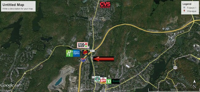
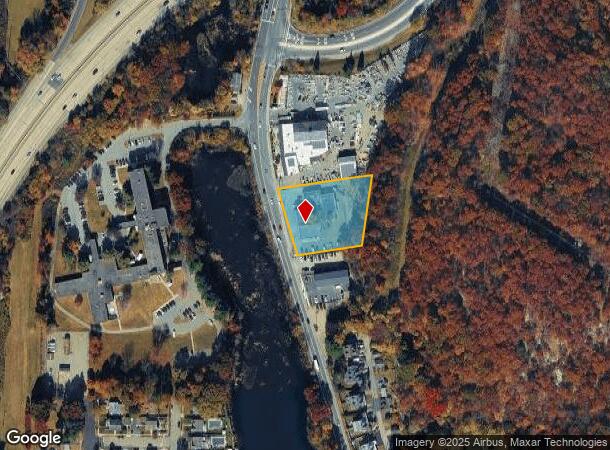
1438 Ringwood Ave, Haskell, NJ 07420
NEARBY LISTINGS FOR SALE OR LEASE
-
-
-
No Photo
-
-
-
-
-
View all Haskell listings for lease on LoopNet.com
Property Detail
1438 Ringwood Ave
13-00478-0000-00004
Passaic
Commercialnec
New Jersey
X
4
34031C0143G
0.32 AC
2024
Upper Suburban Passaic
2025
Northern New Jersey
236601
New York-Jersey City-White Plains, NY-NJ
DEMOGRAPHICS near 1438 Ringwood Ave
1 Mile
3 Mile
5 Mile
2024 Total Population
7,240
50,103
113,411
2029 Population
7,213
49,706
112,853
Pop Growth 2024-2029
(0.37%)
(0.79%)
(0.49%)
Average Age
41
45
43
2024 Total Households
2,871
19,899
41,985
HH Growth 2024-2029
(0.38%)
(0.98%)
(0.68%)
Median Household Inc
$92,528
$106,687
$120,495
Avg Household Size
2.50
2.50
2.60
2024 Avg HH Vehicles
2.00
2.00
2.00
Median Home Value
$341,005
$387,045
$452,510
Median Year Built
1964
1966
1966
Nearby Places
Map Layers
Map Styles
 Street
 Aerial
- Restaurants
- Banks
- Shops
- Fitness
- Groceries
PUBLIC TRANSPORTATION
COMMUTER RAIL
Lincoln Park (Montclair-Boonton Line - NJ Transit Commuter Rail (NJ Transit))
DRIVE
WALK
Distance
Lincoln Park (Montclair-Boonton Line - NJ Transit Commuter Rail (NJ Transit))
11 min
7.0 mi
AIRPORT
Newark Liberty International
DRIVE
WALK
Distance
Newark Liberty International
37 min
30.8 mi
LaGuardia
DRIVE
WALK
Distance
LaGuardia
48 min
34.7 mi
Freight Ports
Port Newark Container Terminal
DRIVE
WALK
Distance
Port Newark Container Terminal
42 min
30.2 mi
SALE & LEASE HISTORY
LISTING DATE
SALE/LEASE

Oct 09, 2017
For Lease
Oct 09, 2017
For Sale
Nearby Properties
Address
Land Use
TOTAL SIZE
Lot Size
Zoning
Address
Land Use
TOTAL SIZE
Lot Size
Zoning
Address
Land Use
TOTAL SIZE
Lot Size
Zoning
143.16 AC
PUD
Address
Land Use
TOTAL SIZE
Lot Size
Zoning
10.88 AC
Address
Land Use
TOTAL SIZE
Lot Size
Zoning
264,080 SF
44.44 AC
HB
Address
Land Use
TOTAL SIZE
Lot Size
Zoning
5.01 AC
IP
Address
Land Use
TOTAL SIZE
Lot Size
Zoning
8.07 AC
IP
Address
Land Use
TOTAL SIZE
Lot Size
Zoning
14.04 AC
B2
Address
Land Use
TOTAL SIZE
Lot Size
Zoning
49,925 SF
4.08 AC
R-4
Address
Land Use
TOTAL SIZE
Lot Size
Zoning
10.42 AC
B2
Address
Land Use
TOTAL SIZE
Lot Size
Zoning
231.26 AC
PRC
Address
Land Use
TOTAL SIZE
Lot Size
Zoning
25,064 SF
14.53 AC
HB
Address
Land Use
TOTAL SIZE
Lot Size
Zoning
131,306 SF
14.40 AC
HB
Address
Land Use
TOTAL SIZE
Lot Size
Zoning
103,603 SF
12.12 AC
LI
Address
Land Use
TOTAL SIZE
Lot Size
Zoning
7.58 AC
R-4
Address
Land Use
TOTAL SIZE
Lot Size
Zoning
1,675.67 AC
Address
Land Use
TOTAL SIZE
Lot Size
Zoning
6.99 AC
IP
Address
Land Use
TOTAL SIZE
Lot Size
Zoning
Address
Land Use
TOTAL SIZE
Lot Size
Zoning
109,848 SF
14.01 AC
HB
Address
Land Use
TOTAL SIZE
Lot Size
Zoning
9.13 AC
R-G
Address
Land Use
TOTAL SIZE
Lot Size
Zoning
6 AC
IP
Address
Land Use
TOTAL SIZE
Lot Size
Zoning
8.87 AC
RA1
Address
Land Use
TOTAL SIZE
Lot Size
Zoning
6.30 AC
I-2
Address
Land Use
TOTAL SIZE
Lot Size
Zoning
13.72 AC
RO
Address
Land Use
TOTAL SIZE
Lot Size
Zoning
2,372 SF
5 AC
IP
Address
Land Use
TOTAL SIZE
Lot Size
Zoning
8,978 SF
7.04 AC
R-4
Address
Land Use
TOTAL SIZE
Lot Size
Zoning
6.95 AC
I-2
Address
Land Use
TOTAL SIZE
Lot Size
Zoning
2.93 AC
B-5
Address
Land Use
TOTAL SIZE
Lot Size
Zoning
2.50 AC
B2
Address
Land Use
TOTAL SIZE
Lot Size
Zoning
67,570 SF
3.02 AC
SC
Address
Land Use
TOTAL SIZE
Lot Size
Zoning
357,779 SF
16.98 AC
The World's #1 Commercial Real Estate Marketplace
Connect with us
© 2025 CoStar Group
The information above has been obtained from sources believed reliable. While we do not doubt its accuracy we have not verified it and make no guarantee, warranty or representation about it. It is your responsibility to independently confirm its accuracy and completeness. Any projections, opinions, assumptions, or estimates used are for example only and do not represent the current or future performance of the property. The value of this transaction to you depends on tax and other factors which should be evaluated by your tax, financial, and legal advisors. You and your advisors should conduct a careful, independent investigation of the property to determine to your satisfaction the suitability of the property for your needs.