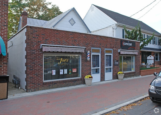
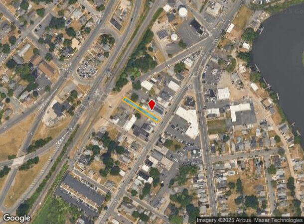
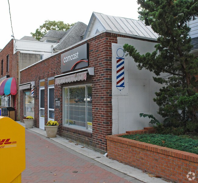
Property Record
144 Broadway, Westville, NJ 08093
NEARBY LISTINGS FOR SALE OR LEASE
Property Detail
144 Broadway
21-00033-0000-00011
Gloucester
Storemultistory
New Jersey
X
11
34007C0082F
0.15 AC
2024
Gloucester County
2025
Philadelphia
500100
Philadelphia-Camden-Wilmington, PA-NJ-DE-MD
4,316 SF
DEMOGRAPHICS near 144 Broadway
1 Mile
3 Mile
5 Mile
2024 Total Population
10,770
53,518
109,434
2029 Population
11,150
55,461
113,157
Pop Growth 2024-2029
+ 3.53%
+ 3.63%
+ 3.40%
Average Age
41
39
40
2024 Total Households
4,182
18,113
38,550
HH Growth 2024-2029
+ 3.61%
+ 3.99%
+ 3.60%
Median Household Inc
$90,021
$96,004
$103,072
Avg Household Size
2.50
2.60
2.60
2024 Avg HH Vehicles
2.00
2.00
2.00
Median Home Value
$222,783
$270,747
$285,500
Median Year Built
1951
1979
1981
Nearby Places
Map Layers
Map Styles
 Street
 Aerial
- Restaurants
- Banks
- Shops
- Fitness
- Groceries
PUBLIC TRANSPORTATION
COMMUTER RAIL
Cherry Hill (Atlantic City Line - NJ Transit Commuter Rail (NJ Transit))
DRIVE
WALK
Distance
Cherry Hill (Atlantic City Line - NJ Transit Commuter Rail (NJ Transit))
12 min
7.8 mi
Market East (R1 - Southeastern Pennsylvania Transportation Authority Regional Rail (SEPTA Regional Rail), R2 - Southeastern Pennsylvania Transportation Authority Regional Rail (SEPTA Regional Rail), R3 - Southeastern Pennsylvania Transportation Authority Regional Rail (SEPTA Regional Rail), R5 - Southeastern Pennsylvania Transportation Authority Regional Rail (SEPTA Regional Rail), R6 - Southeastern Pennsylvania Transportation Authority Regional Rail (SEPTA Regional Rail), R7 - Southeastern Pennsylvania Transportation Authority Regional Rail (SEPTA Regional Rail), R8 - Southeastern Pennsylvania Transportation Authority Regional Rail (SEPTA Regional Rail))
DRIVE
WALK
Distance
Market East (R1 - Southeastern Pennsylvania Transportation Authority Regional Rail (SEPTA Regional Rail), R2 - Southeastern Pennsylvania Transportation Authority Regional Rail (SEPTA Regional Rail), R3 - Southeastern Pennsylvania Transportation Authority Regional Rail (SEPTA Regional Rail), R5 - Southeastern Pennsylvania Transportation Authority Regional Rail (SEPTA Regional Rail), R6 - Southeastern Pennsylvania Transportation Authority Regional Rail (SEPTA Regional Rail), R7 - Southeastern Pennsylvania Transportation Authority Regional Rail (SEPTA Regional Rail), R8 - Southeastern Pennsylvania Transportation Authority Regional Rail (SEPTA Regional Rail))
15 min
9.0 mi
AIRPORT
Philadelphia International
DRIVE
WALK
Distance
Philadelphia International
23 min
12.8 mi
Trenton Mercer
DRIVE
WALK
Distance
Trenton Mercer
58 min
38.8 mi
Atlantic City International
DRIVE
WALK
Distance
Atlantic City International
80 min
48.8 mi
Freight Ports
Broadway Terminal - Pier 5
DRIVE
WALK
Distance
Broadway Terminal - Pier 5
7 min
2.9 mi
Nearby Properties
Address
Land Use
TOTAL SIZE
Lot Size
Zoning
Address
Land Use
TOTAL SIZE
Lot Size
Zoning
80,064 SF
51.52 AC
I3
Address
Land Use
TOTAL SIZE
Lot Size
Zoning
810.21 AC
0108
Address
Land Use
TOTAL SIZE
Lot Size
Zoning
3.85 AC
CMX3
Address
Land Use
TOTAL SIZE
Lot Size
Zoning
47.20 AC
I3
Address
Land Use
TOTAL SIZE
Lot Size
Zoning
44.20 AC
I1
Address
Land Use
TOTAL SIZE
Lot Size
Zoning
1.66 AC
R01
Address
Land Use
TOTAL SIZE
Lot Size
Zoning
30.63 AC
R10
Address
Land Use
TOTAL SIZE
Lot Size
Zoning
79,400 SF
3.05 AC
CMX3
Address
Land Use
TOTAL SIZE
Lot Size
Zoning
106,200 SF
3.87 AC
CMX3
Address
Land Use
TOTAL SIZE
Lot Size
Zoning
80,052 SF
4.41 AC
CMX3
Address
Land Use
TOTAL SIZE
Lot Size
Zoning
100,000 SF
2.42 AC
CMX3
Address
Land Use
TOTAL SIZE
Lot Size
Zoning
134,568 SF
5.94 AC
I2
Address
Land Use
TOTAL SIZE
Lot Size
Zoning
78.64 AC
Address
Land Use
TOTAL SIZE
Lot Size
Zoning
338,373 SF
6.45 AC
IP
Address
Land Use
TOTAL SIZE
Lot Size
Zoning
Address
Land Use
TOTAL SIZE
Lot Size
Zoning
25.77 AC
R10
Address
Land Use
TOTAL SIZE
Lot Size
Zoning
579,304 SF
26.98 AC
IP
Address
Land Use
TOTAL SIZE
Lot Size
Zoning
95,676 SF
6.64 AC
I2
Address
Land Use
TOTAL SIZE
Lot Size
Zoning
27.25 AC
Address
Land Use
TOTAL SIZE
Lot Size
Zoning
67.33 AC
BC2
Address
Land Use
TOTAL SIZE
Lot Size
Zoning
57.58 AC
C
Address
Land Use
TOTAL SIZE
Lot Size
Zoning
Address
Land Use
TOTAL SIZE
Lot Size
Zoning
56,412 SF
2.02 AC
CMX3
Address
Land Use
TOTAL SIZE
Lot Size
Zoning
15.75 AC
Address
Land Use
TOTAL SIZE
Lot Size
Zoning
132.57 AC
M2
Address
Land Use
TOTAL SIZE
Lot Size
Zoning
29.23 AC
BC3
Address
Land Use
TOTAL SIZE
Lot Size
Zoning
Address
Land Use
TOTAL SIZE
Lot Size
Zoning
Address
Land Use
TOTAL SIZE
Lot Size
Zoning
288,766 SF
12.40 AC
I2
Address
Land Use
TOTAL SIZE
Lot Size
Zoning
21.60 AC
The World's #1 Commercial Real Estate Marketplace
Connect with us
© 2025 CoStar Group
The information above has been obtained from sources believed reliable. While we do not doubt its accuracy we have not verified it and make no guarantee, warranty or representation about it. It is your responsibility to independently confirm its accuracy and completeness. Any projections, opinions, assumptions, or estimates used are for example only and do not represent the current or future performance of the property. The value of this transaction to you depends on tax and other factors which should be evaluated by your tax, financial, and legal advisors. You and your advisors should conduct a careful, independent investigation of the property to determine to your satisfaction the suitability of the property for your needs.