Property Record
144 Runnymeade Rd, Bunker Hill, WV 25413
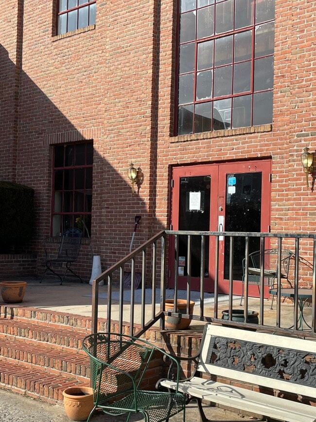

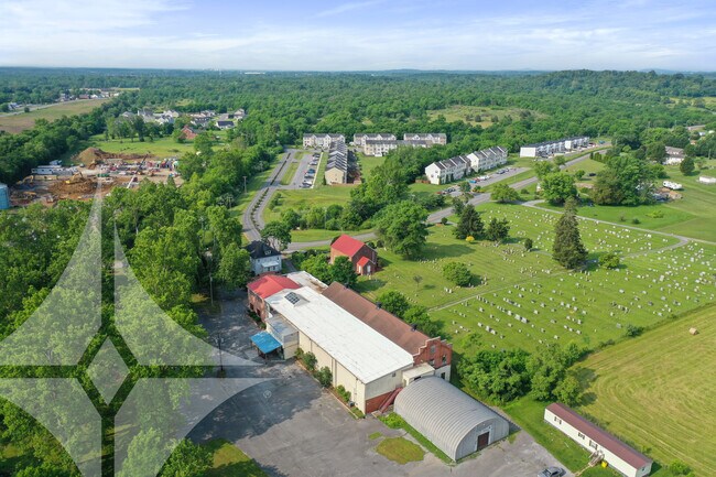
This Property Is For Sale
NEARBY LISTINGS FOR SALE OR LEASE
-
-
View all Bunker Hill listings for sale on LoopNet.com
Property Detail
144 Runnymeade Rd
07-9-00680002
3.06 AC RESIDUE PLAT OF STORAGE INWOOD STORAGE CO
Storebuilding
Berkeley
AE
West Virginia
54037C0080E
3.06 AC
2025
Berkeley County
2025
Washington, DC
972101
Hagerstown-Martinsburg, MD-WV
DEMOGRAPHICS near 144 Runnymeade Rd
1 Mile
3 Mile
5 Mile
2024 Total Population
3,834
18,618
31,230
2029 Population
4,406
21,375
35,664
Pop Growth 2024-2029
+ 14.92%
+ 14.81%
+ 14.20%
Average Age
37
38
39
2024 Total Households
1,403
6,952
11,825
HH Growth 2024-2029
+ 15.54%
+ 15.38%
+ 14.69%
Median Household Inc
$73,111
$76,417
$81,512
Avg Household Size
2.70
2.60
2.60
2024 Avg HH Vehicles
2.00
2.00
2.00
Median Home Value
$195,668
$218,080
$228,543
Median Year Built
1998
2001
1998
Nearby Places
Map Layers
Map Styles
 Street
 Aerial
- Restaurants
- Banks
- Shops
- Fitness
- Groceries
PUBLIC TRANSPORTATION
AIRPORT
Hagerstown Regional/Richard A Henson Field
DRIVE
WALK
Distance
Hagerstown Regional/Richard A Henson Field
43 min
34.9 mi
Nearby Properties
Address
Land Use
TOTAL SIZE
Lot Size
Zoning
Address
Land Use
TOTAL SIZE
Lot Size
Zoning
60.09 AC
Address
Land Use
TOTAL SIZE
Lot Size
Zoning
Address
Land Use
TOTAL SIZE
Lot Size
Zoning
45.60 AC
Address
Land Use
TOTAL SIZE
Lot Size
Zoning
15.34 AC
Address
Land Use
TOTAL SIZE
Lot Size
Zoning
Address
Land Use
TOTAL SIZE
Lot Size
Zoning
14.16 AC
Address
Land Use
TOTAL SIZE
Lot Size
Zoning
Address
Land Use
TOTAL SIZE
Lot Size
Zoning
6.74 AC
Address
Land Use
TOTAL SIZE
Lot Size
Zoning
5.21 AC
Address
Land Use
TOTAL SIZE
Lot Size
Zoning
5,206 SF
0.29 AC
PSC*
Address
Land Use
TOTAL SIZE
Lot Size
Zoning
3.80 AC
Address
Land Use
TOTAL SIZE
Lot Size
Zoning
1.27 AC
Address
Land Use
TOTAL SIZE
Lot Size
Zoning
2.30 AC
Address
Land Use
TOTAL SIZE
Lot Size
Zoning
21.19 AC
Address
Land Use
TOTAL SIZE
Lot Size
Zoning
50.46 AC
Address
Land Use
TOTAL SIZE
Lot Size
Zoning
3.47 AC
Address
Land Use
TOTAL SIZE
Lot Size
Zoning
2.11 AC
Address
Land Use
TOTAL SIZE
Lot Size
Zoning
1.37 AC
Address
Land Use
TOTAL SIZE
Lot Size
Zoning
6.95 AC
Address
Land Use
TOTAL SIZE
Lot Size
Zoning
4.50 AC
Address
Land Use
TOTAL SIZE
Lot Size
Zoning
4.92 AC
Address
Land Use
TOTAL SIZE
Lot Size
Zoning
12.19 AC
Address
Land Use
TOTAL SIZE
Lot Size
Zoning
22.80 AC
Address
Land Use
TOTAL SIZE
Lot Size
Zoning
3.67 AC
Address
Land Use
TOTAL SIZE
Lot Size
Zoning
2.49 AC
Address
Land Use
TOTAL SIZE
Lot Size
Zoning
Address
Land Use
TOTAL SIZE
Lot Size
Zoning
2.50 AC
Address
Land Use
TOTAL SIZE
Lot Size
Zoning
0.98 AC
Address
Land Use
TOTAL SIZE
Lot Size
Zoning
3.82 AC
Address
Land Use
TOTAL SIZE
Lot Size
Zoning
4.43 AC
The World's #1 Commercial Real Estate Marketplace
Connect with us
© 2025 CoStar Group
The information above has been obtained from sources believed reliable. While we do not doubt its accuracy we have not verified it and make no guarantee, warranty or representation about it. It is your responsibility to independently confirm its accuracy and completeness. Any projections, opinions, assumptions, or estimates used are for example only and do not represent the current or future performance of the property. The value of this transaction to you depends on tax and other factors which should be evaluated by your tax, financial, and legal advisors. You and your advisors should conduct a careful, independent investigation of the property to determine to your satisfaction the suitability of the property for your needs.