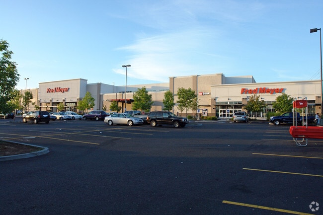
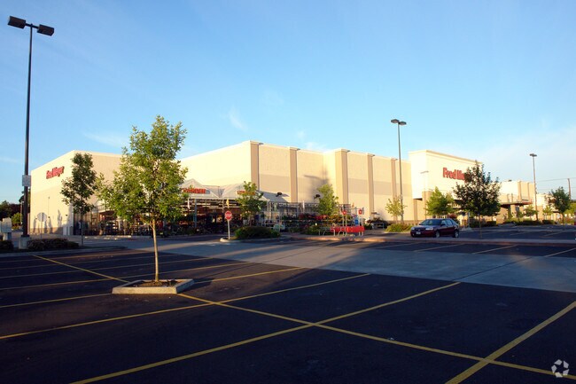
Property Record
1440 N Lombard St, Portland, OR 97217
NEARBY LISTINGS FOR SALE OR LEASE
Property Detail
1440 N Lombard St
R195859
Kenmore
Commercialnec
VAN BURENS ADD, BLOCK 1-5 TL 10600
ARE
Multnomah
41067C0400E
Oregon
2025
0.39 AC
2025
Hayden Island/Swan Island
003802
Portland
11,200 SF
Portland-Vancouver-Hillsboro, OR-WA
DEMOGRAPHICS near 1440 N Lombard St
1 Mile
3 Mile
5 Mile
2024 Total Population
21,213
110,960
308,464
2029 Population
21,020
109,124
308,195
Pop Growth 2024-2029
(0.91%)
(1.65%)
(0.09%)
Average Age
39
39
40
2024 Total Households
9,196
46,986
147,903
HH Growth 2024-2029
(1.13%)
(1.80%)
(0.01%)
Median Household Inc
$92,425
$94,619
$79,863
Avg Household Size
2.20
2.20
2.00
2024 Avg HH Vehicles
2.00
2.00
1.00
Median Home Value
$518,880
$591,271
$618,212
Median Year Built
1948
1952
1963
Nearby Places
Map Layers
Map Styles
 Street
 Aerial
- Restaurants
- Banks
- Shops
- Fitness
- Groceries
PUBLIC TRANSPORTATION
TRANSIT/SUBWAY
N Lombard Transit Center (MAX Yellow Line - Tri-County Metropolitan Transportation District of Oregon Rail (TriMet Rail))
DRIVE
WALK
Distance
N Lombard Transit Center (MAX Yellow Line - Tri-County Metropolitan Transportation District of Oregon Rail (TriMet Rail))
0 min
0 min
0.0 mi
Rosa Parks (MAX Yellow Line - Tri-County Metropolitan Transportation District of Oregon Rail (TriMet Rail))
DRIVE
WALK
Distance
Rosa Parks (MAX Yellow Line - Tri-County Metropolitan Transportation District of Oregon Rail (TriMet Rail))
1 min
9 min
0.5 mi
Kenton/N Denver (MAX Yellow Line - Tri-County Metropolitan Transportation District of Oregon Rail (TriMet Rail))
DRIVE
WALK
Distance
Kenton/N Denver (MAX Yellow Line - Tri-County Metropolitan Transportation District of Oregon Rail (TriMet Rail))
3 min
12 min
0.6 mi
N Killingsworth (MAX Yellow Line - Tri-County Metropolitan Transportation District of Oregon Rail (TriMet Rail))
DRIVE
WALK
Distance
N Killingsworth (MAX Yellow Line - Tri-County Metropolitan Transportation District of Oregon Rail (TriMet Rail))
3 min
19 min
1.0 mi
COMMUTER RAIL
Portland (Amtrak Cascades - Amtrak, Coast Starlight - Amtrak, Empire Builder - Amtrak)
DRIVE
WALK
Distance
Portland (Amtrak Cascades - Amtrak, Coast Starlight - Amtrak, Empire Builder - Amtrak)
7 min
4.0 mi
Vancouver (Amtrak Cascades - Amtrak, Coast Starlight - Amtrak, Empire Builder - Amtrak)
DRIVE
WALK
Distance
Vancouver (Amtrak Cascades - Amtrak, Coast Starlight - Amtrak, Empire Builder - Amtrak)
12 min
5.1 mi
AIRPORT
Portland International
DRIVE
WALK
Distance
Portland International
16 min
7.4 mi
Freight Ports
Port of Portland
DRIVE
WALK
Distance
Port of Portland
8 min
4.7 mi
Nearby Properties
Address
Land Use
TOTAL SIZE
Lot Size
Zoning
Address
Land Use
TOTAL SIZE
Lot Size
Zoning
200,109 SF
70.44 AC
IH
Address
Land Use
TOTAL SIZE
Lot Size
Zoning
395,815 SF
2.66 AC
IRD
Address
Land Use
TOTAL SIZE
Lot Size
Zoning
882,480 SF
80.73 AC
CI1
Address
Land Use
TOTAL SIZE
Lot Size
Zoning
15,473 SF
192.67 AC
IG2
Address
Land Use
TOTAL SIZE
Lot Size
Zoning
257,700 SF
2.89 AC
EX
Address
Land Use
TOTAL SIZE
Lot Size
Zoning
437,419 SF
37.90 AC
IG2
Address
Land Use
TOTAL SIZE
Lot Size
Zoning
Address
Land Use
TOTAL SIZE
Lot Size
Zoning
Address
Land Use
TOTAL SIZE
Lot Size
Zoning
243,371 SF
0.67 AC
CI2
Address
Land Use
TOTAL SIZE
Lot Size
Zoning
262,045 SF
17.10 AC
R5
Address
Land Use
TOTAL SIZE
Lot Size
Zoning
645,294 SF
5.64 AC
CO2D
Address
Land Use
TOTAL SIZE
Lot Size
Zoning
490,802 SF
56.17 AC
CGX
Address
Land Use
TOTAL SIZE
Lot Size
Zoning
193,898 SF
2.50 AC
IRD
Address
Land Use
TOTAL SIZE
Lot Size
Zoning
134,398 SF
3.17 AC
CG
Address
Land Use
TOTAL SIZE
Lot Size
Zoning
1,660,710 SF
110.33 AC
IG2
Address
Land Use
TOTAL SIZE
Lot Size
Zoning
265,110 SF
1.32 AC
EX
Address
Land Use
TOTAL SIZE
Lot Size
Zoning
537,280 SF
NULL
Address
Land Use
TOTAL SIZE
Lot Size
Zoning
85,000 SF
1.65 AC
CI2
Address
Land Use
TOTAL SIZE
Lot Size
Zoning
318,562 SF
33.59 AC
CI1
Address
Land Use
TOTAL SIZE
Lot Size
Zoning
97,000 SF
NULL
Address
Land Use
TOTAL SIZE
Lot Size
Zoning
107,958 SF
2.48 AC
IG2
Address
Land Use
TOTAL SIZE
Lot Size
Zoning
40,595 SF
1.99 AC
IRD
Address
Land Use
TOTAL SIZE
Lot Size
Zoning
96,554 SF
2.02 AC
CM3
Address
Land Use
TOTAL SIZE
Lot Size
Zoning
11,375 SF
1.46 AC
CI2
Address
Land Use
TOTAL SIZE
Lot Size
Zoning
133.11 AC
IG2
Address
Land Use
TOTAL SIZE
Lot Size
Zoning
73,657 SF
1.90 AC
CI1
Address
Land Use
TOTAL SIZE
Lot Size
Zoning
266,958 SF
1.65 AC
EXDG
Address
Land Use
TOTAL SIZE
Lot Size
Zoning
8.01 AC
EG2
Address
Land Use
TOTAL SIZE
Lot Size
Zoning
112,578 SF
2.94 AC
CI2
Address
Land Use
TOTAL SIZE
Lot Size
Zoning
963,658 SF
64.43 AC
IH
The World's #1 Commercial Real Estate Marketplace
Connect with us
© 2026 CoStar Group
The information above has been obtained from sources believed reliable. While we do not doubt its accuracy we have not verified it and make no guarantee, warranty or representation about it. It is your responsibility to independently confirm its accuracy and completeness. Any projections, opinions, assumptions, or estimates used are for example only and do not represent the current or future performance of the property. The value of this transaction to you depends on tax and other factors which should be evaluated by your tax, financial, and legal advisors. You and your advisors should conduct a careful, independent investigation of the property to determine to your satisfaction the suitability of the property for your needs.