Property Record
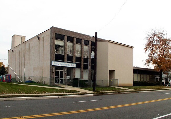
1440 Pennington Rd, Ewing, NJ 08618


Property Detail
1440 Pennington Rd
02-00454-0000-00015
14
Officebuilding
Mercer
PRO
New Jersey
B and X Area of moderate flood hazard, usually the area between the limits of the 100-year and 500-year floods.
15
2024
1.42 AC
2025
Trenton
003400
Northern New Jersey
11,130 SF
Trenton-Princeton, NJ
NEARBY LISTINGS FOR SALE OR LEASE
DEMOGRAPHICS near 1440 Pennington Rd
1 mile
3 mile
5 mile
2025 Total Population
19,350
136,718
249,049
2030 Population
20,159
141,011
255,788
Pop Growth 2025-2030
+ 4.18%
+ 3.14%
+ 2.71%
Average Age
40
39
40
2025 Total Households
7,643
50,048
91,682
HH Growth 2025-2030
+ 4.15%
+ 3.58%
+ 3.03%
Median Household Inc
$49,051
$64,699
$80,388
Avg Household Size
2.50
2.50
2.60
2025 Avg HH Vehicles
2.00
1.00
2.00
Median Home Value
$213,868
$270,205
$341,511
Median Year Built
1953
1953
1957
Nearby Places
Map Layers
Map Styles
 Street
 Aerial
Transit
 Traffic
 Biking
Places
Listings with unknown addresses are not visible on the map
- Restaurants
- Banks
- Shops
- Fitness
- Groceries
PUBLIC TRANSPORTATION
COMMUTER RAIL
Drive
Walk
Distance
6 min
2.8 mi
Trenton Transit Center (NJT) (Northeast Corridor Line - NJ Transit Commuter Rail (NJ Transit), River LINE - River LINE (River LINE))
Drive
Walk
Distance
Trenton Transit Center (NJT) (Northeast Corridor Line - NJ Transit Commuter Rail (NJ Transit), River LINE - River LINE (River LINE))
7 min
3.0 mi
AIRPORT
Trenton Mercer
Drive
Walk
Distance
Trenton Mercer
10 min
4.4 mi
Philadelphia International
Drive
Walk
Distance
Philadelphia International
66 min
44.8 mi
Freight Ports
Port of Philadelphia
Drive
Walk
Distance
Port of Philadelphia
46 min
31.1 mi
Nearby Properties
Address
Land Use
TOTAL SIZE
Lot Size
Zoning
Address
Land Use
TOTAL SIZE
Lot Size
Zoning
67.65 AC
R-1
Address
Land Use
TOTAL SIZE
Lot Size
Zoning
8.23 AC
BA
Address
Land Use
TOTAL SIZE
Lot Size
Zoning
26 AC
HIST
Address
Land Use
TOTAL SIZE
Lot Size
Zoning
6.69 AC
BA
Address
Land Use
TOTAL SIZE
Lot Size
Zoning
13.73 AC
Address
Land Use
TOTAL SIZE
Lot Size
Zoning
Address
Land Use
TOTAL SIZE
Lot Size
Zoning
1,996 SF
125 AC
RA
Address
Land Use
TOTAL SIZE
Lot Size
Zoning
5.97 AC
R-1
Address
Land Use
TOTAL SIZE
Lot Size
Zoning
879,376 SF
2.54 AC
BA
Address
Land Use
TOTAL SIZE
Lot Size
Zoning
4,320 SF
12.06 AC
PRO
Address
Land Use
TOTAL SIZE
Lot Size
Zoning
125,000 SF
3.68 AC
MU
Address
Land Use
TOTAL SIZE
Lot Size
Zoning
96.60 AC
OP-2
Address
Land Use
TOTAL SIZE
Lot Size
Zoning
117.50 AC
OP-1
Address
Land Use
TOTAL SIZE
Lot Size
Zoning
60,000 SF
42.80 AC
IP-1
Address
Land Use
TOTAL SIZE
Lot Size
Zoning
104,448 SF
8.49 AC
IA
Address
Land Use
TOTAL SIZE
Lot Size
Zoning
5.38 AC
MU
Address
Land Use
TOTAL SIZE
Lot Size
Zoning
27.21 AC
PRO
Address
Land Use
TOTAL SIZE
Lot Size
Zoning
288,000 SF
1.23 AC
BA
Address
Land Use
TOTAL SIZE
Lot Size
Zoning
6.11 AC
R-1
Address
Land Use
TOTAL SIZE
Lot Size
Zoning
35.83 AC
RB
Address
Land Use
TOTAL SIZE
Lot Size
Zoning
56.45 AC
EGI
Address
Land Use
TOTAL SIZE
Lot Size
Zoning
0.24 AC
BA
Address
Land Use
TOTAL SIZE
Lot Size
Zoning
186,960 SF
2.37 AC
BA
Address
Land Use
TOTAL SIZE
Lot Size
Zoning
24.44 AC
AT
Address
Land Use
TOTAL SIZE
Lot Size
Zoning
212,074 SF
0.82 AC
BA
Address
Land Use
TOTAL SIZE
Lot Size
Zoning
23.50 AC
R-2
Address
Land Use
TOTAL SIZE
Lot Size
Zoning
Address
Land Use
TOTAL SIZE
Lot Size
Zoning
58,620 SF
1.95 AC
PM
Address
Land Use
TOTAL SIZE
Lot Size
Zoning
161,080 SF
2.21 AC
BA
Address
Land Use
TOTAL SIZE
Lot Size
Zoning
11.40 AC
The World's #1 Commercial Real Estate Marketplace
Connect with us
© 2026 CoStar Group
The information above has been obtained from sources believed reliable. While we do not doubt its accuracy we have not verified it and make no guarantee, warranty or representation about it. It is your responsibility to independently confirm its accuracy and completeness. Any projections, opinions, assumptions, or estimates used are for example only and do not represent the current or future performance of the property. The value of this transaction to you depends on tax and other factors which should be evaluated by your tax, financial, and legal advisors. You and your advisors should conduct a careful, independent investigation of the property to determine to your satisfaction the suitability of the property for your needs.