Property Record
14405 County Road 192, Tyler, TX 75703

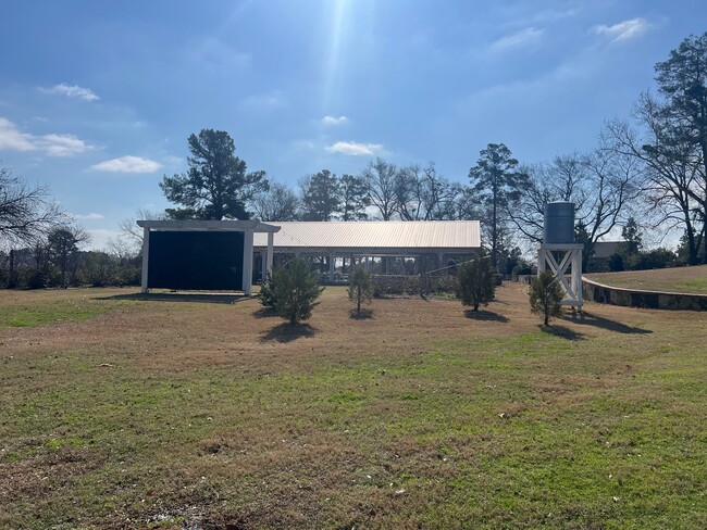
Property Detail
14405 County Road 192
1-00000-0018-06-015010
ABST A0018 T QUEVADO ABST A0018 T QUEVADO TRACT 25.1 (PT 14.342 AC/SEE TR 25) TRACT 25 (PT 14.342 AC/SEE TR 25.1) SPLIT 1 AC
Charitableorganization
Smith
R1B
Texas
B and X Area of moderate flood hazard, usually the area between the limits of the 100-year and 500-year floods.
5.26 AC
2025
Tyler
2025
Other Market Areas
002012
Tyler, TX
4,860 SF
NEARBY LISTINGS FOR SALE OR LEASE
-
-
View all Tyler listings for sale on LoopNet.com
DEMOGRAPHICS near 14405 County Road 192
1 mile
3 mile
5 mile
2025 Total Population
2,499
27,084
69,082
2030 Population
2,719
28,510
72,748
Pop Growth 2025-2030
+ 8.80%
+ 5.27%
+ 5.31%
Average Age
44
41
40
2025 Total Households
980
11,891
28,582
HH Growth 2025-2030
+ 8.67%
+ 4.64%
+ 4.71%
Median Household Inc
$68,906
$75,197
$76,075
Avg Household Size
2.40
2.20
2.30
2025 Avg HH Vehicles
2.00
2.00
2.00
Median Home Value
$616,925
$376,869
$321,234
Median Year Built
2007
1995
1988
Nearby Places
Map Layers
Map Styles
 Street
 Aerial
Layers
 Traffic
 Biking
Places
Listings with unknown addresses are not visible on the map
- Restaurants
- Banks
- Shops
- Fitness
- Groceries
PUBLIC TRANSPORTATION
AIRPORT
Tyler Pounds Regional
Drive
Walk
Distance
Tyler Pounds Regional
21 min
12.2 mi
Freight Ports
Port of Shreveport
Drive
Walk
Distance
Port of Shreveport
132 min
114.7 mi
Nearby Properties
Address
Land Use
TOTAL SIZE
Lot Size
Zoning
Address
Land Use
TOTAL SIZE
Lot Size
Zoning
2,500 SF
19.76 AC
RMF
Address
Land Use
TOTAL SIZE
Lot Size
Zoning
29.58 AC
Address
Land Use
TOTAL SIZE
Lot Size
Zoning
14,504 SF
16.68 AC
Address
Land Use
TOTAL SIZE
Lot Size
Zoning
5,068 SF
18.35 AC
RMF
Address
Land Use
TOTAL SIZE
Lot Size
Zoning
4,333 SF
13.32 AC
Address
Land Use
TOTAL SIZE
Lot Size
Zoning
2,774 SF
16.15 AC
RMF
Address
Land Use
TOTAL SIZE
Lot Size
Zoning
3,724 SF
33.26 AC
RMF
Address
Land Use
TOTAL SIZE
Lot Size
Zoning
53,412 SF
11.17 AC
PMF
Address
Land Use
TOTAL SIZE
Lot Size
Zoning
Address
Land Use
TOTAL SIZE
Lot Size
Zoning
163,161 SF
2.67 AC
Address
Land Use
TOTAL SIZE
Lot Size
Zoning
10.51 AC
Address
Land Use
TOTAL SIZE
Lot Size
Zoning
1,867 SF
13.63 AC
RMF
Address
Land Use
TOTAL SIZE
Lot Size
Zoning
1,920 SF
12.04 AC
RMF
Address
Land Use
TOTAL SIZE
Lot Size
Zoning
43,692 SF
4.02 AC
Address
Land Use
TOTAL SIZE
Lot Size
Zoning
1,813 SF
9.51 AC
RMF
Address
Land Use
TOTAL SIZE
Lot Size
Zoning
90,410 SF
4.94 AC
Address
Land Use
TOTAL SIZE
Lot Size
Zoning
3,477 SF
9.56 AC
RMF
Address
Land Use
TOTAL SIZE
Lot Size
Zoning
2,936 SF
9.66 AC
RMF
Address
Land Use
TOTAL SIZE
Lot Size
Zoning
4,478 SF
9.06 AC
RMF
Address
Land Use
TOTAL SIZE
Lot Size
Zoning
4,096 SF
8.90 AC
RMF
Address
Land Use
TOTAL SIZE
Lot Size
Zoning
1,848 SF
Address
Land Use
TOTAL SIZE
Lot Size
Zoning
19.16 AC
Address
Land Use
TOTAL SIZE
Lot Size
Zoning
105,407 SF
6.14 AC
C4
Address
Land Use
TOTAL SIZE
Lot Size
Zoning
15,400 SF
4.41 AC
RMF
Address
Land Use
TOTAL SIZE
Lot Size
Zoning
58,161 SF
7.02 AC
Address
Land Use
TOTAL SIZE
Lot Size
Zoning
34,758 SF
9.76 AC
Address
Land Use
TOTAL SIZE
Lot Size
Zoning
23,796 SF
10.88 AC
RMF
Address
Land Use
TOTAL SIZE
Lot Size
Zoning
540 SF
6.55 AC
PCD
Address
Land Use
TOTAL SIZE
Lot Size
Zoning
207,849 SF
24.89 AC
Address
Land Use
TOTAL SIZE
Lot Size
Zoning
1,821 SF
9.80 AC
RMF
The World's #1 Commercial Real Estate Marketplace
Connect with us
© 2026 CoStar Group
The information above has been obtained from sources believed reliable. While we do not doubt its accuracy we have not verified it and make no guarantee, warranty or representation about it. It is your responsibility to independently confirm its accuracy and completeness. Any projections, opinions, assumptions, or estimates used are for example only and do not represent the current or future performance of the property. The value of this transaction to you depends on tax and other factors which should be evaluated by your tax, financial, and legal advisors. You and your advisors should conduct a careful, independent investigation of the property to determine to your satisfaction the suitability of the property for your needs.