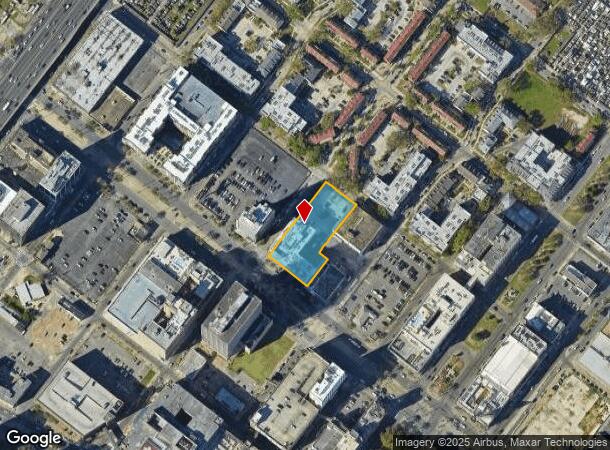
Property Record
1441 Canal St, New Orleans, LA 70112


NEARBY LISTINGS FOR SALE OR LEASE
Property Detail
1441 Canal St
New Orleans-Metairie, LA
SQ 157 LOT 3 CANAL 25X114 LOT 4 CANAL 40X114 LOTS 6 12 5 CANAL AND N MARAIS 99X114 LOTS 9 10 OR 6 N MARAIS 85X128 PT LOT 9 OR 7
2-06-1-050-02
Orleans
Commercialnec
Louisiana
X
3
22051C0225F
1.04 AC
0
Mid-City/Central City
2025
New Orleans/Metairie/Kenner
013400
DEMOGRAPHICS near 1441 Canal St
1 Mile
3 Mile
5 Mile
2024 Total Population
23,207
176,045
355,842
2029 Population
23,336
170,892
343,549
Pop Growth 2024-2029
+ 0.56%
(2.93%)
(3.45%)
Average Age
43
41
41
2024 Total Households
13,419
84,982
158,467
HH Growth 2024-2029
+ 1.02%
(2.87%)
(3.48%)
Median Household Inc
$38,372
$47,679
$50,788
Avg Household Size
1.60
1.90
2.10
2024 Avg HH Vehicles
1.00
1.00
1.00
Median Home Value
$457,843
$353,098
$311,151
Median Year Built
1947
1948
1954
Nearby Places
Map Layers
Map Styles
 Street
 Aerial
- Restaurants
- Banks
- Shops
- Fitness
- Groceries
PUBLIC TRANSPORTATION
TRANSIT/SUBWAY
Canal And Marais/Lasalle (Canal Streetcar - Cemeteries - NORTA, Canal Streetcar - City Park/Muse - NORTA, Canal-Cemeteries Streetcar - NORTA, Canal-Museum Streetcar - NORTA, UPT-Riverfront - NORTA)
DRIVE
WALK
Distance
Canal And Marais/Lasalle (Canal Streetcar - Cemeteries - NORTA, Canal Streetcar - City Park/Muse - NORTA, Canal-Cemeteries Streetcar - NORTA, Canal-Museum Streetcar - NORTA, UPT-Riverfront - NORTA)
0 min
0 min
0.0 mi
Canal And Basin/Elk (Canal Streetcar - Cemeteries - NORTA, Canal Streetcar - City Park/Muse - NORTA, Canal-Cemeteries Streetcar - NORTA, Canal-Museum Streetcar - NORTA, Rampart-Loyola Streetcar - NORTA, UPT-Riverfront - NORTA)
DRIVE
WALK
Distance
Canal And Basin/Elk (Canal Streetcar - Cemeteries - NORTA, Canal Streetcar - City Park/Muse - NORTA, Canal-Cemeteries Streetcar - NORTA, Canal-Museum Streetcar - NORTA, Rampart-Loyola Streetcar - NORTA, UPT-Riverfront - NORTA)
0 min
3 min
0.2 mi
Canal And Rampart (Canal-Cemeteries Streetcar - New Orleans Regional Transit Authority Streetcars (New Orleans Streetcars), Canal-Museum Streetcar - New Orleans Regional Transit Authority Streetcars (New Orleans Streetcars))
DRIVE
WALK
Distance
Canal And Rampart (Canal-Cemeteries Streetcar - New Orleans Regional Transit Authority Streetcars (New Orleans Streetcars), Canal-Museum Streetcar - New Orleans Regional Transit Authority Streetcars (New Orleans Streetcars))
1 min
4 min
0.2 mi
Canal And Claiborne (Canal-Cemeteries Streetcar - New Orleans Regional Transit Authority Streetcars (New Orleans Streetcars), Canal-Museum Streetcar - New Orleans Regional Transit Authority Streetcars (New Orleans Streetcars))
DRIVE
WALK
Distance
Canal And Claiborne (Canal-Cemeteries Streetcar - New Orleans Regional Transit Authority Streetcars (New Orleans Streetcars), Canal-Museum Streetcar - New Orleans Regional Transit Authority Streetcars (New Orleans Streetcars))
0 min
5 min
0.3 mi
Tulane Station (O) (Rampart-Loyola Streetcar - NORTA, UPT-Riverfront - NORTA)
DRIVE
WALK
Distance
Tulane Station (O) (Rampart-Loyola Streetcar - NORTA, UPT-Riverfront - NORTA)
1 min
6 min
0.3 mi
COMMUTER RAIL
New Orleans Union Passenger Terminal (City of New Orleans - Amtrak, Crescent - Amtrak, Sunset Limited - Amtrak)
DRIVE
WALK
Distance
New Orleans Union Passenger Terminal (City of New Orleans - Amtrak, Crescent - Amtrak, Sunset Limited - Amtrak)
3 min
19 min
1.0 mi
AIRPORT
Louis Armstrong New Orleans International
DRIVE
WALK
Distance
Louis Armstrong New Orleans International
22 min
15.0 mi
Freight Ports
Port of New Orleans
DRIVE
WALK
Distance
Port of New Orleans
11 min
3.2 mi
SALE & LEASE HISTORY
LISTING DATE
SALE/LEASE

Nov 06, 2017
For Lease
May 15, 2019
For Lease
Apr 10, 2019
For Lease
Nearby Properties
Address
Land Use
TOTAL SIZE
Lot Size
Zoning
Address
Land Use
TOTAL SIZE
Lot Size
Zoning
Address
Land Use
TOTAL SIZE
Lot Size
Zoning
300 SF
2.19 AC
LS
Address
Land Use
TOTAL SIZE
Lot Size
Zoning
85,052 SF
2.19 AC
LS
Address
Land Use
TOTAL SIZE
Lot Size
Zoning
80.92 AC
EC
Address
Land Use
TOTAL SIZE
Lot Size
Zoning
44.43 AC
CBD-4
Address
Land Use
TOTAL SIZE
Lot Size
Zoning
66.23 AC
CBD-4
Address
Land Use
TOTAL SIZE
Lot Size
Zoning
3.66 AC
MC
Address
Land Use
TOTAL SIZE
Lot Size
Zoning
834,043 SF
1.40 AC
CBD-2
Address
Land Use
TOTAL SIZE
Lot Size
Zoning
18.31 AC
CBD-4
Address
Land Use
TOTAL SIZE
Lot Size
Zoning
1.87 AC
CBD-2
Address
Land Use
TOTAL SIZE
Lot Size
Zoning
6.64 AC
Address
Land Use
TOTAL SIZE
Lot Size
Zoning
844,362 SF
5.85 AC
CBD-4
Address
Land Use
TOTAL SIZE
Lot Size
Zoning
0.12 AC
Address
Land Use
TOTAL SIZE
Lot Size
Zoning
30.63 AC
Address
Land Use
TOTAL SIZE
Lot Size
Zoning
444,121 SF
1.46 AC
CBD-1
Address
Land Use
TOTAL SIZE
Lot Size
Zoning
0.88 AC
CBD-2
Address
Land Use
TOTAL SIZE
Lot Size
Zoning
22.17 AC
Address
Land Use
TOTAL SIZE
Lot Size
Zoning
725,677 SF
54.19 AC
EC
Address
Land Use
TOTAL SIZE
Lot Size
Zoning
1.91 AC
CBD-1
Address
Land Use
TOTAL SIZE
Lot Size
Zoning
576,962 SF
3.31 AC
CBD-4
Address
Land Use
TOTAL SIZE
Lot Size
Zoning
1.79 AC
Address
Land Use
TOTAL SIZE
Lot Size
Zoning
512,729 SF
6.60 AC
Address
Land Use
TOTAL SIZE
Lot Size
Zoning
1.24 AC
CBD-1
Address
Land Use
TOTAL SIZE
Lot Size
Zoning
190,708 SF
1.09 AC
CBD-2
Address
Land Use
TOTAL SIZE
Lot Size
Zoning
225,284 SF
16.83 AC
S-RD
Address
Land Use
TOTAL SIZE
Lot Size
Zoning
499,287 SF
1.44 AC
VCE
Address
Land Use
TOTAL SIZE
Lot Size
Zoning
0.67 AC
CBD-3
Address
Land Use
TOTAL SIZE
Lot Size
Zoning
202,291 SF
4.04 AC
HU-RD2
Address
Land Use
TOTAL SIZE
Lot Size
Zoning
162,382 SF
1.25 AC
CBD-2
Address
Land Use
TOTAL SIZE
Lot Size
Zoning
258,024 SF
0.63 AC
CBD-2
The World's #1 Commercial Real Estate Marketplace
Connect with us
© 2026 CoStar Group
The information above has been obtained from sources believed reliable. While we do not doubt its accuracy we have not verified it and make no guarantee, warranty or representation about it. It is your responsibility to independently confirm its accuracy and completeness. Any projections, opinions, assumptions, or estimates used are for example only and do not represent the current or future performance of the property. The value of this transaction to you depends on tax and other factors which should be evaluated by your tax, financial, and legal advisors. You and your advisors should conduct a careful, independent investigation of the property to determine to your satisfaction the suitability of the property for your needs.