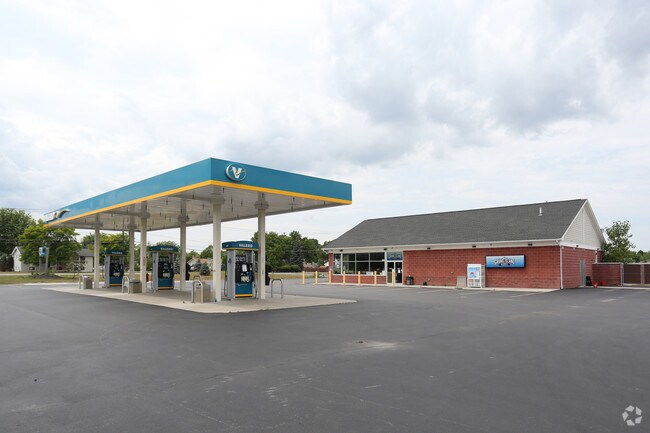
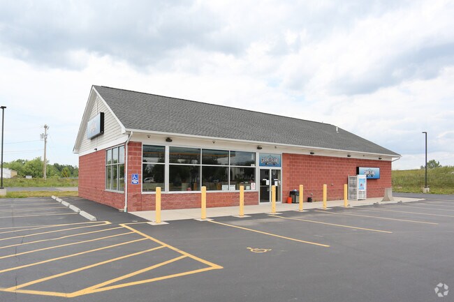
Property Record
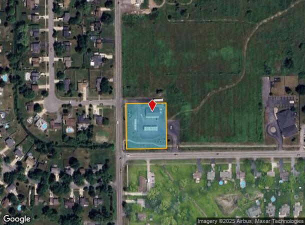
1441 Ransom Rd, Grand Island, NY 14072

NEARBY LISTINGS FOR SALE OR LEASE
Property Detail
1441 Ransom Rd
144600-024-150-0003-008-200
Erie
Servicestationmarket
New York
AE
8.200
36029C0037J
1.37 AC
2025
North
2024
Buffalo/Niagara Falls
007304
Buffalo-Cheektowaga-Niagara Falls, NY
3,182 SF
DEMOGRAPHICS near 1441 Ransom Rd
1 Mile
3 Mile
5 Mile
2024 Total Population
4,468
21,758
96,548
2029 Population
4,499
21,814
95,542
Pop Growth 2024-2029
+ 0.69%
+ 0.26%
(1.04%)
Average Age
41
43
43
2024 Total Households
1,547
9,182
42,843
HH Growth 2024-2029
+ 0.71%
+ 0.28%
(1.13%)
Median Household Inc
$123,094
$85,545
$66,250
Avg Household Size
2.70
2.30
2.20
2024 Avg HH Vehicles
2.00
2.00
2.00
Median Home Value
$271,761
$255,714
$172,332
Median Year Built
1982
1974
1958
Nearby Places
- Restaurants
- Banks
- Shops
- Fitness
- Groceries
PUBLIC TRANSPORTATION
COMMUTER RAIL
Niagara Falls Station (Toronto - New York - VIA Rail)
DRIVE
WALK
Distance
Niagara Falls Station (Toronto - New York - VIA Rail)
18 min
9.7 mi
Niagara Falls Amtrak Station (Empire Service - Amtrak, Maple Leaf - Amtrak)
DRIVE
WALK
Distance
Niagara Falls Amtrak Station (Empire Service - Amtrak, Maple Leaf - Amtrak)
18 min
10.0 mi
AIRPORT
Niagara Falls International
DRIVE
WALK
Distance
Niagara Falls International
16 min
8.5 mi
Buffalo Niagara International
DRIVE
WALK
Distance
Buffalo Niagara International
28 min
17.2 mi
Freight Ports
Port of Toledo
DRIVE
WALK
Distance
Port of Toledo
377 min
316.7 mi
Nearby Properties
Address
Land Use
TOTAL SIZE
Lot Size
Zoning
Address
Land Use
TOTAL SIZE
Lot Size
Zoning
3,600 SF
72.50 AC
Address
Land Use
TOTAL SIZE
Lot Size
Zoning
9,626 SF
31.67 AC
Address
Land Use
TOTAL SIZE
Lot Size
Zoning
4,707 SF
13.60 AC
WD NT
Address
Land Use
TOTAL SIZE
Lot Size
Zoning
368,190 SF
98.37 AC
R1D
Address
Land Use
TOTAL SIZE
Lot Size
Zoning
17,820 SF
29.86 AC
CBD
Address
Land Use
TOTAL SIZE
Lot Size
Zoning
17,941 SF
4.41 AC
OS
Address
Land Use
TOTAL SIZE
Lot Size
Zoning
58,226 SF
16.40 AC
Address
Land Use
TOTAL SIZE
Lot Size
Zoning
Address
Land Use
TOTAL SIZE
Lot Size
Zoning
Address
Land Use
TOTAL SIZE
Lot Size
Zoning
Address
Land Use
TOTAL SIZE
Lot Size
Zoning
36,700 SF
11.29 AC
B1
Address
Land Use
TOTAL SIZE
Lot Size
Zoning
11,442 SF
23.87 AC
Address
Land Use
TOTAL SIZE
Lot Size
Zoning
22,014 SF
26.62 AC
R3
Address
Land Use
TOTAL SIZE
Lot Size
Zoning
22,014 SF
14.20 AC
R3
Address
Land Use
TOTAL SIZE
Lot Size
Zoning
Address
Land Use
TOTAL SIZE
Lot Size
Zoning
137,200 SF
3.56 AC
WD
Address
Land Use
TOTAL SIZE
Lot Size
Zoning
51,232 SF
2.55 AC
WD
Address
Land Use
TOTAL SIZE
Lot Size
Zoning
51,232 SF
1.62 AC
WD
Address
Land Use
TOTAL SIZE
Lot Size
Zoning
74,215 SF
26.80 AC
05000
Address
Land Use
TOTAL SIZE
Lot Size
Zoning
1,040 SF
592.10 AC
OS
Address
Land Use
TOTAL SIZE
Lot Size
Zoning
41.96 AC
Address
Land Use
TOTAL SIZE
Lot Size
Zoning
117,355 SF
20.59 AC
M1
Address
Land Use
TOTAL SIZE
Lot Size
Zoning
75,357 SF
25 AC
R1D
Address
Land Use
TOTAL SIZE
Lot Size
Zoning
56,239 SF
CBD
Address
Land Use
TOTAL SIZE
Lot Size
Zoning
8,306 SF
8.86 AC
NBD
Address
Land Use
TOTAL SIZE
Lot Size
Zoning
Address
Land Use
TOTAL SIZE
Lot Size
Zoning
136,218 SF
7.70 AC
R1-C
Address
Land Use
TOTAL SIZE
Lot Size
Zoning
3.60 AC
R1D
Address
Land Use
TOTAL SIZE
Lot Size
Zoning
35,202 SF
9.09 AC
B1
Address
Land Use
TOTAL SIZE
Lot Size
Zoning
105,404 SF
13.33 AC
M1
The World's #1 Commercial Real Estate Marketplace
Connect with us
© 2025 CoStar Group
The information above has been obtained from sources believed reliable. While we do not doubt its accuracy we have not verified it and make no guarantee, warranty or representation about it. It is your responsibility to independently confirm its accuracy and completeness. Any projections, opinions, assumptions, or estimates used are for example only and do not represent the current or future performance of the property. The value of this transaction to you depends on tax and other factors which should be evaluated by your tax, financial, and legal advisors. You and your advisors should conduct a careful, independent investigation of the property to determine to your satisfaction the suitability of the property for your needs.