Property Record
1441 W Memorial Rd, Oklahoma City, OK 73114


NEARBY LISTINGS FOR SALE OR LEASE
Property Detail
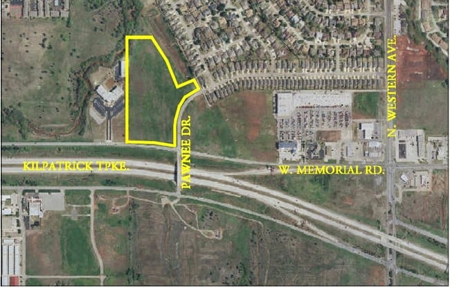
1441 W Memorial Rd
Oklahoma City, OK
Main Event
213391000
MAIN EVENT 001 001
Storebuilding
Oklahoma
X
Oklahoma
40109C0160H
1
2024
5.62 AC
2024
Edmond
108323
Oklahoma City
58,444 SF
DEMOGRAPHICS near 1441 W Memorial Rd
1 Mile
3 Mile
5 Mile
2024 Total Population
7,642
77,441
180,713
2029 Population
7,779
79,311
185,224
Pop Growth 2024-2029
+ 1.79%
+ 2.41%
+ 2.50%
Average Age
37
38
38
2024 Total Households
3,553
33,967
75,802
HH Growth 2024-2029
+ 2.11%
+ 2.70%
+ 2.61%
Median Household Inc
$54,557
$59,939
$70,315
Avg Household Size
2.10
2.20
2.30
2024 Avg HH Vehicles
2.00
2.00
2.00
Median Home Value
$236,202
$206,794
$235,304
Median Year Built
1995
1989
1988
Nearby Places
Map Layers
Map Styles
 Street
 Aerial
- Restaurants
- Banks
- Shops
- Fitness
- Groceries
PUBLIC TRANSPORTATION
AIRPORT
Will Rogers World
DRIVE
WALK
Distance
Will Rogers World
32 min
19.4 mi
Nearby Properties
Address
Land Use
TOTAL SIZE
Lot Size
Zoning
Address
Land Use
TOTAL SIZE
Lot Size
Zoning
140,312 SF
7.91 AC
C-3
Address
Land Use
TOTAL SIZE
Lot Size
Zoning
460,954 SF
24.83 AC
PUD
Address
Land Use
TOTAL SIZE
Lot Size
Zoning
594,334 SF
71.64 AC
C-3
Address
Land Use
TOTAL SIZE
Lot Size
Zoning
41,733 SF
2.63 AC
O-1
Address
Land Use
TOTAL SIZE
Lot Size
Zoning
41,733 SF
2.47 AC
C-3
Address
Land Use
TOTAL SIZE
Lot Size
Zoning
366,844 SF
18.47 AC
PUD
Address
Land Use
TOTAL SIZE
Lot Size
Zoning
469,063 SF
71.44 AC
I-2
Address
Land Use
TOTAL SIZE
Lot Size
Zoning
376,079 SF
29.77 AC
PUD
Address
Land Use
TOTAL SIZE
Lot Size
Zoning
8,354 SF
16.65 AC
PUD
Address
Land Use
TOTAL SIZE
Lot Size
Zoning
391,776 SF
10.12 AC
PUD
Address
Land Use
TOTAL SIZE
Lot Size
Zoning
268,796 SF
45.68 AC
I-2
Address
Land Use
TOTAL SIZE
Lot Size
Zoning
304,423 SF
31.20 AC
PUD
Address
Land Use
TOTAL SIZE
Lot Size
Zoning
399,688 SF
80.57 AC
PUD
Address
Land Use
TOTAL SIZE
Lot Size
Zoning
184,238 SF
7.35 AC
C-3
Address
Land Use
TOTAL SIZE
Lot Size
Zoning
10,811 SF
1.46 AC
PUD
Address
Land Use
TOTAL SIZE
Lot Size
Zoning
358,436 SF
18.03 AC
PUD
Address
Land Use
TOTAL SIZE
Lot Size
Zoning
247,230 SF
22.75 AC
PUD
Address
Land Use
TOTAL SIZE
Lot Size
Zoning
297,836 SF
15 AC
PUD
Address
Land Use
TOTAL SIZE
Lot Size
Zoning
227,714 SF
14.15 AC
PUD
Address
Land Use
TOTAL SIZE
Lot Size
Zoning
470,139 SF
80.39 AC
I-2
Address
Land Use
TOTAL SIZE
Lot Size
Zoning
291,228 SF
14.15 AC
PUD
Address
Land Use
TOTAL SIZE
Lot Size
Zoning
255,921 SF
9.93 AC
PUD
Address
Land Use
TOTAL SIZE
Lot Size
Zoning
158,078 SF
15.58 AC
PUD
Address
Land Use
TOTAL SIZE
Lot Size
Zoning
12,633 SF
2 AC
C-3
Address
Land Use
TOTAL SIZE
Lot Size
Zoning
191,504 SF
20.03 AC
PUD
Address
Land Use
TOTAL SIZE
Lot Size
Zoning
316,212 SF
16.36 AC
PUD
Address
Land Use
TOTAL SIZE
Lot Size
Zoning
235,612 SF
28.09 AC
PUD
Address
Land Use
TOTAL SIZE
Lot Size
Zoning
279,215 SF
11.58 AC
PUD
Address
Land Use
TOTAL SIZE
Lot Size
Zoning
403,628 SF
15.57 AC
C-3
Address
Land Use
TOTAL SIZE
Lot Size
Zoning
34,734 SF
9.07 AC
PUD
The World's #1 Commercial Real Estate Marketplace
Connect with us
© 2026 CoStar Group
The information above has been obtained from sources believed reliable. While we do not doubt its accuracy we have not verified it and make no guarantee, warranty or representation about it. It is your responsibility to independently confirm its accuracy and completeness. Any projections, opinions, assumptions, or estimates used are for example only and do not represent the current or future performance of the property. The value of this transaction to you depends on tax and other factors which should be evaluated by your tax, financial, and legal advisors. You and your advisors should conduct a careful, independent investigation of the property to determine to your satisfaction the suitability of the property for your needs.