Property Record
14410 W Interstate 20, Odessa, TX 79763
NEARBY LISTINGS FOR SALE OR LEASE
Property Detail
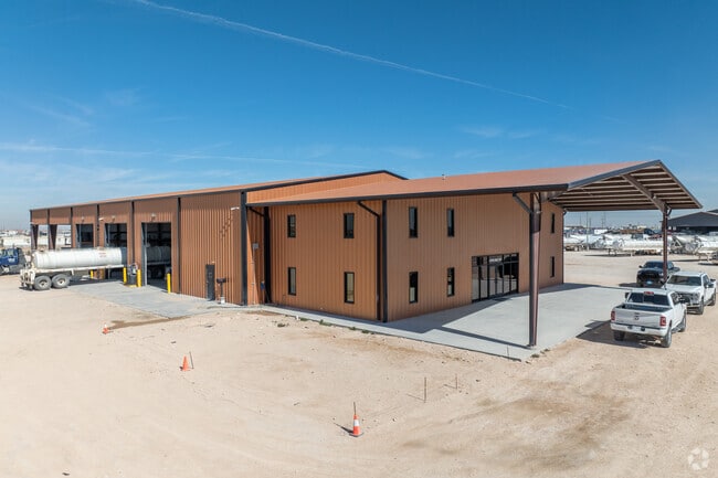
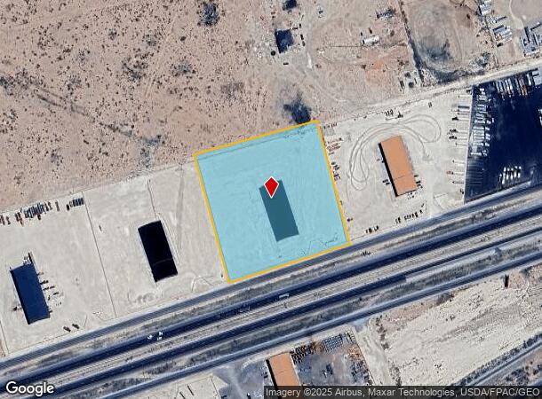
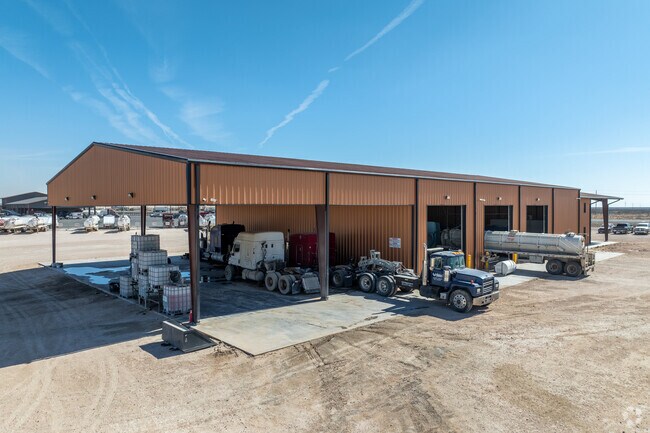
14410 W Interstate 20
Other Market Areas
High Performance West I 20 South Sub 2Nd
Odessa, TX
HIGH PERFORMANCE WEST I 20 SOUTH SUB 2ND FILING BLOCK 3 LOT 3
13990.00320.00000
Ector
Commercialnec
Texas
2025
3
2025
5 AC
002803
Midland & Odessa
8,000 SF
DEMOGRAPHICS near 14410 W Interstate 20
1 Mile
3 Mile
5 Mile
2024 Total Population
298
3,369
9,453
2029 Population
275
3,152
9,109
Pop Growth 2024-2029
(7.72%)
(6.44%)
(3.64%)
Average Age
31
31
32
2024 Total Households
89
1,010
2,823
HH Growth 2024-2029
(7.87%)
(6.83%)
(4.11%)
Median Household Inc
$38,333
$38,084
$44,059
Avg Household Size
3.20
3.20
3.20
2024 Avg HH Vehicles
2.00
2.00
2.00
Median Home Value
$87,804
$101,224
$99,584
Median Year Built
1997
1997
1991
Nearby Places
Map Layers
Map Styles
 Street
 Aerial
- Restaurants
- Banks
- Shops
- Fitness
- Groceries
PUBLIC TRANSPORTATION
AIRPORT
Midland International Air And Space Port
DRIVE
WALK
Distance
Midland International Air And Space Port
34 min
24.1 mi
Freight Ports
Port of Corpus Christi
DRIVE
WALK
Distance
Port of Corpus Christi
507 min
488.0 mi
SALE & LEASE HISTORY
LISTING DATE
SALE/LEASE

May 15, 2023
For Lease
May 03, 2023
For Sale
Jun 12, 2025
For Sale
Nearby Properties
Address
Land Use
TOTAL SIZE
Lot Size
Zoning
Address
Land Use
TOTAL SIZE
Lot Size
Zoning
11,912 SF
500.80 AC
ES1
Address
Land Use
TOTAL SIZE
Lot Size
Zoning
11,500 SF
11.42 AC
ES1
Address
Land Use
TOTAL SIZE
Lot Size
Zoning
2,684 SF
203.90 AC
EW7
Address
Land Use
TOTAL SIZE
Lot Size
Zoning
2,632 SF
395.72 AC
EW7
Address
Land Use
TOTAL SIZE
Lot Size
Zoning
4,350 SF
55.86 AC
ES1
Address
Land Use
TOTAL SIZE
Lot Size
Zoning
5,600 SF
7.70 AC
ES1
Address
Land Use
TOTAL SIZE
Lot Size
Zoning
1,872 SF
19.87 AC
ES1
Address
Land Use
TOTAL SIZE
Lot Size
Zoning
8,865 SF
2.83 AC
EW5
Address
Land Use
TOTAL SIZE
Lot Size
Zoning
8,000 SF
5.23 AC
EW7
Address
Land Use
TOTAL SIZE
Lot Size
Zoning
3,500 SF
10.77 AC
EW5
Address
Land Use
TOTAL SIZE
Lot Size
Zoning
12,000 SF
6.08 AC
ES1
Address
Land Use
TOTAL SIZE
Lot Size
Zoning
12,000 SF
7.80 AC
ES1
Address
Land Use
TOTAL SIZE
Lot Size
Zoning
12,000 SF
5.14 AC
ES1
Address
Land Use
TOTAL SIZE
Lot Size
Zoning
12,000 SF
4.43 AC
ES1
Address
Land Use
TOTAL SIZE
Lot Size
Zoning
2,450 SF
8 AC
ES1
Address
Land Use
TOTAL SIZE
Lot Size
Zoning
9,600 SF
5.24 AC
ES1
Address
Land Use
TOTAL SIZE
Lot Size
Zoning
12,000 SF
2.47 AC
ES1
Address
Land Use
TOTAL SIZE
Lot Size
Zoning
10,000 SF
4.63 AC
ES1
Address
Land Use
TOTAL SIZE
Lot Size
Zoning
8,750 SF
4.51 AC
ES1
Address
Land Use
TOTAL SIZE
Lot Size
Zoning
9,600 SF
5.25 AC
ES1
Address
Land Use
TOTAL SIZE
Lot Size
Zoning
2,450 SF
6.40 AC
ES1
Address
Land Use
TOTAL SIZE
Lot Size
Zoning
10,000 SF
5 AC
ES1
Address
Land Use
TOTAL SIZE
Lot Size
Zoning
8,000 SF
5.16 AC
EW7
Address
Land Use
TOTAL SIZE
Lot Size
Zoning
8,000 SF
5 AC
EW7
Address
Land Use
TOTAL SIZE
Lot Size
Zoning
8,000 SF
5 AC
EW7
Address
Land Use
TOTAL SIZE
Lot Size
Zoning
2,450 SF
4.52 AC
Address
Land Use
TOTAL SIZE
Lot Size
Zoning
9,600 SF
2 AC
ES1
Address
Land Use
TOTAL SIZE
Lot Size
Zoning
3,000 SF
5.86 AC
ES1
Address
Land Use
TOTAL SIZE
Lot Size
Zoning
2,000 SF
4.54 AC
ES1
The World's #1 Commercial Real Estate Marketplace
Connect with us
© 2025 CoStar Group
The information above has been obtained from sources believed reliable. While we do not doubt its accuracy we have not verified it and make no guarantee, warranty or representation about it. It is your responsibility to independently confirm its accuracy and completeness. Any projections, opinions, assumptions, or estimates used are for example only and do not represent the current or future performance of the property. The value of this transaction to you depends on tax and other factors which should be evaluated by your tax, financial, and legal advisors. You and your advisors should conduct a careful, independent investigation of the property to determine to your satisfaction the suitability of the property for your needs.