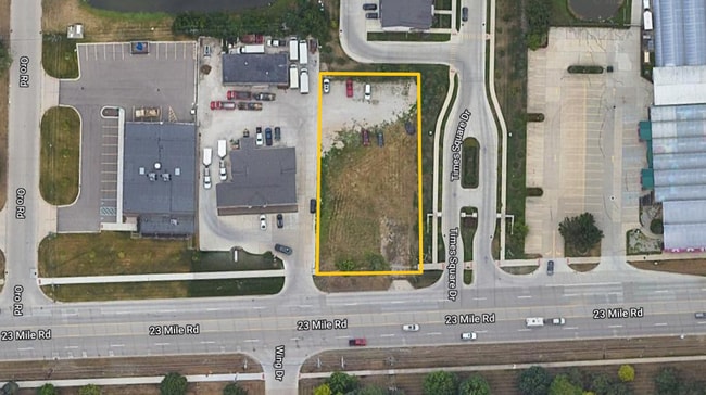
Property Record
14419 23 Mile Rd, Shelby Township, MI 48315


NEARBY LISTINGS FOR SALE OR LEASE
Property Detail
14419 23 Mile Rd
23-07-13-400-012
L 247A1 82 SPLIT T3N R12E SEC 13 BEG AT S 1/4 POST SEC 13, TH N 3 DEG 10' 30" E 264.51 FT, TH N 89 DEG 37' E 110 FT, TH S 3
Industrialacreage
Macomb
X
Michigan
26099C0236G
0.58 AC
2025
Macomb West
2025
Detroit
226400
Detroit-Warren-Dearborn, MI
928 SF
DEMOGRAPHICS near 14419 23 Mile Rd
1 Mile
3 Mile
5 Mile
2024 Total Population
6,038
75,304
200,482
2029 Population
6,032
74,109
197,975
Pop Growth 2024-2029
(0.10%)
(1.59%)
(1.25%)
Average Age
44
43
41
2024 Total Households
2,366
27,301
77,418
HH Growth 2024-2029
(0.59%)
(1.79%)
(1.31%)
Median Household Inc
$88,946
$98,602
$85,487
Avg Household Size
2.50
2.70
2.50
2024 Avg HH Vehicles
2.00
2.00
2.00
Median Home Value
$290,999
$317,449
$293,163
Median Year Built
1991
1993
1992
Nearby Places
Map Layers
Map Styles
 Street
 Aerial
- Restaurants
- Banks
- Shops
- Fitness
- Groceries
PUBLIC TRANSPORTATION
AIRPORT
Windsor International
DRIVE
WALK
Distance
Windsor International
66 min
40.4 mi
Detroit Metro Wayne County
DRIVE
WALK
Distance
Detroit Metro Wayne County
71 min
50.0 mi
SALE & LEASE HISTORY
LISTING DATE
SALE/LEASE

Nov 08, 2023
For Sale
Nearby Properties
Address
Land Use
TOTAL SIZE
Lot Size
Zoning
Address
Land Use
TOTAL SIZE
Lot Size
Zoning
447,434 SF
23.29 AC
LM
Address
Land Use
TOTAL SIZE
Lot Size
Zoning
371,520 SF
21.91 AC
CK MAP
Address
Land Use
TOTAL SIZE
Lot Size
Zoning
89,559 SF
44.54 AC
O2
Address
Land Use
TOTAL SIZE
Lot Size
Zoning
190,996 SF
33.80 AC
LM
Address
Land Use
TOTAL SIZE
Lot Size
Zoning
118,343 SF
7.33 AC
R1
Address
Land Use
TOTAL SIZE
Lot Size
Zoning
10.29 AC
LM
Address
Land Use
TOTAL SIZE
Lot Size
Zoning
237,108 SF
10.30 AC
R-12
Address
Land Use
TOTAL SIZE
Lot Size
Zoning
181,725 SF
CK MAP
Address
Land Use
TOTAL SIZE
Lot Size
Zoning
90,185 SF
14.73 AC
C2
Address
Land Use
TOTAL SIZE
Lot Size
Zoning
224,323 SF
22.15 AC
C-3
Address
Land Use
TOTAL SIZE
Lot Size
Zoning
17.40 AC
CK MAP
Address
Land Use
TOTAL SIZE
Lot Size
Zoning
73.49 AC
CK MAP
Address
Land Use
TOTAL SIZE
Lot Size
Zoning
50,577 SF
21.43 AC
C-2
Address
Land Use
TOTAL SIZE
Lot Size
Zoning
79,942 SF
4.65 AC
M1
Address
Land Use
TOTAL SIZE
Lot Size
Zoning
120,658 SF
13.97 AC
C-3
Address
Land Use
TOTAL SIZE
Lot Size
Zoning
8.81 AC
C-6
Address
Land Use
TOTAL SIZE
Lot Size
Zoning
233,584 SF
26.03 AC
C-3
Address
Land Use
TOTAL SIZE
Lot Size
Zoning
118,581 SF
15.17 AC
R-5
Address
Land Use
TOTAL SIZE
Lot Size
Zoning
21,992 SF
16.24 AC
R-3
Address
Land Use
TOTAL SIZE
Lot Size
Zoning
121,156 SF
9.40 AC
CK MAP
Address
Land Use
TOTAL SIZE
Lot Size
Zoning
293,800 SF
M1
Address
Land Use
TOTAL SIZE
Lot Size
Zoning
184,084 SF
15.61 AC
CK MAP
Address
Land Use
TOTAL SIZE
Lot Size
Zoning
134,400 SF
7.55 AC
CK MAP
Address
Land Use
TOTAL SIZE
Lot Size
Zoning
142,325 SF
3.39 AC
MXD
Address
Land Use
TOTAL SIZE
Lot Size
Zoning
115,223 SF
12.72 AC
C-5
Address
Land Use
TOTAL SIZE
Lot Size
Zoning
14.46 AC
R-7
Address
Land Use
TOTAL SIZE
Lot Size
Zoning
138,697 SF
11.62 AC
C-5
Address
Land Use
TOTAL SIZE
Lot Size
Zoning
152,568 SF
18.44 AC
CK MAP
Address
Land Use
TOTAL SIZE
Lot Size
Zoning
122,540 SF
CK MAP
Address
Land Use
TOTAL SIZE
Lot Size
Zoning
214,282 SF
22.26 AC
M1
The World's #1 Commercial Real Estate Marketplace
Connect with us
© 2026 CoStar Group
The information above has been obtained from sources believed reliable. While we do not doubt its accuracy we have not verified it and make no guarantee, warranty or representation about it. It is your responsibility to independently confirm its accuracy and completeness. Any projections, opinions, assumptions, or estimates used are for example only and do not represent the current or future performance of the property. The value of this transaction to you depends on tax and other factors which should be evaluated by your tax, financial, and legal advisors. You and your advisors should conduct a careful, independent investigation of the property to determine to your satisfaction the suitability of the property for your needs.