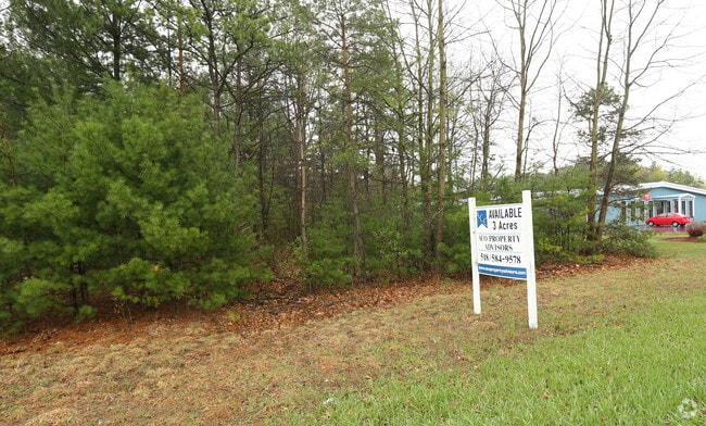
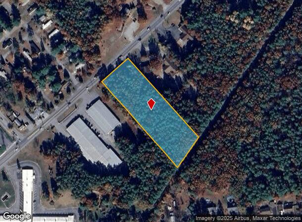
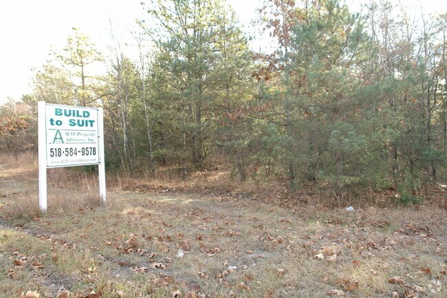
Property Record
1442 Route 9, Fort Edward, NY 12828
NEARBY LISTINGS FOR SALE OR LEASE
Property Detail
1442 Route 9
Albany/Schenectady/Troy
LOT 4
Albany-Schenectady-Troy, NY
Saratoga
414489-063-003-0001-025-000-0000
New York
Commercialacreage
25.000
2024
3 AC
2024
Saratoga County
060104
DEMOGRAPHICS near 1442 Route 9
1 Mile
3 Mile
5 Mile
2024 Total Population
2,250
11,613
47,005
2029 Population
2,324
12,079
47,151
Pop Growth 2024-2029
+ 3.29%
+ 4.01%
+ 0.31%
Average Age
44
43
42
2024 Total Households
967
4,703
19,902
HH Growth 2024-2029
+ 3.21%
+ 3.87%
+ 0.19%
Median Household Inc
$85,250
$95,487
$72,889
Avg Household Size
2.30
2.40
2.30
2024 Avg HH Vehicles
2.00
2.00
2.00
Median Home Value
$230,184
$236,107
$201,330
Median Year Built
1983
1983
1969
Nearby Places
- Restaurants
- Banks
- Shops
- Fitness
- Groceries
PUBLIC TRANSPORTATION
COMMUTER RAIL
Fort Edward Amtrak (Adirondack - Amtrak, Ethan Allen Express - Amtrak)
DRIVE
WALK
Distance
Fort Edward Amtrak (Adirondack - Amtrak, Ethan Allen Express - Amtrak)
8 min
5.5 mi
Freight Ports
Albany, NY Port
DRIVE
WALK
Distance
Albany, NY Port
64 min
49.8 mi
SALE & LEASE HISTORY
LISTING DATE
SALE/LEASE

May 01, 2017
For Sale
Nearby Properties
Address
Land Use
TOTAL SIZE
Lot Size
Zoning
Address
Land Use
TOTAL SIZE
Lot Size
Zoning
115.90 AC
WR
Address
Land Use
TOTAL SIZE
Lot Size
Zoning
938 SF
80.03 AC
C1
Address
Land Use
TOTAL SIZE
Lot Size
Zoning
144,029 SF
28.34 AC
R1
Address
Land Use
TOTAL SIZE
Lot Size
Zoning
22,317 SF
5.28 AC
C1
Address
Land Use
TOTAL SIZE
Lot Size
Zoning
16.20 AC
R1
Address
Land Use
TOTAL SIZE
Lot Size
Zoning
76,451 SF
23.20 AC
R2
Address
Land Use
TOTAL SIZE
Lot Size
Zoning
4,340 SF
0.40 AC
PUD
Address
Land Use
TOTAL SIZE
Lot Size
Zoning
627.78 AC
RP
Address
Land Use
TOTAL SIZE
Lot Size
Zoning
1,216 SF
34.17 AC
R2
Address
Land Use
TOTAL SIZE
Lot Size
Zoning
1,400 SF
31.07 AC
R3
Address
Land Use
TOTAL SIZE
Lot Size
Zoning
62,278 SF
6.86 AC
C1
Address
Land Use
TOTAL SIZE
Lot Size
Zoning
25,400 SF
9.38 AC
CLI
Address
Land Use
TOTAL SIZE
Lot Size
Zoning
572 SF
124.63 AC
RP
Address
Land Use
TOTAL SIZE
Lot Size
Zoning
53,590 SF
13.74 AC
R1
Address
Land Use
TOTAL SIZE
Lot Size
Zoning
4,715 SF
43.55 AC
RP
Address
Land Use
TOTAL SIZE
Lot Size
Zoning
6,300 SF
3.27 AC
C1
Address
Land Use
TOTAL SIZE
Lot Size
Zoning
19,052 SF
6.21 AC
R1
Address
Land Use
TOTAL SIZE
Lot Size
Zoning
23,058 SF
3.81 AC
M2
Address
Land Use
TOTAL SIZE
Lot Size
Zoning
18,690 SF
21.86 AC
R2
Address
Land Use
TOTAL SIZE
Lot Size
Zoning
800 SF
3.16 AC
C1
Address
Land Use
TOTAL SIZE
Lot Size
Zoning
7,200 SF
1.42 AC
C1
Address
Land Use
TOTAL SIZE
Lot Size
Zoning
9,600 SF
184.87 AC
C1
Address
Land Use
TOTAL SIZE
Lot Size
Zoning
30,020 SF
5.95 AC
C1
Address
Land Use
TOTAL SIZE
Lot Size
Zoning
3,480 SF
17.38 AC
C1
Address
Land Use
TOTAL SIZE
Lot Size
Zoning
5,882 SF
1.66 AC
C1
Address
Land Use
TOTAL SIZE
Lot Size
Zoning
16,000 SF
0.01 AC
CLI
Address
Land Use
TOTAL SIZE
Lot Size
Zoning
32,253 SF
4.31 AC
CLI
Address
Land Use
TOTAL SIZE
Lot Size
Zoning
39,248 SF
3.16 AC
C1
Address
Land Use
TOTAL SIZE
Lot Size
Zoning
3.61 AC
WR
Address
Land Use
TOTAL SIZE
Lot Size
Zoning
14,426 SF
11.44 AC
R2
The World's #1 Commercial Real Estate Marketplace
Connect with us
© 2025 CoStar Group
The information above has been obtained from sources believed reliable. While we do not doubt its accuracy we have not verified it and make no guarantee, warranty or representation about it. It is your responsibility to independently confirm its accuracy and completeness. Any projections, opinions, assumptions, or estimates used are for example only and do not represent the current or future performance of the property. The value of this transaction to you depends on tax and other factors which should be evaluated by your tax, financial, and legal advisors. You and your advisors should conduct a careful, independent investigation of the property to determine to your satisfaction the suitability of the property for your needs.