Property Record
14427 E State Road 64 St E, Bradenton, FL 34212
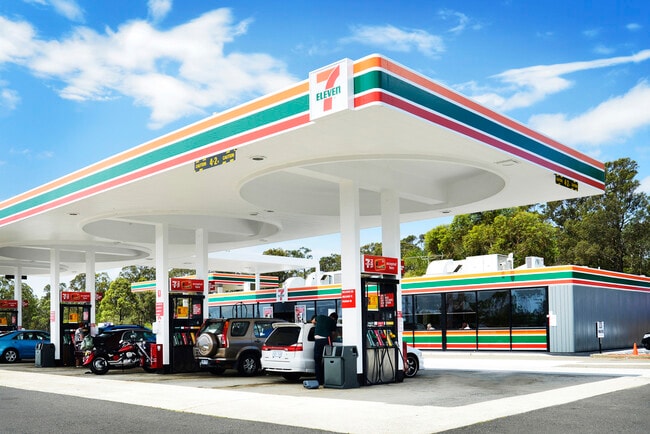

Property Detail
14427 E State Road 64 St E
5696-0040-9
A PORTION OF THE PREMISES DESC IN THE WD REC IN OR INST#202041082413 PRMCF DESC AS FOLLOWS: COM AT THE SWLY COR OF SD PREMISES, SD COR BEING ON THE NLY R/W LN OF SR 64, A
Servicestationmarket
Manatee
PD-C
Florida
B and X Area of moderate flood hazard, usually the area between the limits of the 100-year and 500-year floods.
1.99 AC
2023
Manatee Outlying
2025
Tampa/St Petersburg
002018
North Port-Bradenton-Sarasota, FL
9,397 SF
NEARBY LISTINGS FOR SALE OR LEASE
DEMOGRAPHICS near 14427 E State Road 64 St E
1 mile
3 mile
5 mile
2025 Total Population
2,293
34,977
72,714
2030 Population
2,661
40,049
82,561
Pop Growth 2025-2030
+ 16.05%
+ 14.50%
+ 13.54%
Average Age
42
44
46
2025 Total Households
807
13,360
28,979
HH Growth 2025-2030
+ 16.48%
+ 14.88%
+ 13.84%
Median Household Inc
$176,041
$136,953
$124,869
Avg Household Size
2.70
2.60
2.50
2025 Avg HH Vehicles
2.00
2.00
2.00
Median Home Value
$690,758
$663,425
$634,242
Median Year Built
2011
2011
2010
Nearby Places
Map Layers
Map Styles
 Street
 Aerial
Transit
 Traffic
 Biking
Places
Listings with unknown addresses are not visible on the map
- Restaurants
- Banks
- Shops
- Fitness
- Groceries
PUBLIC TRANSPORTATION
AIRPORT
Sarasota/Bradenton International
Drive
Walk
Distance
Sarasota/Bradenton International
31 min
20.6 mi
St Pete-Clearwater International
Drive
Walk
Distance
St Pete-Clearwater International
63 min
45.6 mi
Freight Ports
Port Manatee
Drive
Walk
Distance
Port Manatee
28 min
18.3 mi
SALE & LEASE HISTORY
LISTING DATE
SALE/LEASE

Jan 21, 2021
For Sale
Nearby Properties
Address
Land Use
TOTAL SIZE
Lot Size
Zoning
Address
Land Use
TOTAL SIZE
Lot Size
Zoning
602,710 SF
36.57 AC
PD-MU
Address
Land Use
TOTAL SIZE
Lot Size
Zoning
628,167 SF
16.77 AC
PD-MU
Address
Land Use
TOTAL SIZE
Lot Size
Zoning
451,049 SF
55.56 AC
PDMU
Address
Land Use
TOTAL SIZE
Lot Size
Zoning
349,074 SF
15.03 AC
PD-MU
Address
Land Use
TOTAL SIZE
Lot Size
Zoning
412,218 SF
19.09 AC
PD-MU
Address
Land Use
TOTAL SIZE
Lot Size
Zoning
282,022 SF
21.30 AC
GC GENERA
Address
Land Use
TOTAL SIZE
Lot Size
Zoning
335,712 SF
27.91 AC
PD-MU
Address
Land Use
TOTAL SIZE
Lot Size
Zoning
422,013 SF
11 AC
PD-MU
Address
Land Use
TOTAL SIZE
Lot Size
Zoning
201,213 SF
27.17 AC
PD-MU
Address
Land Use
TOTAL SIZE
Lot Size
Zoning
211,519 SF
82.32 AC
PD-MU
Address
Land Use
TOTAL SIZE
Lot Size
Zoning
125,972 SF
24.18 AC
PD-PI
Address
Land Use
TOTAL SIZE
Lot Size
Zoning
175,410 SF
39.05 AC
PD-MU
Address
Land Use
TOTAL SIZE
Lot Size
Zoning
210,061 SF
45.14 AC
A-1 SUBURB
Address
Land Use
TOTAL SIZE
Lot Size
Zoning
158,863 SF
71.98 AC
A GENERAL
Address
Land Use
TOTAL SIZE
Lot Size
Zoning
112,961 SF
19.44 AC
Address
Land Use
TOTAL SIZE
Lot Size
Zoning
164,551 SF
31.22 AC
PD-MU
Address
Land Use
TOTAL SIZE
Lot Size
Zoning
1,800 SF
18.04 AC
Address
Land Use
TOTAL SIZE
Lot Size
Zoning
197,761 SF
22.73 AC
PD-R,A
Address
Land Use
TOTAL SIZE
Lot Size
Zoning
82,573 SF
16.26 AC
PD-C
Address
Land Use
TOTAL SIZE
Lot Size
Zoning
Address
Land Use
TOTAL SIZE
Lot Size
Zoning
106,384 SF
15.55 AC
PD-MU
Address
Land Use
TOTAL SIZE
Lot Size
Zoning
44,216 SF
74.28 AC
A,PD-R
Address
Land Use
TOTAL SIZE
Lot Size
Zoning
57,754 SF
8.53 AC
Address
Land Use
TOTAL SIZE
Lot Size
Zoning
58,785 SF
5.49 AC
PD-MU
Address
Land Use
TOTAL SIZE
Lot Size
Zoning
100,270 SF
5.58 AC
PD-MU
Address
Land Use
TOTAL SIZE
Lot Size
Zoning
100,270 SF
6.98 AC
PD-MU
Address
Land Use
TOTAL SIZE
Lot Size
Zoning
76,172 SF
89.74 AC
Address
Land Use
TOTAL SIZE
Lot Size
Zoning
76,172 SF
92.93 AC
PD-R
Address
Land Use
TOTAL SIZE
Lot Size
Zoning
89,450 SF
4.57 AC
PD-MU
Address
Land Use
TOTAL SIZE
Lot Size
Zoning
55,694 SF
15.93 AC
PD-PI
The World's #1 Commercial Real Estate Marketplace
Connect with us
© 2026 CoStar Group
The information above has been obtained from sources believed reliable. While we do not doubt its accuracy we have not verified it and make no guarantee, warranty or representation about it. It is your responsibility to independently confirm its accuracy and completeness. Any projections, opinions, assumptions, or estimates used are for example only and do not represent the current or future performance of the property. The value of this transaction to you depends on tax and other factors which should be evaluated by your tax, financial, and legal advisors. You and your advisors should conduct a careful, independent investigation of the property to determine to your satisfaction the suitability of the property for your needs.