Property Record
1443 7Th St, Houlton, WI 54082

NEARBY LISTINGS FOR SALE OR LEASE
-
-
View all Houlton listings for lease on LoopNet.com
Property Detail
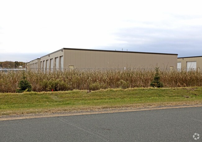
1443 7Th St
Minneapolis-St. Paul-Bloomington, MN-WI
Wigwagm Shores
030-2147-00-023
SEC 22 T30N R20W PT NE SE PARK PLACE STORAGE CONDOMINIUMS 4TH ADDM UNIT 1 & COMMON ELEMENTS
Industrialcondominium
St Croix
X
Wisconsin
27163C0258E
1
2025
0.03 AC
2024
St Croix County
120402
Minneapolis/St Paul
DEMOGRAPHICS near 1443 7Th St
1 Mile
3 Mile
5 Mile
2024 Total Population
735
18,629
38,053
2029 Population
799
20,150
41,203
Pop Growth 2024-2029
+ 8.71%
+ 8.16%
+ 8.28%
Average Age
42
43
43
2024 Total Households
276
7,923
15,545
HH Growth 2024-2029
+ 8.70%
+ 8.39%
+ 8.45%
Median Household Inc
$138,942
$101,894
$108,426
Avg Household Size
2.70
2.30
2.40
2024 Avg HH Vehicles
3.00
2.00
2.00
Median Home Value
$471,428
$371,065
$405,669
Median Year Built
1986
1975
1984
Nearby Places
Map Layers
Map Styles
 Street
 Aerial
- Restaurants
- Banks
- Shops
- Fitness
- Groceries
PUBLIC TRANSPORTATION
AIRPORT
Minneapolis-St Paul International/Wold-Chamberlain
DRIVE
WALK
Distance
Minneapolis-St Paul International/Wold-Chamberlain
48 min
32.7 mi
Freight Ports
Port Milwaukee
DRIVE
WALK
Distance
Port Milwaukee
360 min
322.1 mi
SALE & LEASE HISTORY
LISTING DATE
SALE/LEASE

May 19, 2025
For Lease
Nearby Properties
Address
Land Use
TOTAL SIZE
Lot Size
Zoning
Address
Land Use
TOTAL SIZE
Lot Size
Zoning
395,455 SF
Address
Land Use
TOTAL SIZE
Lot Size
Zoning
519,636 SF
40.40 AC
Address
Land Use
TOTAL SIZE
Lot Size
Zoning
197,300 SF
0.55 AC
Address
Land Use
TOTAL SIZE
Lot Size
Zoning
198,596 SF
5 AC
Address
Land Use
TOTAL SIZE
Lot Size
Zoning
84.75 AC
Address
Land Use
TOTAL SIZE
Lot Size
Zoning
81,240 SF
18.16 AC
Address
Land Use
TOTAL SIZE
Lot Size
Zoning
74,608 SF
0.66 AC
Address
Land Use
TOTAL SIZE
Lot Size
Zoning
45,777 SF
5.12 AC
Address
Land Use
TOTAL SIZE
Lot Size
Zoning
71,040 SF
12.02 AC
Address
Land Use
TOTAL SIZE
Lot Size
Zoning
66,665 SF
9.77 AC
Address
Land Use
TOTAL SIZE
Lot Size
Zoning
7,312 SF
3.43 AC
Address
Land Use
TOTAL SIZE
Lot Size
Zoning
46,145 SF
4.75 AC
Address
Land Use
TOTAL SIZE
Lot Size
Zoning
65,255 SF
5.08 AC
Address
Land Use
TOTAL SIZE
Lot Size
Zoning
114,012 SF
10.77 AC
Address
Land Use
TOTAL SIZE
Lot Size
Zoning
95,480 SF
1.11 AC
Address
Land Use
TOTAL SIZE
Lot Size
Zoning
243,612 SF
3.32 AC
Address
Land Use
TOTAL SIZE
Lot Size
Zoning
120 SF
8.27 AC
Address
Land Use
TOTAL SIZE
Lot Size
Zoning
44,721 SF
0.58 AC
Address
Land Use
TOTAL SIZE
Lot Size
Zoning
Address
Land Use
TOTAL SIZE
Lot Size
Zoning
30,352 SF
0.58 AC
Address
Land Use
TOTAL SIZE
Lot Size
Zoning
56 SF
4.70 AC
Address
Land Use
TOTAL SIZE
Lot Size
Zoning
25,012 SF
2.66 AC
Address
Land Use
TOTAL SIZE
Lot Size
Zoning
94,188 SF
Address
Land Use
TOTAL SIZE
Lot Size
Zoning
16,827 SF
0.64 AC
Address
Land Use
TOTAL SIZE
Lot Size
Zoning
47,684 SF
3.68 AC
Address
Land Use
TOTAL SIZE
Lot Size
Zoning
49,276 SF
1.93 AC
Address
Land Use
TOTAL SIZE
Lot Size
Zoning
28,212 SF
4.28 AC
Address
Land Use
TOTAL SIZE
Lot Size
Zoning
29,432 SF
1.23 AC
Address
Land Use
TOTAL SIZE
Lot Size
Zoning
5,408 SF
5.35 AC
Address
Land Use
TOTAL SIZE
Lot Size
Zoning
36,096 SF
2.92 AC
The World's #1 Commercial Real Estate Marketplace
Connect with us
© 2025 CoStar Group
The information above has been obtained from sources believed reliable. While we do not doubt its accuracy we have not verified it and make no guarantee, warranty or representation about it. It is your responsibility to independently confirm its accuracy and completeness. Any projections, opinions, assumptions, or estimates used are for example only and do not represent the current or future performance of the property. The value of this transaction to you depends on tax and other factors which should be evaluated by your tax, financial, and legal advisors. You and your advisors should conduct a careful, independent investigation of the property to determine to your satisfaction the suitability of the property for your needs.