Property Record
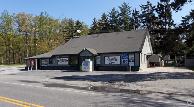
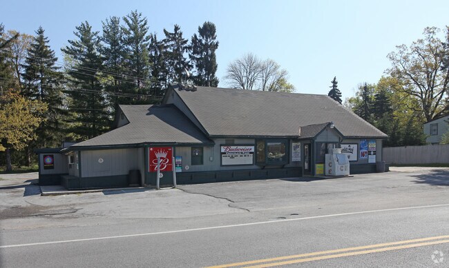
14433 Macafee Hill Rd, Cascade, MD 21719

Property Detail
14433 Macafee Hill Rd
14-011757
.96 ACRES IRREG 14433 MCAFEE HILL ROAD SE/S PENNERSVILLE RD
Bartavern
WASHINGTON
U
Maryland
B and X Area of moderate flood hazard, usually the area between the limits of the 100-year and 500-year floods.
0.96 AC
2024
Washington County
2025
Washington, DC
010100
Hagerstown-Martinsburg, MD-WV
3,225 SF
NEARBY LISTINGS FOR SALE OR LEASE
DEMOGRAPHICS near 14433 Macafee Hill Rd
1 mile
3 mile
5 mile
2025 Total Population
1,526
7,534
17,620
2030 Population
1,627
7,789
18,150
Pop Growth 2025-2030
+ 6.62%
+ 3.38%
+ 3.01%
Average Age
42
44
44
2025 Total Households
605
3,090
7,150
HH Growth 2025-2030
+ 6.45%
+ 3.27%
+ 2.98%
Median Household Inc
$71,952
$76,623
$83,429
Avg Household Size
2.50
2.40
2.40
2025 Avg HH Vehicles
3.00
2.00
2.00
Median Home Value
$247,891
$261,999
$282,903
Median Year Built
1953
1970
1980
Nearby Places
Map Layers
Map Styles
 Street
 Aerial
Transit
 Traffic
 Biking
Places
Listings with unknown addresses are not visible on the map
- Restaurants
- Banks
- Shops
- Fitness
- Groceries
PUBLIC TRANSPORTATION
AIRPORT
Hagerstown Regional/Richard A Henson Field
Drive
Walk
Distance
Hagerstown Regional/Richard A Henson Field
30 min
15.6 mi
Freight Ports
Port of Baltimore
Drive
Walk
Distance
Port of Baltimore
101 min
71.1 mi
Nearby Properties
Address
Land Use
TOTAL SIZE
Lot Size
Zoning
Address
Land Use
TOTAL SIZE
Lot Size
Zoning
197,652 SF
281.70 AC
IE
Address
Land Use
TOTAL SIZE
Lot Size
Zoning
2,660 SF
4,262.14 AC
RC
Address
Land Use
TOTAL SIZE
Lot Size
Zoning
95,779 SF
76.94 AC
U
Address
Land Use
TOTAL SIZE
Lot Size
Zoning
54,646 SF
9.72 AC
RV
Address
Land Use
TOTAL SIZE
Lot Size
Zoning
6,002 SF
10.07 AC
RC
Address
Land Use
TOTAL SIZE
Lot Size
Zoning
3.77 AC
SED
Address
Land Use
TOTAL SIZE
Lot Size
Zoning
700 SF
35.49 AC
SED
Address
Land Use
TOTAL SIZE
Lot Size
Zoning
3,038 SF
34.98 AC
SED
Address
Land Use
TOTAL SIZE
Lot Size
Zoning
19,587 SF
23.29 AC
SED
Address
Land Use
TOTAL SIZE
Lot Size
Zoning
11,400 SF
36.81 AC
SED
Address
Land Use
TOTAL SIZE
Lot Size
Zoning
22,795 SF
3.66 AC
A
Address
Land Use
TOTAL SIZE
Lot Size
Zoning
12.23 AC
SED
Address
Land Use
TOTAL SIZE
Lot Size
Zoning
9,398 SF
100 AC
A
Address
Land Use
TOTAL SIZE
Lot Size
Zoning
6.81 AC
U
Address
Land Use
TOTAL SIZE
Lot Size
Zoning
12,810 SF
5 AC
A
Address
Land Use
TOTAL SIZE
Lot Size
Zoning
Address
Land Use
TOTAL SIZE
Lot Size
Zoning
31.16 AC
C
Address
Land Use
TOTAL SIZE
Lot Size
Zoning
2.77 AC
U
Address
Land Use
TOTAL SIZE
Lot Size
Zoning
10,800 SF
4.91 AC
Address
Land Use
TOTAL SIZE
Lot Size
Zoning
508.39 AC
C
Address
Land Use
TOTAL SIZE
Lot Size
Zoning
Address
Land Use
TOTAL SIZE
Lot Size
Zoning
9,000 SF
164.51 AC
SED
Address
Land Use
TOTAL SIZE
Lot Size
Zoning
360 SF
38.70 AC
U
Address
Land Use
TOTAL SIZE
Lot Size
Zoning
10,579 SF
5.41 AC
VC
Address
Land Use
TOTAL SIZE
Lot Size
Zoning
5,873 SF
3 AC
R1
Address
Land Use
TOTAL SIZE
Lot Size
Zoning
Address
Land Use
TOTAL SIZE
Lot Size
Zoning
2,070 SF
3.88 AC
EC
Address
Land Use
TOTAL SIZE
Lot Size
Zoning
Address
Land Use
TOTAL SIZE
Lot Size
Zoning
147.22 AC
Address
Land Use
TOTAL SIZE
Lot Size
Zoning
4,000 SF
75.68 AC
SED
The World's #1 Commercial Real Estate Marketplace
Connect with us
© 2026 CoStar Group
The information above has been obtained from sources believed reliable. While we do not doubt its accuracy we have not verified it and make no guarantee, warranty or representation about it. It is your responsibility to independently confirm its accuracy and completeness. Any projections, opinions, assumptions, or estimates used are for example only and do not represent the current or future performance of the property. The value of this transaction to you depends on tax and other factors which should be evaluated by your tax, financial, and legal advisors. You and your advisors should conduct a careful, independent investigation of the property to determine to your satisfaction the suitability of the property for your needs.