Property Record
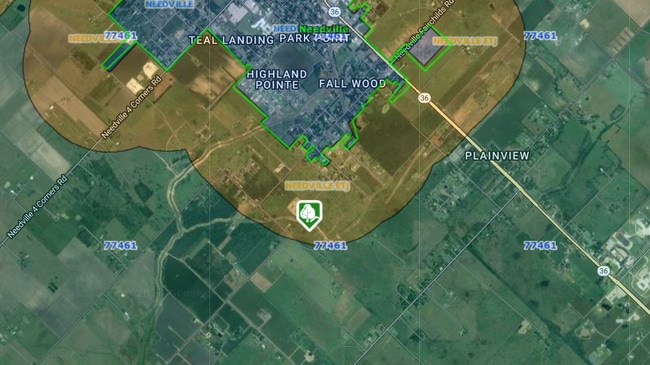
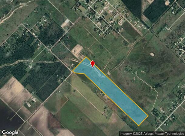
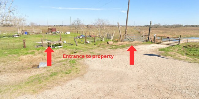
14435 Hurta Rd, Needville, TX 77461
NEARBY LISTINGS FOR SALE OR LEASE
Property Detail
14435 Hurta Rd
Houston-The Woodlands-Sugar Land, TX
F Mading
0524-00-000-1380-906
0524 F MADING, ACRES 56.61
Ranch
Fort Bend
X
Texas
48039C0200K
56.61 AC
2024
Southwest Outlier
2025
Houston
675701
DEMOGRAPHICS near 14435 Hurta Rd
1 Mile
3 Mile
5 Mile
2024 Total Population
687
6,352
10,254
2029 Population
803
7,486
12,130
Pop Growth 2024-2029
+ 16.89%
+ 17.85%
+ 18.30%
Average Age
39
39
39
2024 Total Households
252
2,226
3,523
HH Growth 2024-2029
+ 17.46%
+ 18.42%
+ 18.85%
Median Household Inc
$117,905
$72,823
$72,978
Avg Household Size
2.70
2.80
2.90
2024 Avg HH Vehicles
3.00
2.00
2.00
Median Home Value
$262,036
$229,068
$248,759
Median Year Built
1989
1991
1993
Nearby Places
Map Layers
Map Styles
 Street
 Aerial
- Restaurants
- Banks
- Shops
- Fitness
- Groceries
Nearby Properties
Address
Land Use
TOTAL SIZE
Lot Size
Zoning
Address
Land Use
TOTAL SIZE
Lot Size
Zoning
283,390 SF
51.10 AC
OY
Address
Land Use
TOTAL SIZE
Lot Size
Zoning
61.23 AC
Address
Land Use
TOTAL SIZE
Lot Size
Zoning
113,567 SF
18 AC
Address
Land Use
TOTAL SIZE
Lot Size
Zoning
72,244 SF
17.68 AC
Address
Land Use
TOTAL SIZE
Lot Size
Zoning
3.74 AC
SY
Address
Land Use
TOTAL SIZE
Lot Size
Zoning
720 SF
72.71 AC
Address
Land Use
TOTAL SIZE
Lot Size
Zoning
26,908 SF
13.05 AC
S
Address
Land Use
TOTAL SIZE
Lot Size
Zoning
22,980 SF
7.65 AC
Address
Land Use
TOTAL SIZE
Lot Size
Zoning
112,221 SF
30.39 AC
Address
Land Use
TOTAL SIZE
Lot Size
Zoning
175.95 AC
OQS
Address
Land Use
TOTAL SIZE
Lot Size
Zoning
18,870 SF
3 AC
O
Address
Land Use
TOTAL SIZE
Lot Size
Zoning
624 SF
156.97 AC
YOT
Address
Land Use
TOTAL SIZE
Lot Size
Zoning
7,093 SF
8.08 AC
Address
Land Use
TOTAL SIZE
Lot Size
Zoning
14,234 SF
10.18 AC
Y
Address
Land Use
TOTAL SIZE
Lot Size
Zoning
1,304 SF
5.50 AC
Y
Address
Land Use
TOTAL SIZE
Lot Size
Zoning
20,053 SF
3.16 AC
Address
Land Use
TOTAL SIZE
Lot Size
Zoning
15,000 SF
1.38 AC
SHMY
Address
Land Use
TOTAL SIZE
Lot Size
Zoning
9,478 SF
3.83 AC
NS
Address
Land Use
TOTAL SIZE
Lot Size
Zoning
20,303 SF
4.72 AC
SY
Address
Land Use
TOTAL SIZE
Lot Size
Zoning
800 SF
100.51 AC
OY
Address
Land Use
TOTAL SIZE
Lot Size
Zoning
10,975 SF
1.16 AC
SHMY
Address
Land Use
TOTAL SIZE
Lot Size
Zoning
800 SF
6.77 AC
Address
Land Use
TOTAL SIZE
Lot Size
Zoning
1.91 AC
Address
Land Use
TOTAL SIZE
Lot Size
Zoning
30.29 AC
QSYT
Address
Land Use
TOTAL SIZE
Lot Size
Zoning
6,848 SF
0.68 AC
Address
Land Use
TOTAL SIZE
Lot Size
Zoning
5,040 SF
1.96 AC
XY
Address
Land Use
TOTAL SIZE
Lot Size
Zoning
6,212 SF
1.17 AC
X
Address
Land Use
TOTAL SIZE
Lot Size
Zoning
88.50 AC
QSN
Address
Land Use
TOTAL SIZE
Lot Size
Zoning
68.62 AC
STY
Address
Land Use
TOTAL SIZE
Lot Size
Zoning
11,258 SF
1.52 AC
The World's #1 Commercial Real Estate Marketplace
Connect with us
© 2026 CoStar Group
The information above has been obtained from sources believed reliable. While we do not doubt its accuracy we have not verified it and make no guarantee, warranty or representation about it. It is your responsibility to independently confirm its accuracy and completeness. Any projections, opinions, assumptions, or estimates used are for example only and do not represent the current or future performance of the property. The value of this transaction to you depends on tax and other factors which should be evaluated by your tax, financial, and legal advisors. You and your advisors should conduct a careful, independent investigation of the property to determine to your satisfaction the suitability of the property for your needs.