Property Record
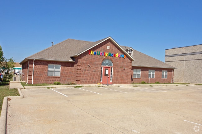
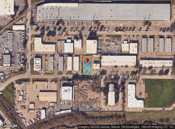
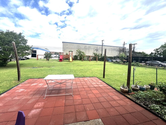
1444 Halsey Way, Carrollton, TX 75007
NEARBY LISTINGS FOR SALE OR LEASE
Property Detail
1444 Halsey Way
Dallas-Fort Worth-Arlington, TX
Kids Quarters
140537700D0050000
KIDS QUARTERS BLK D PT LT 5 ACS 0.4732 JURIS SPLIT REM IN DENTON CO INT201000012887 DD01152010 CO-DC 0537700D00500 1CC0537700D
Religious
Dallas
X
Texas
48113C0160K
5
0
0.47 AC
2025
Lewisville
013719
Dallas/Ft Worth
3,470 SF
DEMOGRAPHICS near 1444 Halsey Way
1 Mile
3 Mile
5 Mile
2024 Total Population
6,557
101,308
309,612
2029 Population
7,491
113,165
344,943
Pop Growth 2024-2029
+ 14.24%
+ 11.70%
+ 11.41%
Average Age
43
39
38
2024 Total Households
2,524
37,808
122,808
HH Growth 2024-2029
+ 13.83%
+ 12.21%
+ 12.13%
Median Household Inc
$108,791
$90,966
$83,830
Avg Household Size
2.60
2.60
2.50
2024 Avg HH Vehicles
2.00
2.00
2.00
Median Home Value
$366,286
$332,918
$350,880
Median Year Built
1989
1989
1990
Nearby Places
Map Layers
Map Styles
 Street
 Aerial
- Restaurants
- Banks
- Shops
- Fitness
- Groceries
PUBLIC TRANSPORTATION
TRANSIT/SUBWAY
North Carrollton/Frankford Station (DART LIGHT RAIL - GREEN LINE - Dallas Area Rapid Transit (DART), Green Line - Dallas Area Rapid Transit (DART))
DRIVE
WALK
Distance
North Carrollton/Frankford Station (DART LIGHT RAIL - GREEN LINE - Dallas Area Rapid Transit (DART), Green Line - Dallas Area Rapid Transit (DART))
4 min
20 min
1.1 mi
COMMUTER RAIL
Trinity Mills Station (Green Line - Dallas Area Rapid Transit (DART))
DRIVE
WALK
Distance
Trinity Mills Station (Green Line - Dallas Area Rapid Transit (DART))
3 min
20 min
1.1 mi
Hebron Station (A-train - Denton County Transportation Authority)
DRIVE
WALK
Distance
Hebron Station (A-train - Denton County Transportation Authority)
9 min
4.1 mi
AIRPORT
Dallas-Fort Worth International
DRIVE
WALK
Distance
Dallas-Fort Worth International
19 min
13.9 mi
Dallas Love Field
DRIVE
WALK
Distance
Dallas Love Field
25 min
15.6 mi
Freight Ports
Port of Shreveport
DRIVE
WALK
Distance
Port of Shreveport
232 min
213.2 mi
Nearby Properties
Address
Land Use
TOTAL SIZE
Lot Size
Zoning
Address
Land Use
TOTAL SIZE
Lot Size
Zoning
660,180 SF
29.95 AC
Address
Land Use
TOTAL SIZE
Lot Size
Zoning
462,692 SF
30.77 AC
2G
Address
Land Use
TOTAL SIZE
Lot Size
Zoning
452,167 SF
5.80 AC
Address
Land Use
TOTAL SIZE
Lot Size
Zoning
513,871 SF
3.63 AC
Z235
Address
Land Use
TOTAL SIZE
Lot Size
Zoning
242,707 SF
27.63 AC
Z343
Address
Land Use
TOTAL SIZE
Lot Size
Zoning
321,732 SF
4.05 AC
Z235
Address
Land Use
TOTAL SIZE
Lot Size
Zoning
343,234 SF
32.41 AC
Address
Land Use
TOTAL SIZE
Lot Size
Zoning
354,546 SF
19.38 AC
3B
Address
Land Use
TOTAL SIZE
Lot Size
Zoning
345,320 SF
20.50 AC
Z172
Address
Land Use
TOTAL SIZE
Lot Size
Zoning
266,871 SF
87 SF
Address
Land Use
TOTAL SIZE
Lot Size
Zoning
725,972 SF
4 AC
Address
Land Use
TOTAL SIZE
Lot Size
Zoning
189,500 SF
53.90 AC
Address
Land Use
TOTAL SIZE
Lot Size
Zoning
297,932 SF
14.05 AC
Address
Land Use
TOTAL SIZE
Lot Size
Zoning
330,816 SF
14.97 AC
Address
Land Use
TOTAL SIZE
Lot Size
Zoning
397,889 SF
23.14 AC
2A
Address
Land Use
TOTAL SIZE
Lot Size
Zoning
251,650 SF
14.22 AC
Address
Land Use
TOTAL SIZE
Lot Size
Zoning
318,477 SF
18.79 AC
Address
Land Use
TOTAL SIZE
Lot Size
Zoning
270,915 SF
3.91 AC
Z84
Address
Land Use
TOTAL SIZE
Lot Size
Zoning
300,958 SF
16.61 AC
Address
Land Use
TOTAL SIZE
Lot Size
Zoning
711,360 SF
32.62 AC
Address
Land Use
TOTAL SIZE
Lot Size
Zoning
350,002 SF
21.01 AC
Z172
Address
Land Use
TOTAL SIZE
Lot Size
Zoning
228,674 SF
11.81 AC
Z235
Address
Land Use
TOTAL SIZE
Lot Size
Zoning
294,764 SF
18 AC
Address
Land Use
TOTAL SIZE
Lot Size
Zoning
276,509 SF
16.67 AC
2G
Address
Land Use
TOTAL SIZE
Lot Size
Zoning
385,026 SF
7.46 AC
Address
Land Use
TOTAL SIZE
Lot Size
Zoning
284,869 SF
12.49 AC
3B
Address
Land Use
TOTAL SIZE
Lot Size
Zoning
217,200 SF
10.50 AC
Address
Land Use
TOTAL SIZE
Lot Size
Zoning
310,696 SF
13.35 AC
2B
Address
Land Use
TOTAL SIZE
Lot Size
Zoning
288,278 SF
16.16 AC
2G
Address
Land Use
TOTAL SIZE
Lot Size
Zoning
219,057 SF
12.63 AC
2B
The World's #1 Commercial Real Estate Marketplace
Connect with us
© 2025 CoStar Group
The information above has been obtained from sources believed reliable. While we do not doubt its accuracy we have not verified it and make no guarantee, warranty or representation about it. It is your responsibility to independently confirm its accuracy and completeness. Any projections, opinions, assumptions, or estimates used are for example only and do not represent the current or future performance of the property. The value of this transaction to you depends on tax and other factors which should be evaluated by your tax, financial, and legal advisors. You and your advisors should conduct a careful, independent investigation of the property to determine to your satisfaction the suitability of the property for your needs.