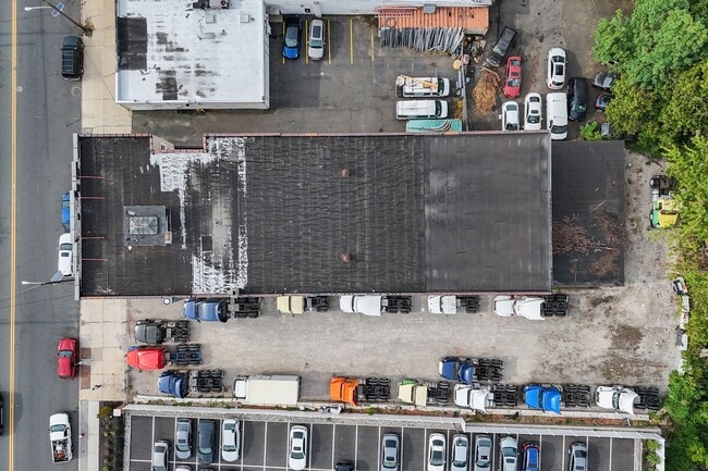
Property Record
1444 N Broad St, Hillside, NJ 07205
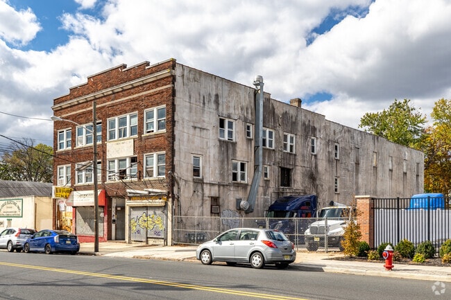
This Property Is For Sale
NEARBY LISTINGS FOR SALE OR LEASE
Property Detail
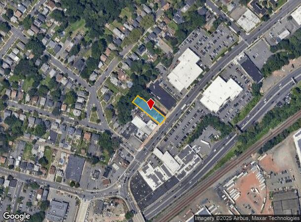
1444 N Broad St
Newark, NJ
Township/Hillside
07-01007-0000-00024
Union
Industrialgeneral
New Jersey
X
24
34013C0154F
0.27 AC
2024
Route 78/22 East
2025
Northern New Jersey
032200
DEMOGRAPHICS near 1444 N Broad St
1 Mile
3 Mile
5 Mile
2024 Total Population
37,458
313,907
727,596
2029 Population
36,343
305,231
708,111
Pop Growth 2024-2029
(2.98%)
(2.76%)
(2.68%)
Average Age
39
38
38
2024 Total Households
13,491
111,043
258,741
HH Growth 2024-2029
(3.11%)
(2.84%)
(2.71%)
Median Household Inc
$52,711
$54,800
$58,712
Avg Household Size
2.60
2.70
2.70
2024 Avg HH Vehicles
1.00
1.00
1.00
Median Home Value
$324,579
$345,924
$369,620
Median Year Built
1949
1956
1958
Nearby Places
Map Layers
Map Styles
 Street
 Aerial
- Restaurants
- Banks
- Shops
- Fitness
- Groceries
PUBLIC TRANSPORTATION
COMMUTER RAIL
North Elizabeth (North Jersey Coast Line - NJ Transit Commuter Rail (NJ Transit), Northeast Corridor Line - NJ Transit Commuter Rail (NJ Transit))
DRIVE
WALK
Distance
North Elizabeth (North Jersey Coast Line - NJ Transit Commuter Rail (NJ Transit), Northeast Corridor Line - NJ Transit Commuter Rail (NJ Transit))
4 min
1.8 mi
Union (Raritan Valley Line - NJ Transit Commuter Rail (NJ Transit))
DRIVE
WALK
Distance
Union (Raritan Valley Line - NJ Transit Commuter Rail (NJ Transit))
6 min
2.8 mi
AIRPORT
Newark Liberty International
DRIVE
WALK
Distance
Newark Liberty International
9 min
6.0 mi
LaGuardia
DRIVE
WALK
Distance
LaGuardia
43 min
25.2 mi
John F Kennedy International
DRIVE
WALK
Distance
John F Kennedy International
53 min
34.6 mi
Freight Ports
Maher Terminal
DRIVE
WALK
Distance
Maher Terminal
11 min
6.0 mi
Nearby Properties
Address
Land Use
TOTAL SIZE
Lot Size
Zoning
Address
Land Use
TOTAL SIZE
Lot Size
Zoning
Address
Land Use
TOTAL SIZE
Lot Size
Zoning
Address
Land Use
TOTAL SIZE
Lot Size
Zoning
Address
Land Use
TOTAL SIZE
Lot Size
Zoning
961.13 AC
Address
Land Use
TOTAL SIZE
Lot Size
Zoning
789.45 AC
Address
Land Use
TOTAL SIZE
Lot Size
Zoning
Address
Land Use
TOTAL SIZE
Lot Size
Zoning
11.36 AC
Address
Land Use
TOTAL SIZE
Lot Size
Zoning
0.61 AC
Address
Land Use
TOTAL SIZE
Lot Size
Zoning
Address
Land Use
TOTAL SIZE
Lot Size
Zoning
Address
Land Use
TOTAL SIZE
Lot Size
Zoning
1,136 SF
6.51 AC
Address
Land Use
TOTAL SIZE
Lot Size
Zoning
Address
Land Use
TOTAL SIZE
Lot Size
Zoning
5.89 AC
Address
Land Use
TOTAL SIZE
Lot Size
Zoning
Address
Land Use
TOTAL SIZE
Lot Size
Zoning
32.27 AC
CCRC
Address
Land Use
TOTAL SIZE
Lot Size
Zoning
Address
Land Use
TOTAL SIZE
Lot Size
Zoning
20,000 SF
30.36 AC
Address
Land Use
TOTAL SIZE
Lot Size
Zoning
4.82 AC
Address
Land Use
TOTAL SIZE
Lot Size
Zoning
1.89 AC
Address
Land Use
TOTAL SIZE
Lot Size
Zoning
2.21 AC
Address
Land Use
TOTAL SIZE
Lot Size
Zoning
Address
Land Use
TOTAL SIZE
Lot Size
Zoning
0.83 AC
Address
Land Use
TOTAL SIZE
Lot Size
Zoning
1 SF
19.95 AC
Address
Land Use
TOTAL SIZE
Lot Size
Zoning
1.01 AC
Address
Land Use
TOTAL SIZE
Lot Size
Zoning
16.14 AC
Address
Land Use
TOTAL SIZE
Lot Size
Zoning
21.25 AC
Address
Land Use
TOTAL SIZE
Lot Size
Zoning
2.22 AC
Address
Land Use
TOTAL SIZE
Lot Size
Zoning
310.45 AC
Address
Land Use
TOTAL SIZE
Lot Size
Zoning
1.72 AC
Address
Land Use
TOTAL SIZE
Lot Size
Zoning
27.71 AC
The World's #1 Commercial Real Estate Marketplace
Connect with us
© 2026 CoStar Group
The information above has been obtained from sources believed reliable. While we do not doubt its accuracy we have not verified it and make no guarantee, warranty or representation about it. It is your responsibility to independently confirm its accuracy and completeness. Any projections, opinions, assumptions, or estimates used are for example only and do not represent the current or future performance of the property. The value of this transaction to you depends on tax and other factors which should be evaluated by your tax, financial, and legal advisors. You and your advisors should conduct a careful, independent investigation of the property to determine to your satisfaction the suitability of the property for your needs.