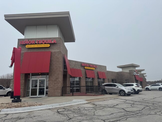
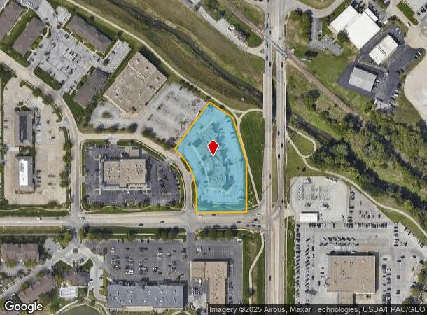
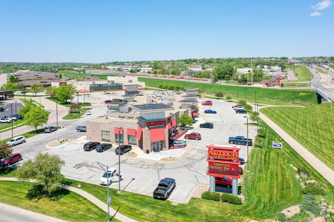
Property Record
14440 F St, Omaha, NE 68137
NEARBY LISTINGS FOR SALE OR LEASE
Property Detail
14440 F St
Omaha-Council Bluffs, NE-IA
Altech Business Park
1223-0091-05
ALTECH BUSINESS PARK LOT 21 BLOCK 0 LOTS 20 & 21
Regionalshoppingcenterormallwithanchorstore
Douglas
AE
Nebraska
31153C0035H
21,20
2024
2.19 AC
2025
Southwest Omaha
007451
Omaha/Council Bluffs
18,554 SF
DEMOGRAPHICS near 14440 F St
1 Mile
3 Mile
5 Mile
2024 Total Population
7,402
89,351
221,735
2029 Population
7,417
90,545
226,570
Pop Growth 2024-2029
+ 0.20%
+ 1.34%
+ 2.18%
Average Age
41
40
39
2024 Total Households
3,019
34,711
86,044
HH Growth 2024-2029
+ 0.23%
+ 1.41%
+ 2.15%
Median Household Inc
$86,008
$90,411
$94,482
Avg Household Size
2.30
2.50
2.50
2024 Avg HH Vehicles
2.00
2.00
2.00
Median Home Value
$201,193
$243,654
$270,302
Median Year Built
1985
1981
1989
Nearby Places
Map Layers
Map Styles
 Street
 Aerial
- Restaurants
- Banks
- Shops
- Fitness
- Groceries
PUBLIC TRANSPORTATION
AIRPORT
Eppley Airfield
DRIVE
WALK
Distance
Eppley Airfield
30 min
18.1 mi
Lincoln
DRIVE
WALK
Distance
Lincoln
54 min
46.7 mi
SALE & LEASE HISTORY
LISTING DATE
SALE/LEASE

Sep 25, 2016
For Lease
May 26, 2017
For Lease
Mar 09, 2017
For Lease
Mar 02, 2020
For Lease
Nearby Properties
Address
Land Use
TOTAL SIZE
Lot Size
Zoning
Address
Land Use
TOTAL SIZE
Lot Size
Zoning
3,654 SF
39.62 AC
Address
Land Use
TOTAL SIZE
Lot Size
Zoning
209,917 SF
9.52 AC
Address
Land Use
TOTAL SIZE
Lot Size
Zoning
370,890 SF
11.20 AC
CC
Address
Land Use
TOTAL SIZE
Lot Size
Zoning
315,685 SF
21.57 AC
RG10
Address
Land Use
TOTAL SIZE
Lot Size
Zoning
56,174 SF
8.65 AC
Address
Land Use
TOTAL SIZE
Lot Size
Zoning
449,891 SF
11.32 AC
Address
Land Use
TOTAL SIZE
Lot Size
Zoning
410,657 SF
18.25 AC
Address
Land Use
TOTAL SIZE
Lot Size
Zoning
186,653 SF
7.96 AC
Address
Land Use
TOTAL SIZE
Lot Size
Zoning
369,614 SF
18.03 AC
CC
Address
Land Use
TOTAL SIZE
Lot Size
Zoning
264,001 SF
10.33 AC
Address
Land Use
TOTAL SIZE
Lot Size
Zoning
294,334 SF
19.14 AC
R6
Address
Land Use
TOTAL SIZE
Lot Size
Zoning
282,180 SF
13.96 AC
Address
Land Use
TOTAL SIZE
Lot Size
Zoning
104,473 SF
0.78 AC
MU
Address
Land Use
TOTAL SIZE
Lot Size
Zoning
423,905 SF
21.96 AC
GI
Address
Land Use
TOTAL SIZE
Lot Size
Zoning
281,964 SF
18.15 AC
R6
Address
Land Use
TOTAL SIZE
Lot Size
Zoning
341,379 SF
18.08 AC
Address
Land Use
TOTAL SIZE
Lot Size
Zoning
274,072 SF
12.06 AC
Address
Land Use
TOTAL SIZE
Lot Size
Zoning
376,653 SF
7.36 AC
Address
Land Use
TOTAL SIZE
Lot Size
Zoning
268,545 SF
7.53 AC
Address
Land Use
TOTAL SIZE
Lot Size
Zoning
124,820 SF
9.69 AC
MU
Address
Land Use
TOTAL SIZE
Lot Size
Zoning
144,271 SF
4.75 AC
Address
Land Use
TOTAL SIZE
Lot Size
Zoning
238,428 SF
18.64 AC
R5
Address
Land Use
TOTAL SIZE
Lot Size
Zoning
154,164 SF
13.33 AC
Address
Land Use
TOTAL SIZE
Lot Size
Zoning
211,228 SF
4.79 AC
Address
Land Use
TOTAL SIZE
Lot Size
Zoning
142,950 SF
5.94 AC
Address
Land Use
TOTAL SIZE
Lot Size
Zoning
201,293 SF
4.71 AC
Address
Land Use
TOTAL SIZE
Lot Size
Zoning
129,609 SF
6.85 AC
R6
Address
Land Use
TOTAL SIZE
Lot Size
Zoning
162,717 SF
6.73 AC
R6
Address
Land Use
TOTAL SIZE
Lot Size
Zoning
106,350 SF
10.99 AC
The World's #1 Commercial Real Estate Marketplace
Connect with us
© 2025 CoStar Group
The information above has been obtained from sources believed reliable. While we do not doubt its accuracy we have not verified it and make no guarantee, warranty or representation about it. It is your responsibility to independently confirm its accuracy and completeness. Any projections, opinions, assumptions, or estimates used are for example only and do not represent the current or future performance of the property. The value of this transaction to you depends on tax and other factors which should be evaluated by your tax, financial, and legal advisors. You and your advisors should conduct a careful, independent investigation of the property to determine to your satisfaction the suitability of the property for your needs.