Property Record
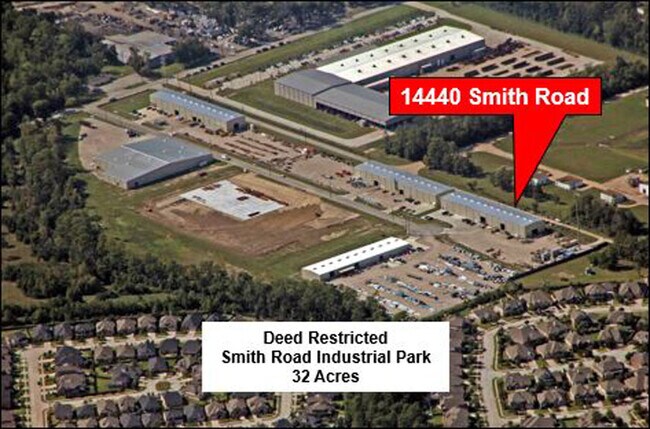
14440 Smith Rd, Humble, TX 77396


NEARBY LISTINGS FOR SALE OR LEASE
Property Detail
14440 Smith Rd
1330900010006
Beltway Fifty Nine North Partners
Lightindustrial
RES A5 BLK 1 BELTWAY FIFTY NINE NORTH PARTNERS
X
Harris
48201C0495L
Texas
2024
2.85 AC
2025
Northeast Hwy 90
232202
Houston
20,150 SF
Houston-Pasadena-The Woodlands, TX
DEMOGRAPHICS near 14440 Smith Rd
1 Mile
3 Mile
5 Mile
2024 Total Population
8,146
60,493
146,925
2029 Population
8,155
61,489
150,708
Pop Growth 2024-2029
+ 0.11%
+ 1.65%
+ 2.57%
Average Age
33
34
34
2024 Total Households
2,549
19,188
45,907
HH Growth 2024-2029
(0.31%)
+ 1.57%
+ 2.56%
Median Household Inc
$102,176
$60,230
$55,267
Avg Household Size
3.20
3.10
3.10
2024 Avg HH Vehicles
2.00
2.00
2.00
Median Home Value
$264,015
$199,827
$172,462
Median Year Built
2001
1997
1988
Nearby Places
Map Layers
Map Styles
 Street
 Aerial
- Restaurants
- Banks
- Shops
- Fitness
- Groceries
PUBLIC TRANSPORTATION
AIRPORT
George Bush Intcntl/Houston
DRIVE
WALK
Distance
George Bush Intcntl/Houston
12 min
7.1 mi
William P Hobby
DRIVE
WALK
Distance
William P Hobby
42 min
26.2 mi
Freight Ports
Port of Houston
DRIVE
WALK
Distance
Port of Houston
31 min
19.9 mi
SALE & LEASE HISTORY
LISTING DATE
SALE/LEASE

Nov 14, 2019
For Lease
Jan 19, 2021
For Lease
Nearby Properties
Address
Land Use
TOTAL SIZE
Lot Size
Zoning
Address
Land Use
TOTAL SIZE
Lot Size
Zoning
785,390 SF
66.02 AC
Address
Land Use
TOTAL SIZE
Lot Size
Zoning
514,500 SF
40.85 AC
Address
Land Use
TOTAL SIZE
Lot Size
Zoning
567,528 SF
76.97 AC
Address
Land Use
TOTAL SIZE
Lot Size
Zoning
306,652 SF
10.67 AC
Address
Land Use
TOTAL SIZE
Lot Size
Zoning
379,570 SF
30.12 AC
Address
Land Use
TOTAL SIZE
Lot Size
Zoning
320,798 SF
14.25 AC
Address
Land Use
TOTAL SIZE
Lot Size
Zoning
431,400 SF
30.88 AC
Address
Land Use
TOTAL SIZE
Lot Size
Zoning
338,700 SF
22.99 AC
Address
Land Use
TOTAL SIZE
Lot Size
Zoning
382,632 SF
22.14 AC
Address
Land Use
TOTAL SIZE
Lot Size
Zoning
361,919 SF
23.59 AC
Address
Land Use
TOTAL SIZE
Lot Size
Zoning
260,427 SF
4.50 AC
Address
Land Use
TOTAL SIZE
Lot Size
Zoning
73,500 SF
115.96 AC
Address
Land Use
TOTAL SIZE
Lot Size
Zoning
449,858 SF
22.20 AC
Address
Land Use
TOTAL SIZE
Lot Size
Zoning
207,720 SF
12.33 AC
Address
Land Use
TOTAL SIZE
Lot Size
Zoning
321,604 SF
16.68 AC
Address
Land Use
TOTAL SIZE
Lot Size
Zoning
246,712 SF
13.33 AC
Address
Land Use
TOTAL SIZE
Lot Size
Zoning
276,464 SF
18.79 AC
Address
Land Use
TOTAL SIZE
Lot Size
Zoning
315,434 SF
13.16 AC
Address
Land Use
TOTAL SIZE
Lot Size
Zoning
262,010 SF
12.64 AC
Address
Land Use
TOTAL SIZE
Lot Size
Zoning
170,407 SF
26.31 AC
Address
Land Use
TOTAL SIZE
Lot Size
Zoning
259,500 SF
12.28 AC
Address
Land Use
TOTAL SIZE
Lot Size
Zoning
314,294 SF
29.50 AC
Address
Land Use
TOTAL SIZE
Lot Size
Zoning
181,720 SF
15.28 AC
Address
Land Use
TOTAL SIZE
Lot Size
Zoning
159,840 SF
16.13 AC
Address
Land Use
TOTAL SIZE
Lot Size
Zoning
113,604 SF
10.70 AC
Address
Land Use
TOTAL SIZE
Lot Size
Zoning
160,930 SF
9.18 AC
Address
Land Use
TOTAL SIZE
Lot Size
Zoning
182,000 SF
8.88 AC
Address
Land Use
TOTAL SIZE
Lot Size
Zoning
156,450 SF
10.69 AC
Address
Land Use
TOTAL SIZE
Lot Size
Zoning
216,082 SF
19.43 AC
Address
Land Use
TOTAL SIZE
Lot Size
Zoning
150,750 SF
18.33 AC
The World's #1 Commercial Real Estate Marketplace
Connect with us
© 2026 CoStar Group
The information above has been obtained from sources believed reliable. While we do not doubt its accuracy we have not verified it and make no guarantee, warranty or representation about it. It is your responsibility to independently confirm its accuracy and completeness. Any projections, opinions, assumptions, or estimates used are for example only and do not represent the current or future performance of the property. The value of this transaction to you depends on tax and other factors which should be evaluated by your tax, financial, and legal advisors. You and your advisors should conduct a careful, independent investigation of the property to determine to your satisfaction the suitability of the property for your needs.