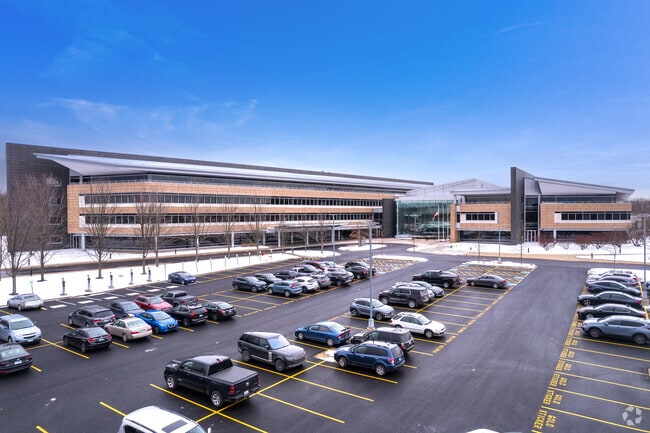
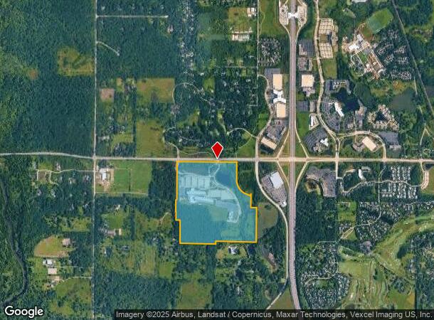
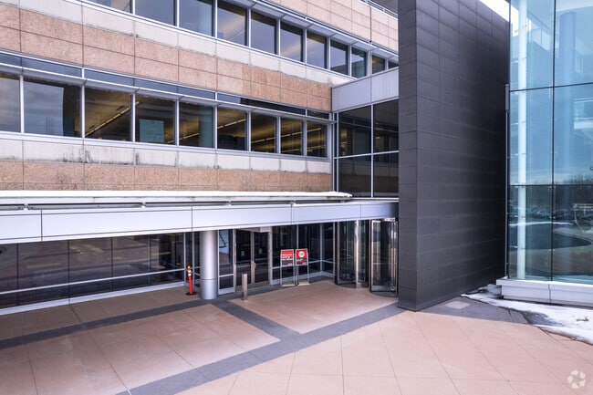
Property Record
14441 W Il Route 60, Lake Forest, IL 60045
NEARBY LISTINGS FOR SALE OR LEASE
Property Detail
14441 W Il Route 60
Chicago-Naperville-Elgin, IL-IN
Beg Nwcor
15-02-200-027
NE1/4;(EX RT60 & TOLL RD&W33G.L.2&BEG NWCOR G.L.2,E33,SW36 .85,N16.5TO POB& W135 S655 & E200 N1558.90 & PCLS 1&2 DOC 3813670)ALSO N95 NW SE(EX W135&EX PCL 2 DOC 3813670 &
Commercialbuilding
Lake
A
Illinois
17097C0256K
145.94 AC
2023
Central North
2024
Chicago
866200
DEMOGRAPHICS near 14441 W Il Route 60
1 Mile
3 Mile
5 Mile
2024 Total Population
769
31,969
128,637
2029 Population
783
32,033
128,180
Pop Growth 2024-2029
+ 1.82%
+ 0.20%
(0.36%)
Average Age
49
44
41
2024 Total Households
273
12,014
47,187
HH Growth 2024-2029
+ 1.83%
+ 0.22%
(0.36%)
Median Household Inc
$169,354
$143,716
$129,507
Avg Household Size
2.50
2.50
2.60
2024 Avg HH Vehicles
2.00
2.00
2.00
Median Home Value
$775,640
$549,306
$501,711
Median Year Built
1995
1987
1982
Nearby Places
Map Layers
Map Styles
 Street
 Aerial
- Restaurants
- Banks
- Shops
- Fitness
- Groceries
PUBLIC TRANSPORTATION
COMMUTER RAIL
Lake Forest Station (Md-North) (Milwaukee District North Line - Northeast Illinois Regional Commuter Railroad (Metra))
DRIVE
WALK
Distance
Lake Forest Station (Md-North) (Milwaukee District North Line - Northeast Illinois Regional Commuter Railroad (Metra))
6 min
3.5 mi
Vernon Hills Station (North Central Service - Northeast Illinois Regional Commuter Railroad (Metra))
DRIVE
WALK
Distance
Vernon Hills Station (North Central Service - Northeast Illinois Regional Commuter Railroad (Metra))
10 min
4.9 mi
AIRPORT
Chicago O'Hare International
DRIVE
WALK
Distance
Chicago O'Hare International
28 min
21.2 mi
Freight Ports
Port Milwaukee
DRIVE
WALK
Distance
Port Milwaukee
66 min
56.6 mi
Nearby Properties
Address
Land Use
TOTAL SIZE
Lot Size
Zoning
Address
Land Use
TOTAL SIZE
Lot Size
Zoning
12.96 AC
Address
Land Use
TOTAL SIZE
Lot Size
Zoning
19.93 AC
Address
Land Use
TOTAL SIZE
Lot Size
Zoning
23.12 AC
Address
Land Use
TOTAL SIZE
Lot Size
Zoning
Address
Land Use
TOTAL SIZE
Lot Size
Zoning
Address
Land Use
TOTAL SIZE
Lot Size
Zoning
28.14 AC
Address
Land Use
TOTAL SIZE
Lot Size
Zoning
Address
Land Use
TOTAL SIZE
Lot Size
Zoning
51,750 SF
48.98 AC
Address
Land Use
TOTAL SIZE
Lot Size
Zoning
17.35 AC
Address
Land Use
TOTAL SIZE
Lot Size
Zoning
Address
Land Use
TOTAL SIZE
Lot Size
Zoning
Address
Land Use
TOTAL SIZE
Lot Size
Zoning
7.98 AC
Address
Land Use
TOTAL SIZE
Lot Size
Zoning
Address
Land Use
TOTAL SIZE
Lot Size
Zoning
10.24 AC
Address
Land Use
TOTAL SIZE
Lot Size
Zoning
Address
Land Use
TOTAL SIZE
Lot Size
Zoning
25.66 AC
Address
Land Use
TOTAL SIZE
Lot Size
Zoning
16.20 AC
Address
Land Use
TOTAL SIZE
Lot Size
Zoning
Address
Land Use
TOTAL SIZE
Lot Size
Zoning
10.68 AC
Address
Land Use
TOTAL SIZE
Lot Size
Zoning
10.80 AC
Address
Land Use
TOTAL SIZE
Lot Size
Zoning
15.47 AC
Address
Land Use
TOTAL SIZE
Lot Size
Zoning
16.06 AC
Address
Land Use
TOTAL SIZE
Lot Size
Zoning
7.99 AC
Address
Land Use
TOTAL SIZE
Lot Size
Zoning
15.23 AC
Address
Land Use
TOTAL SIZE
Lot Size
Zoning
15.18 AC
Address
Land Use
TOTAL SIZE
Lot Size
Zoning
3.57 AC
Address
Land Use
TOTAL SIZE
Lot Size
Zoning
13.39 AC
Address
Land Use
TOTAL SIZE
Lot Size
Zoning
840 SF
2.37 AC
Address
Land Use
TOTAL SIZE
Lot Size
Zoning
8.81 AC
The World's #1 Commercial Real Estate Marketplace
Connect with us
© 2026 CoStar Group
The information above has been obtained from sources believed reliable. While we do not doubt its accuracy we have not verified it and make no guarantee, warranty or representation about it. It is your responsibility to independently confirm its accuracy and completeness. Any projections, opinions, assumptions, or estimates used are for example only and do not represent the current or future performance of the property. The value of this transaction to you depends on tax and other factors which should be evaluated by your tax, financial, and legal advisors. You and your advisors should conduct a careful, independent investigation of the property to determine to your satisfaction the suitability of the property for your needs.