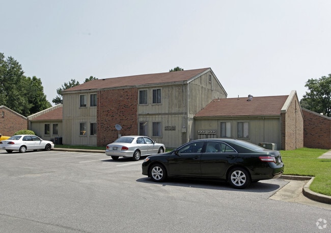
Property Record
1445 E Raines Rd, Memphis, TN 38116

Save to a Folder
{{folder.Name}}
{{folder.ListingIds.length}} Properties
{{folder.ListingIds.length}} Property
Create a New Folder
Property Detail
1445 E Raines Rd
07-9004-0-0006
ES EAST WIND DR COR RAINES RD (SE) TO GRACELAND DR SEE MAP S-10,11
Retirementnursinghomecombined
SHELBY
RU-3
Tennessee
B and X Area of moderate flood hazard, usually the area between the limits of the 100-year and 500-year floods.
1
0
9.36 AC
2025
Whitehaven
022131
Memphis
14,075 SF
Memphis, TN-MS-AR
NEARBY LISTINGS FOR SALE OR LEASE
DEMOGRAPHICS near 1445 E Raines Rd
1 mile
3 mile
5 mile
2025 Total Population
10,998
55,784
138,792
2030 Population
10,711
55,338
139,466
Pop Growth 2025-2030
(2.61%)
(0.80%)
+ 0.49%
Average Age
38
38
38
2025 Total Households
4,318
21,328
53,701
HH Growth 2025-2030
(2.87%)
(0.90%)
+ 0.47%
Median Household Inc
$40,238
$43,738
$43,484
Avg Household Size
2.50
2.60
2.50
2025 Avg HH Vehicles
1.00
2.00
2.00
Median Home Value
$151,572
$149,892
$130,213
Median Year Built
1961
1964
1965
Nearby Places
Map Layers
Map Styles
 Street
 Aerial
Layers
 Traffic
 Biking
Places
Listings with unknown addresses are not visible on the map
- Restaurants
- Banks
- Shops
- Fitness
- Groceries
PUBLIC TRANSPORTATION
COMMUTER RAIL
Central Station (Riverfront Loop - Memphis Area Transit Authority Trolley (MataTrolley))
Drive
Walk
Distance
Central Station (Riverfront Loop - Memphis Area Transit Authority Trolley (MataTrolley))
15 min
9.4 mi
AIRPORT
Memphis International
Drive
Walk
Distance
Memphis International
7 min
3.9 mi
Freight Ports
Port of Shreveport
Drive
Walk
Distance
Port of Shreveport
410 min
377.1 mi
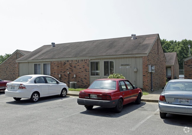
Nearby Properties
Address
Land Use
TOTAL SIZE
Lot Size
Zoning
Address
Land Use
TOTAL SIZE
Lot Size
Zoning
1,013,319 SF
38.86 AC
EMP
Address
Land Use
TOTAL SIZE
Lot Size
Zoning
1,009,363 SF
78.56 AC
EMP
Address
Land Use
TOTAL SIZE
Lot Size
Zoning
180,831 SF
13.11 AC
EMP
Address
Land Use
TOTAL SIZE
Lot Size
Zoning
279,419 SF
172.07 AC
EMP
Address
Land Use
TOTAL SIZE
Lot Size
Zoning
357,582 SF
5.61 AC
EMP
Address
Land Use
TOTAL SIZE
Lot Size
Zoning
146,316 SF
18.07 AC
CMU-3
Address
Land Use
TOTAL SIZE
Lot Size
Zoning
853,440 SF
39.22 AC
EMP
Address
Land Use
TOTAL SIZE
Lot Size
Zoning
144,078 SF
17.93 AC
RU-3
Address
Land Use
TOTAL SIZE
Lot Size
Zoning
38,600 SF
30.35 AC
RU-3
Address
Land Use
TOTAL SIZE
Lot Size
Zoning
345,806 SF
33.16 AC
RU-3
Address
Land Use
TOTAL SIZE
Lot Size
Zoning
47.65 AC
R-8
Address
Land Use
TOTAL SIZE
Lot Size
Zoning
95,307 SF
25.91 AC
RU-3
Address
Land Use
TOTAL SIZE
Lot Size
Zoning
214,950 SF
17.05 AC
CMU-2
Address
Land Use
TOTAL SIZE
Lot Size
Zoning
509,111 SF
EMP
Address
Land Use
TOTAL SIZE
Lot Size
Zoning
52,347 SF
11.55 AC
R-8
Address
Land Use
TOTAL SIZE
Lot Size
Zoning
81,790 SF
17.82 AC
CMU-2
Address
Land Use
TOTAL SIZE
Lot Size
Zoning
432,700 SF
28.16 AC
EMP
Address
Land Use
TOTAL SIZE
Lot Size
Zoning
342,605 SF
82.99 AC
CA
Address
Land Use
TOTAL SIZE
Lot Size
Zoning
188,404 SF
59.17 AC
R-8
Address
Land Use
TOTAL SIZE
Lot Size
Zoning
165,227 SF
25.12 AC
RU-3
Address
Land Use
TOTAL SIZE
Lot Size
Zoning
147,890 SF
16.92 AC
EMP
Address
Land Use
TOTAL SIZE
Lot Size
Zoning
43,476 SF
4.62 AC
CMU-3
Address
Land Use
TOTAL SIZE
Lot Size
Zoning
367,132 SF
18.54 AC
EMP
Address
Land Use
TOTAL SIZE
Lot Size
Zoning
56,848 SF
1.61 AC
EMP
Address
Land Use
TOTAL SIZE
Lot Size
Zoning
61,164 SF
36.95 AC
RU-3
Address
Land Use
TOTAL SIZE
Lot Size
Zoning
230,103 SF
22.07 AC
CMU-2
Address
Land Use
TOTAL SIZE
Lot Size
Zoning
233,060 SF
20 AC
EMP
Address
Land Use
TOTAL SIZE
Lot Size
Zoning
41,868 SF
3.21 AC
EMP
Address
Land Use
TOTAL SIZE
Lot Size
Zoning
29,712 SF
1.92 AC
EMP
The World's #1 Commercial Real Estate Marketplace
Connect with us
© 2026 CoStar Group
The information above has been obtained from sources believed reliable. While we do not doubt its accuracy we have not verified it and make no guarantee, warranty or representation about it. It is your responsibility to independently confirm its accuracy and completeness. Any projections, opinions, assumptions, or estimates used are for example only and do not represent the current or future performance of the property. The value of this transaction to you depends on tax and other factors which should be evaluated by your tax, financial, and legal advisors. You and your advisors should conduct a careful, independent investigation of the property to determine to your satisfaction the suitability of the property for your needs.