Property Record
1445 Greenleaf St, North Charleston, SC 29405


Current Lease Availabilities
NEARBY LISTINGS FOR SALE OR LEASE
Property Detail
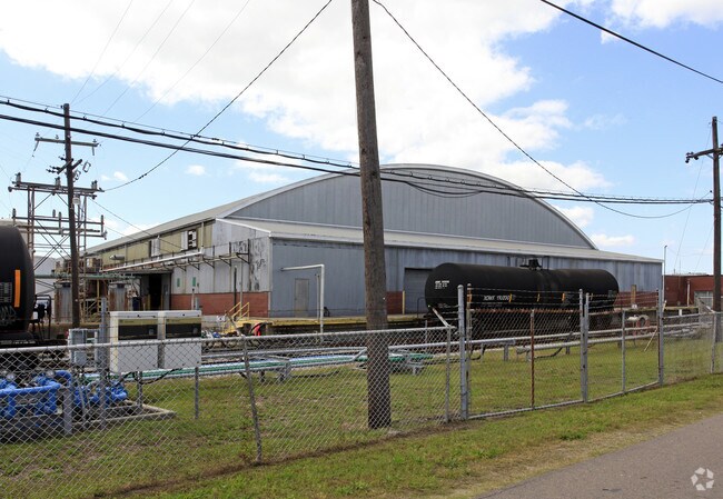
1445 Greenleaf St
464-00-00-032
140
Warehouse
SUBDIVISION NAME -SCTC 1324165-140 DESCRIPTION -TRACT II SITE NAME -SCTC 1324165-140
AE
Charleston
45019C0504K
South Carolina
2025
15.83 AC
2024
Downtown Charleston
005400
Charleston/N Charleston
7,000 SF
Charleston-North Charleston, SC
DEMOGRAPHICS near 1445 Greenleaf St
1 Mile
3 Mile
5 Mile
2024 Total Population
3,811
51,040
135,527
2029 Population
4,183
56,109
147,981
Pop Growth 2024-2029
+ 9.76%
+ 9.93%
+ 9.19%
Average Age
37
37
40
2024 Total Households
1,724
21,879
59,904
HH Growth 2024-2029
+ 9.34%
+ 10.12%
+ 9.17%
Median Household Inc
$37,688
$59,480
$71,592
Avg Household Size
2.20
2.10
2.10
2024 Avg HH Vehicles
1.00
1.00
2.00
Median Home Value
$595,637
$551,095
$492,257
Median Year Built
1974
1968
1977
Nearby Places
Map Layers
Map Styles
 Street
 Aerial
- Restaurants
- Banks
- Shops
- Fitness
- Groceries
PUBLIC TRANSPORTATION
COMMUTER RAIL
Charleston Amtrak Station (Palmetto - Amtrak, Silver Meteor - Amtrak)
DRIVE
WALK
Distance
Charleston Amtrak Station (Palmetto - Amtrak, Silver Meteor - Amtrak)
7 min
5.3 mi
AIRPORT
Charleston AFB/International
DRIVE
WALK
Distance
Charleston AFB/International
18 min
11.8 mi
Freight Ports
Columbus Street Terminal
DRIVE
WALK
Distance
Columbus Street Terminal
4 min
2.4 mi
Nearby Properties
Address
Land Use
TOTAL SIZE
Lot Size
Zoning
Address
Land Use
TOTAL SIZE
Lot Size
Zoning
14,402 SF
9.83 AC
CHARLESTON
Address
Land Use
TOTAL SIZE
Lot Size
Zoning
267,280 SF
6.66 AC
CHARLESTON
Address
Land Use
TOTAL SIZE
Lot Size
Zoning
79,990 SF
9.22 AC
Address
Land Use
TOTAL SIZE
Lot Size
Zoning
Address
Land Use
TOTAL SIZE
Lot Size
Zoning
0.62 AC
Address
Land Use
TOTAL SIZE
Lot Size
Zoning
96,576 SF
11.20 AC
CHARLESTON
Address
Land Use
TOTAL SIZE
Lot Size
Zoning
75,596 SF
39.82 AC
CHARLESTON
Address
Land Use
TOTAL SIZE
Lot Size
Zoning
22,620 SF
12.23 AC
Address
Land Use
TOTAL SIZE
Lot Size
Zoning
480.58 AC
CHARLESTON
Address
Land Use
TOTAL SIZE
Lot Size
Zoning
8,472 SF
9.84 AC
Address
Land Use
TOTAL SIZE
Lot Size
Zoning
8,472 SF
9.83 AC
Address
Land Use
TOTAL SIZE
Lot Size
Zoning
65,776 SF
2.77 AC
CHARLESTON
Address
Land Use
TOTAL SIZE
Lot Size
Zoning
49,014 SF
2.07 AC
CHARLESTON
Address
Land Use
TOTAL SIZE
Lot Size
Zoning
23,712 SF
19.34 AC
Address
Land Use
TOTAL SIZE
Lot Size
Zoning
Address
Land Use
TOTAL SIZE
Lot Size
Zoning
91,150 SF
16.72 AC
CHARLESTON
Address
Land Use
TOTAL SIZE
Lot Size
Zoning
1,435 SF
1.98 AC
Address
Land Use
TOTAL SIZE
Lot Size
Zoning
6.11 AC
Address
Land Use
TOTAL SIZE
Lot Size
Zoning
127,156 SF
12.49 AC
Address
Land Use
TOTAL SIZE
Lot Size
Zoning
23.21 AC
CHARLESTON
Address
Land Use
TOTAL SIZE
Lot Size
Zoning
Address
Land Use
TOTAL SIZE
Lot Size
Zoning
5,733 SF
0.10 AC
Address
Land Use
TOTAL SIZE
Lot Size
Zoning
43,934 SF
1.50 AC
Address
Land Use
TOTAL SIZE
Lot Size
Zoning
14,240 SF
3.50 AC
Address
Land Use
TOTAL SIZE
Lot Size
Zoning
8,740 SF
0.58 AC
Address
Land Use
TOTAL SIZE
Lot Size
Zoning
1,150 SF
Address
Land Use
TOTAL SIZE
Lot Size
Zoning
24,320 SF
1.31 AC
Address
Land Use
TOTAL SIZE
Lot Size
Zoning
29,910 SF
2.82 AC
Address
Land Use
TOTAL SIZE
Lot Size
Zoning
41,070 SF
0.61 AC
Address
Land Use
TOTAL SIZE
Lot Size
Zoning
6.57 AC
The World's #1 Commercial Real Estate Marketplace
Connect with us
© 2025 CoStar Group
The information above has been obtained from sources believed reliable. While we do not doubt its accuracy we have not verified it and make no guarantee, warranty or representation about it. It is your responsibility to independently confirm its accuracy and completeness. Any projections, opinions, assumptions, or estimates used are for example only and do not represent the current or future performance of the property. The value of this transaction to you depends on tax and other factors which should be evaluated by your tax, financial, and legal advisors. You and your advisors should conduct a careful, independent investigation of the property to determine to your satisfaction the suitability of the property for your needs.