Property Record
1414 Harbour Way S, Richmond, CA 94804


Current Lease Availabilities
NEARBY LISTINGS FOR SALE OR LEASE
Property Detail
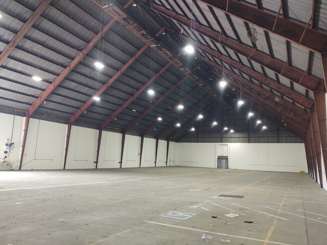
1414 Harbour Way S
Oakland-Fremont-Berkeley, CA
30 31 In
560-181-113-5
PCL MAP 176 PG 11 PCL H & POR REM
Lightindustrial
Contra Costa
VE
California
06013C0236G
18
2025
22.92 AC
2025
Richmond/San Pablo
380002
East Bay/Oakland
476,200 SF
DEMOGRAPHICS near 1414 Harbour Way S
1 Mile
3 Mile
5 Mile
2024 Total Population
5,359
95,936
220,889
2029 Population
5,384
94,887
217,576
Pop Growth 2024-2029
+ 0.47%
(1.09%)
(1.50%)
Average Age
44
39
40
2024 Total Households
2,540
32,396
77,029
HH Growth 2024-2029
+ 0.08%
(1.11%)
(1.66%)
Median Household Inc
$124,545
$79,205
$91,835
Avg Household Size
2.00
2.80
2.70
2024 Avg HH Vehicles
2.00
2.00
2.00
Median Home Value
$734,060
$711,229
$849,214
Median Year Built
1991
1958
1956
Nearby Places
Map Layers
Map Styles
 Street
 Aerial
- Restaurants
- Banks
- Shops
- Fitness
- Groceries
PUBLIC TRANSPORTATION
COMMUTER RAIL
Richmond (Capitol Corridor - Capitol Corridor Joint Powers Authority)
DRIVE
WALK
Distance
Richmond (Capitol Corridor - Capitol Corridor Joint Powers Authority)
7 min
2.3 mi
Berkeley (Capitol Corridor - Amtrak)
DRIVE
WALK
Distance
Berkeley (Capitol Corridor - Amtrak)
13 min
7.5 mi
AIRPORT
Metro Oakland International
DRIVE
WALK
Distance
Metro Oakland International
32 min
21.9 mi
San Francisco International
DRIVE
WALK
Distance
San Francisco International
44 min
29.5 mi
Freight Ports
Port of Richmond
DRIVE
WALK
Distance
Port of Richmond
12 min
4.7 mi
Nearby Properties
Address
Land Use
TOTAL SIZE
Lot Size
Zoning
Address
Land Use
TOTAL SIZE
Lot Size
Zoning
244.30 AC
Address
Land Use
TOTAL SIZE
Lot Size
Zoning
820,000 SF
6.36 AC
Address
Land Use
TOTAL SIZE
Lot Size
Zoning
68,400 SF
5.13 AC
CM
Address
Land Use
TOTAL SIZE
Lot Size
Zoning
76.15 AC
Address
Land Use
TOTAL SIZE
Lot Size
Zoning
581,157 SF
10.52 AC
Address
Land Use
TOTAL SIZE
Lot Size
Zoning
195,281 SF
0.96 AC
Address
Land Use
TOTAL SIZE
Lot Size
Zoning
163,721 SF
0.76 AC
Address
Land Use
TOTAL SIZE
Lot Size
Zoning
3,950 SF
11.47 AC
Address
Land Use
TOTAL SIZE
Lot Size
Zoning
19,308 SF
40.39 AC
Address
Land Use
TOTAL SIZE
Lot Size
Zoning
105,704 SF
10.85 AC
M3
Address
Land Use
TOTAL SIZE
Lot Size
Zoning
12.31 AC
Address
Land Use
TOTAL SIZE
Lot Size
Zoning
35.94 AC
Address
Land Use
TOTAL SIZE
Lot Size
Zoning
22.06 AC
Address
Land Use
TOTAL SIZE
Lot Size
Zoning
16,800 SF
11.62 AC
Address
Land Use
TOTAL SIZE
Lot Size
Zoning
4,550 SF
24.81 AC
Address
Land Use
TOTAL SIZE
Lot Size
Zoning
245,894 SF
12.67 AC
M2
Address
Land Use
TOTAL SIZE
Lot Size
Zoning
202,811 SF
10.98 AC
Address
Land Use
TOTAL SIZE
Lot Size
Zoning
191,800 SF
1.09 AC
Address
Land Use
TOTAL SIZE
Lot Size
Zoning
124,257 SF
2.72 AC
Address
Land Use
TOTAL SIZE
Lot Size
Zoning
149,558 SF
7.94 AC
Address
Land Use
TOTAL SIZE
Lot Size
Zoning
69,949 SF
0.65 AC
C2 CD
Address
Land Use
TOTAL SIZE
Lot Size
Zoning
182,408 SF
10.55 AC
Address
Land Use
TOTAL SIZE
Lot Size
Zoning
34.95 AC
M3
Address
Land Use
TOTAL SIZE
Lot Size
Zoning
81,352 SF
5.06 AC
C2
Address
Land Use
TOTAL SIZE
Lot Size
Zoning
96,440 SF
4.73 AC
Address
Land Use
TOTAL SIZE
Lot Size
Zoning
404,098 SF
24.03 AC
MSL1RD
Address
Land Use
TOTAL SIZE
Lot Size
Zoning
131,400 SF
8.93 AC
M-1
Address
Land Use
TOTAL SIZE
Lot Size
Zoning
54,728 SF
0.96 AC
Address
Land Use
TOTAL SIZE
Lot Size
Zoning
147,500 SF
9.84 AC
The World's #1 Commercial Real Estate Marketplace
Connect with us
© 2026 CoStar Group
The information above has been obtained from sources believed reliable. While we do not doubt its accuracy we have not verified it and make no guarantee, warranty or representation about it. It is your responsibility to independently confirm its accuracy and completeness. Any projections, opinions, assumptions, or estimates used are for example only and do not represent the current or future performance of the property. The value of this transaction to you depends on tax and other factors which should be evaluated by your tax, financial, and legal advisors. You and your advisors should conduct a careful, independent investigation of the property to determine to your satisfaction the suitability of the property for your needs.