Property Record
1445 Huntwood Dr, Cherry Valley, IL 61016

NEARBY LISTINGS FOR SALE OR LEASE
Property Detail
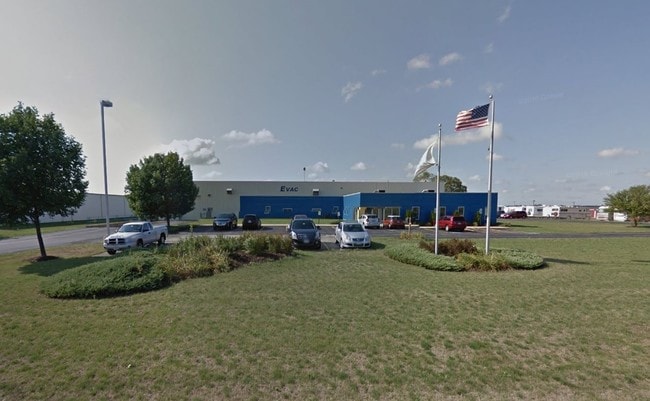
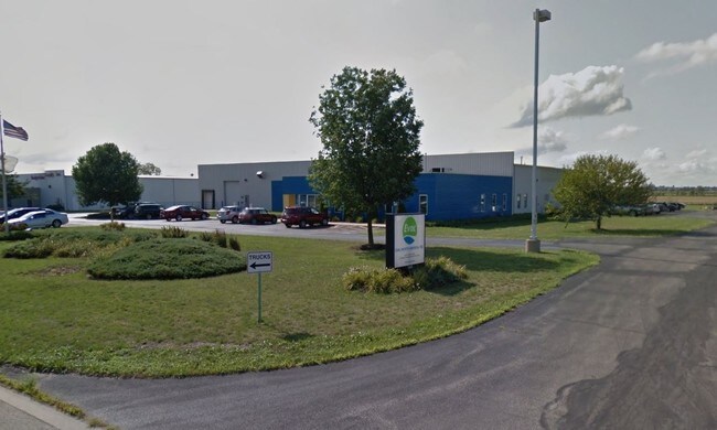
1445 Huntwood Dr
Rockford, IL
Huntwood Bus Park
07-05-100-019
1 2016-03-27 00:00:00 A HUNTWOOD BUSINESS PARK LOT 8 1445 HUNTWOOD DR
Industrialgeneral
Boone
X
Illinois
17007C0175C
8
2024
4.10 AC
2024
Boone County
010400
Chicago
30,718 SF
DEMOGRAPHICS near 1445 Huntwood Dr
1 Mile
3 Mile
5 Mile
2024 Total Population
85
7,595
48,912
2029 Population
84
7,507
48,146
Pop Growth 2024-2029
(1.18%)
(1.16%)
(1.57%)
Average Age
42
45
43
2024 Total Households
33
3,082
19,389
HH Growth 2024-2029
(3.03%)
(1.10%)
(1.51%)
Median Household Inc
$58,333
$78,073
$67,252
Avg Household Size
2.60
2.40
2.50
2024 Avg HH Vehicles
2.00
2.00
2.00
Median Home Value
$142,307
$177,998
$161,412
Median Year Built
2000
1992
1982
Nearby Places
Map Layers
Map Styles
 Street
 Aerial
- Restaurants
- Banks
- Shops
- Fitness
- Groceries
PUBLIC TRANSPORTATION
AIRPORT
Chicago/Rockford International
DRIVE
WALK
Distance
Chicago/Rockford International
24 min
14.4 mi
Freight Ports
Port Milwaukee
DRIVE
WALK
Distance
Port Milwaukee
110 min
93.5 mi
Nearby Properties
Address
Land Use
TOTAL SIZE
Lot Size
Zoning
Address
Land Use
TOTAL SIZE
Lot Size
Zoning
110.99 AC
Address
Land Use
TOTAL SIZE
Lot Size
Zoning
4,004,221 SF
249.03 AC
Address
Land Use
TOTAL SIZE
Lot Size
Zoning
80.50 AC
Address
Land Use
TOTAL SIZE
Lot Size
Zoning
336,204 SF
26.66 AC
Address
Land Use
TOTAL SIZE
Lot Size
Zoning
180,020 SF
21.26 AC
Address
Land Use
TOTAL SIZE
Lot Size
Zoning
200,666 SF
28.90 AC
IL
Address
Land Use
TOTAL SIZE
Lot Size
Zoning
70,986 SF
4.33 AC
OF
Address
Land Use
TOTAL SIZE
Lot Size
Zoning
178.10 AC
Address
Land Use
TOTAL SIZE
Lot Size
Zoning
69,440 SF
11.65 AC
C3
Address
Land Use
TOTAL SIZE
Lot Size
Zoning
172,500 SF
5.96 AC
Address
Land Use
TOTAL SIZE
Lot Size
Zoning
177,080 SF
9.19 AC
Address
Land Use
TOTAL SIZE
Lot Size
Zoning
100,000 SF
7.90 AC
Address
Land Use
TOTAL SIZE
Lot Size
Zoning
122,500 SF
9.37 AC
Address
Land Use
TOTAL SIZE
Lot Size
Zoning
105,000 SF
16 AC
Address
Land Use
TOTAL SIZE
Lot Size
Zoning
382,082 SF
34.81 AC
Address
Land Use
TOTAL SIZE
Lot Size
Zoning
105,000 SF
7.51 AC
Address
Land Use
TOTAL SIZE
Lot Size
Zoning
100,000 SF
10.32 AC
Address
Land Use
TOTAL SIZE
Lot Size
Zoning
146,148 SF
1.14 AC
CC
Address
Land Use
TOTAL SIZE
Lot Size
Zoning
56,464 SF
3.70 AC
CG
Address
Land Use
TOTAL SIZE
Lot Size
Zoning
173,200 SF
83.10 AC
I1
Address
Land Use
TOTAL SIZE
Lot Size
Zoning
96,000 SF
6.48 AC
Address
Land Use
TOTAL SIZE
Lot Size
Zoning
105,000 SF
8.65 AC
Address
Land Use
TOTAL SIZE
Lot Size
Zoning
100,000 SF
5.81 AC
Address
Land Use
TOTAL SIZE
Lot Size
Zoning
73,558 SF
10.20 AC
CC
Address
Land Use
TOTAL SIZE
Lot Size
Zoning
82,500 SF
12.64 AC
Address
Land Use
TOTAL SIZE
Lot Size
Zoning
87,320 SF
3.48 AC
CC
Address
Land Use
TOTAL SIZE
Lot Size
Zoning
90,000 SF
6.53 AC
Address
Land Use
TOTAL SIZE
Lot Size
Zoning
131,811 SF
26.64 AC
I1
Address
Land Use
TOTAL SIZE
Lot Size
Zoning
22,648 SF
7.79 AC
R4
Address
Land Use
TOTAL SIZE
Lot Size
Zoning
23,700 SF
49.19 AC
The World's #1 Commercial Real Estate Marketplace
Connect with us
© 2025 CoStar Group
The information above has been obtained from sources believed reliable. While we do not doubt its accuracy we have not verified it and make no guarantee, warranty or representation about it. It is your responsibility to independently confirm its accuracy and completeness. Any projections, opinions, assumptions, or estimates used are for example only and do not represent the current or future performance of the property. The value of this transaction to you depends on tax and other factors which should be evaluated by your tax, financial, and legal advisors. You and your advisors should conduct a careful, independent investigation of the property to determine to your satisfaction the suitability of the property for your needs.