Property Record
1445 N Sunrise Way, Palm Springs, CA 92262


NEARBY LISTINGS FOR SALE OR LEASE
Property Detail
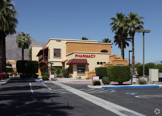
1445 N Sunrise Way
507-100-026
1.66 ACRES M/L IN POR NE 1/4 OF SEC 11 T4S R4E FOR TOTAL DESCRIPTION SEE ASSESSORS MAPS
Officebuilding
Riverside
X
California
06065C1559G
1.66 AC
2024
Coachella Valley
2025
Inland Empire (California)
044602
Riverside-San Bernardino-Ontario, CA
12,953 SF
DEMOGRAPHICS near 1445 N Sunrise Way
1 Mile
3 Mile
5 Mile
2024 Total Population
10,464
57,782
110,997
2029 Population
11,528
63,835
121,569
Pop Growth 2024-2029
+ 10.17%
+ 10.48%
+ 9.52%
Average Age
52
49
47
2024 Total Households
5,599
28,595
50,260
HH Growth 2024-2029
+ 9.88%
+ 10.35%
+ 9.97%
Median Household Inc
$73,155
$68,316
$66,385
Avg Household Size
1.80
1.90
2.10
2024 Avg HH Vehicles
2.00
2.00
2.00
Median Home Value
$706,755
$652,116
$596,460
Median Year Built
1975
1981
1983
Nearby Places
Map Layers
Map Styles
 Street
 Aerial
- Restaurants
- Banks
- Shops
- Fitness
- Groceries
PUBLIC TRANSPORTATION
COMMUTER RAIL
DRIVE
WALK
Distance
12 min
5.2 mi
AIRPORT
Palm Springs International
DRIVE
WALK
Distance
Palm Springs International
7 min
2.8 mi
SALE & LEASE HISTORY
LISTING DATE
SALE/LEASE

Sep 24, 2016
For Lease
Mar 21, 2017
For Lease
Jan 30, 2021
For Lease
Aug 30, 2017
For Lease
Aug 03, 2017
For Lease
Aug 01, 2017
For Lease
Nearby Properties
Address
Land Use
TOTAL SIZE
Lot Size
Zoning
Address
Land Use
TOTAL SIZE
Lot Size
Zoning
485,000 SF
14.71 AC
Address
Land Use
TOTAL SIZE
Lot Size
Zoning
97,065 SF
4.64 AC
R3
Address
Land Use
TOTAL SIZE
Lot Size
Zoning
197,439 SF
8.76 AC
Address
Land Use
TOTAL SIZE
Lot Size
Zoning
258,547 SF
3.84 AC
Address
Land Use
TOTAL SIZE
Lot Size
Zoning
445,755 SF
16.21 AC
R3
Address
Land Use
TOTAL SIZE
Lot Size
Zoning
332,356 SF
9.05 AC
Address
Land Use
TOTAL SIZE
Lot Size
Zoning
35,188 SF
5.98 AC
R3
Address
Land Use
TOTAL SIZE
Lot Size
Zoning
148,746 SF
6.21 AC
R3
Address
Land Use
TOTAL SIZE
Lot Size
Zoning
225,833 SF
22 AC
Address
Land Use
TOTAL SIZE
Lot Size
Zoning
207,931 SF
6.34 AC
C1AA
Address
Land Use
TOTAL SIZE
Lot Size
Zoning
120,754 SF
14.30 AC
Address
Land Use
TOTAL SIZE
Lot Size
Zoning
147,744 SF
3.62 AC
Address
Land Use
TOTAL SIZE
Lot Size
Zoning
120,548 SF
4.63 AC
Address
Land Use
TOTAL SIZE
Lot Size
Zoning
3.20 AC
GR5
Address
Land Use
TOTAL SIZE
Lot Size
Zoning
48,958 SF
0.96 AC
Address
Land Use
TOTAL SIZE
Lot Size
Zoning
70,670 SF
3.90 AC
R4
Address
Land Use
TOTAL SIZE
Lot Size
Zoning
31,488 SF
3.40 AC
A
Address
Land Use
TOTAL SIZE
Lot Size
Zoning
56,129 SF
2.76 AC
R3
Address
Land Use
TOTAL SIZE
Lot Size
Zoning
28,506 SF
2.30 AC
R3
Address
Land Use
TOTAL SIZE
Lot Size
Zoning
233,083 SF
2.20 AC
Address
Land Use
TOTAL SIZE
Lot Size
Zoning
126,869 SF
6.53 AC
Address
Land Use
TOTAL SIZE
Lot Size
Zoning
133,920 SF
8.26 AC
R1
Address
Land Use
TOTAL SIZE
Lot Size
Zoning
114,044 SF
5.40 AC
R3
Address
Land Use
TOTAL SIZE
Lot Size
Zoning
109,231 SF
5.57 AC
R4
Address
Land Use
TOTAL SIZE
Lot Size
Zoning
86,810 SF
3.60 AC
R4VP
Address
Land Use
TOTAL SIZE
Lot Size
Zoning
103,526 SF
11.40 AC
Address
Land Use
TOTAL SIZE
Lot Size
Zoning
238,554 SF
13.31 AC
R1
Address
Land Use
TOTAL SIZE
Lot Size
Zoning
0.51 AC
C-B-D
Address
Land Use
TOTAL SIZE
Lot Size
Zoning
81,687 SF
4.97 AC
R3
Address
Land Use
TOTAL SIZE
Lot Size
Zoning
176,519 SF
12.60 AC
The World's #1 Commercial Real Estate Marketplace
Connect with us
© 2026 CoStar Group
The information above has been obtained from sources believed reliable. While we do not doubt its accuracy we have not verified it and make no guarantee, warranty or representation about it. It is your responsibility to independently confirm its accuracy and completeness. Any projections, opinions, assumptions, or estimates used are for example only and do not represent the current or future performance of the property. The value of this transaction to you depends on tax and other factors which should be evaluated by your tax, financial, and legal advisors. You and your advisors should conduct a careful, independent investigation of the property to determine to your satisfaction the suitability of the property for your needs.