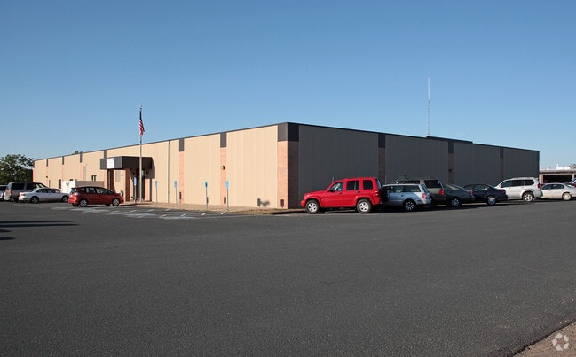
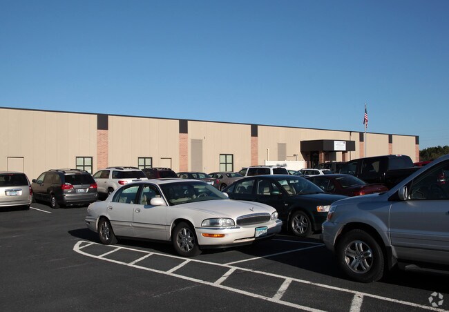
Property Record
14455 Diamond Path, Saint Paul, MN 55124

Save to a Folder
{{folder.Name}}
{{folder.ListingIds.length}} Properties
{{folder.ListingIds.length}} Property
Create a New Folder
Property Detail
14455 Diamond Path
Minneapolis-St. Paul-Bloomington, MN-WI
ROSEMOUNT SCHOOL DISTRICT ADDITION 1 2
01-64675-02-010
DAKOTA
Publicschool
Minnesota
B and X Area of moderate flood hazard, usually the area between the limits of the 100-year and 500-year floods.
10
0
13.44 AC
2025
Burnsville/Eagan/Apple Vy
060838
Minneapolis/St Paul
80,888 SF
NEARBY LISTINGS FOR SALE OR LEASE
DEMOGRAPHICS near 14455 Diamond Path
1 mile
3 mile
5 mile
2025 Total Population
11,636
66,722
166,039
2030 Population
11,810
68,619
170,893
Pop Growth 2025-2030
+ 1.50%
+ 2.84%
+ 2.92%
Average Age
41
40
39
2025 Total Households
4,364
24,617
59,865
HH Growth 2025-2030
+ 1.60%
+ 3.03%
+ 3.06%
Median Household Inc
$107,220
$108,747
$114,279
Avg Household Size
2.60
2.60
2.70
2025 Avg HH Vehicles
2.00
2.00
2.00
Median Home Value
$372,450
$394,216
$403,897
Median Year Built
1987
1995
1991
Nearby Places
Map Layers
Map Styles
 Street
 Aerial
Layers
 Traffic
 Biking
Places
Listings with unknown addresses are not visible on the map
- Restaurants
- Banks
- Shops
- Fitness
- Groceries
PUBLIC TRANSPORTATION
AIRPORT
Minneapolis-St Paul International/Wold-Chamberlain
Drive
Walk
Distance
Minneapolis-St Paul International/Wold-Chamberlain
23 min
14.2 mi
Freight Ports
Port Milwaukee
Drive
Walk
Distance
Port Milwaukee
384 min
343.4 mi
Nearby Properties
Address
Land Use
TOTAL SIZE
Lot Size
Zoning
Address
Land Use
TOTAL SIZE
Lot Size
Zoning
124,880 SF
20.24 AC
Address
Land Use
TOTAL SIZE
Lot Size
Zoning
580,336 SF
12.28 AC
Address
Land Use
TOTAL SIZE
Lot Size
Zoning
413,138 SF
11.86 AC
Address
Land Use
TOTAL SIZE
Lot Size
Zoning
312,292 SF
4.77 AC
Address
Land Use
TOTAL SIZE
Lot Size
Zoning
98,397 SF
12.42 AC
Address
Land Use
TOTAL SIZE
Lot Size
Zoning
422,000 SF
62.13 AC
Address
Land Use
TOTAL SIZE
Lot Size
Zoning
269,828 SF
3.58 AC
Address
Land Use
TOTAL SIZE
Lot Size
Zoning
18,687 SF
7.71 AC
Address
Land Use
TOTAL SIZE
Lot Size
Zoning
351,484 SF
57.09 AC
Address
Land Use
TOTAL SIZE
Lot Size
Zoning
277,504 SF
5.27 AC
Address
Land Use
TOTAL SIZE
Lot Size
Zoning
Address
Land Use
TOTAL SIZE
Lot Size
Zoning
207,187 SF
2.45 AC
Address
Land Use
TOTAL SIZE
Lot Size
Zoning
193,413 SF
2.95 AC
Address
Land Use
TOTAL SIZE
Lot Size
Zoning
232,598 SF
3.61 AC
Address
Land Use
TOTAL SIZE
Lot Size
Zoning
181,250 SF
2.68 AC
Address
Land Use
TOTAL SIZE
Lot Size
Zoning
181,880 SF
3.23 AC
Address
Land Use
TOTAL SIZE
Lot Size
Zoning
179,476 SF
2.46 AC
Address
Land Use
TOTAL SIZE
Lot Size
Zoning
168,324 SF
2.66 AC
Address
Land Use
TOTAL SIZE
Lot Size
Zoning
201,999 SF
70.51 AC
Address
Land Use
TOTAL SIZE
Lot Size
Zoning
183,197 SF
2.20 AC
Address
Land Use
TOTAL SIZE
Lot Size
Zoning
226,621 SF
35.56 AC
Address
Land Use
TOTAL SIZE
Lot Size
Zoning
247,930 SF
16.48 AC
Address
Land Use
TOTAL SIZE
Lot Size
Zoning
246,662 SF
22.62 AC
Address
Land Use
TOTAL SIZE
Lot Size
Zoning
210,772 SF
15.28 AC
Address
Land Use
TOTAL SIZE
Lot Size
Zoning
214,000 SF
28.74 AC
Address
Land Use
TOTAL SIZE
Lot Size
Zoning
198,672 SF
14.87 AC
Address
Land Use
TOTAL SIZE
Lot Size
Zoning
85,020 SF
22.08 AC
Address
Land Use
TOTAL SIZE
Lot Size
Zoning
58,398 SF
5.40 AC
Address
Land Use
TOTAL SIZE
Lot Size
Zoning
The World's #1 Commercial Real Estate Marketplace
Connect with us
© 2026 CoStar Group
The information above has been obtained from sources believed reliable. While we do not doubt its accuracy we have not verified it and make no guarantee, warranty or representation about it. It is your responsibility to independently confirm its accuracy and completeness. Any projections, opinions, assumptions, or estimates used are for example only and do not represent the current or future performance of the property. The value of this transaction to you depends on tax and other factors which should be evaluated by your tax, financial, and legal advisors. You and your advisors should conduct a careful, independent investigation of the property to determine to your satisfaction the suitability of the property for your needs.