Property Record
14469 Olio Rd, Noblesville, IN 46060
NEARBY LISTINGS FOR SALE OR LEASE
-
-
View all Noblesville listings for lease on LoopNet.com
Property Detail
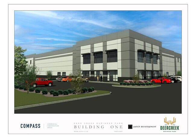
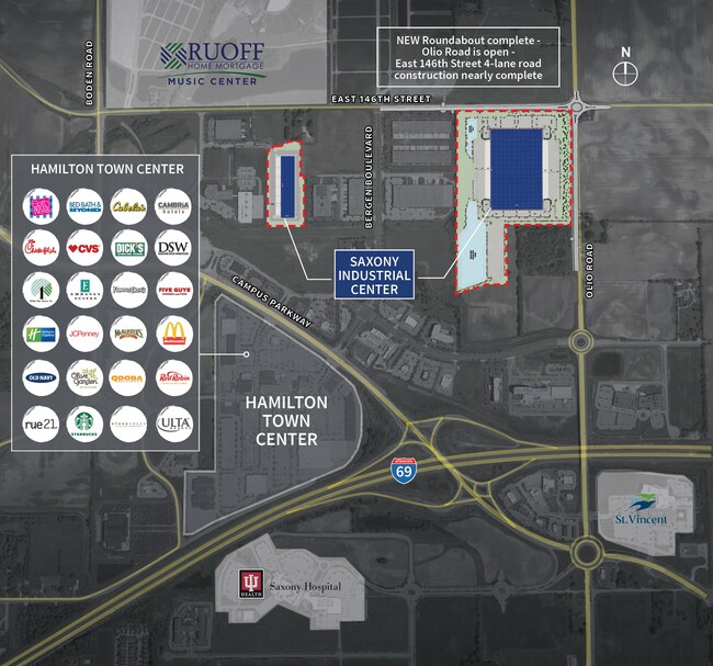
14469 Olio Rd
Indianapolis-Carmel-Anderson, IN
Brueckmann Cornett
29-11-23-000-007.000-021
ACREAGE 45.06, SECTION 23, TOWNSHIP 18, RANGE 5, BRUECKMANN CORNETT, BLOCK PT A, IRREGULAR SHAPE
Agriculturalland
Hamilton
X
Indiana
18057C0256G
45.06 AC
2023
Fishers/Noblesville
2024
Indianapolis
110818
DEMOGRAPHICS near 14469 Olio Rd
1 Mile
3 Mile
5 Mile
2024 Total Population
437
45,269
107,848
2029 Population
474
48,440
115,192
Pop Growth 2024-2029
+ 8.47%
+ 7.00%
+ 6.81%
Average Age
35
36
37
2024 Total Households
180
15,177
37,407
HH Growth 2024-2029
+ 8.33%
+ 7.21%
+ 6.96%
Median Household Inc
$74,999
$128,744
$128,930
Avg Household Size
2.40
3.00
2.90
2024 Avg HH Vehicles
2.00
2.00
2.00
Median Home Value
$192,726
$399,838
$405,579
Median Year Built
2006
2009
2007
Nearby Places
- Restaurants
- Banks
- Shops
- Fitness
- Groceries
PUBLIC TRANSPORTATION
AIRPORT
Indianapolis International
DRIVE
WALK
Distance
Indianapolis International
57 min
36.5 mi
Freight Ports
Port of Toledo
DRIVE
WALK
Distance
Port of Toledo
243 min
204.9 mi
SALE & LEASE HISTORY
LISTING DATE
SALE/LEASE

Mar 28, 2023
For Lease
Nearby Properties
Address
Land Use
TOTAL SIZE
Lot Size
Zoning
Address
Land Use
TOTAL SIZE
Lot Size
Zoning
250,101 SF
25.60 AC
Address
Land Use
TOTAL SIZE
Lot Size
Zoning
450,420 SF
24.54 AC
Address
Land Use
TOTAL SIZE
Lot Size
Zoning
172,571 SF
36.77 AC
Address
Land Use
TOTAL SIZE
Lot Size
Zoning
375,289 SF
20.36 AC
Address
Land Use
TOTAL SIZE
Lot Size
Zoning
234,304 SF
5.85 AC
Address
Land Use
TOTAL SIZE
Lot Size
Zoning
93,140 SF
24 AC
Address
Land Use
TOTAL SIZE
Lot Size
Zoning
110,632 SF
35.36 AC
Address
Land Use
TOTAL SIZE
Lot Size
Zoning
139,271 SF
15.06 AC
Address
Land Use
TOTAL SIZE
Lot Size
Zoning
178,207 SF
4.25 AC
Address
Land Use
TOTAL SIZE
Lot Size
Zoning
87,125 SF
7.40 AC
Address
Land Use
TOTAL SIZE
Lot Size
Zoning
155,815 SF
10.07 AC
Address
Land Use
TOTAL SIZE
Lot Size
Zoning
105,277 SF
9.70 AC
Address
Land Use
TOTAL SIZE
Lot Size
Zoning
154,237 SF
9.09 AC
Address
Land Use
TOTAL SIZE
Lot Size
Zoning
188,004 SF
11.07 AC
Address
Land Use
TOTAL SIZE
Lot Size
Zoning
67,674 SF
24.91 AC
Address
Land Use
TOTAL SIZE
Lot Size
Zoning
88,088 SF
8.53 AC
Address
Land Use
TOTAL SIZE
Lot Size
Zoning
79,556 SF
5.15 AC
Address
Land Use
TOTAL SIZE
Lot Size
Zoning
110,316 SF
10.50 AC
Address
Land Use
TOTAL SIZE
Lot Size
Zoning
184,814 SF
13.10 AC
Address
Land Use
TOTAL SIZE
Lot Size
Zoning
69,151 SF
23.86 AC
Address
Land Use
TOTAL SIZE
Lot Size
Zoning
156,610 SF
12.10 AC
Address
Land Use
TOTAL SIZE
Lot Size
Zoning
72,252 SF
4 AC
Address
Land Use
TOTAL SIZE
Lot Size
Zoning
67,234 SF
6.56 AC
Address
Land Use
TOTAL SIZE
Lot Size
Zoning
162,902 SF
10.44 AC
Address
Land Use
TOTAL SIZE
Lot Size
Zoning
69,672 SF
34.35 AC
Address
Land Use
TOTAL SIZE
Lot Size
Zoning
161,200 SF
13.07 AC
Address
Land Use
TOTAL SIZE
Lot Size
Zoning
126,486 SF
8.48 AC
Address
Land Use
TOTAL SIZE
Lot Size
Zoning
106,050 SF
10.40 AC
Address
Land Use
TOTAL SIZE
Lot Size
Zoning
124,410 SF
15.48 AC
Address
Land Use
TOTAL SIZE
Lot Size
Zoning
166,386 SF
13.52 AC
The World's #1 Commercial Real Estate Marketplace
Connect with us
© 2025 CoStar Group
The information above has been obtained from sources believed reliable. While we do not doubt its accuracy we have not verified it and make no guarantee, warranty or representation about it. It is your responsibility to independently confirm its accuracy and completeness. Any projections, opinions, assumptions, or estimates used are for example only and do not represent the current or future performance of the property. The value of this transaction to you depends on tax and other factors which should be evaluated by your tax, financial, and legal advisors. You and your advisors should conduct a careful, independent investigation of the property to determine to your satisfaction the suitability of the property for your needs.