Property Record
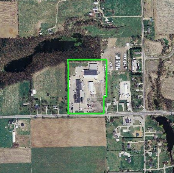
14489 Us Highway 20, Middlebury, IN 46540

NEARBY LISTINGS FOR SALE OR LEASE
-
-
View all Middlebury listings for sale on LoopNet.com
Property Detail
14489 Us Highway 20
20-08-08-451-003.000-034
PT S1/2 -2023.5FT W SE COR 290X35X676.81X677 EX 1.112A ROW SEC 8 13.658A
Lightindustrial
Elkhart
X
Indiana
18087C0150C
13.66 AC
2024
Outlying Elkhart County
2025
South Bend/Mishawaka
000801
Elkhart-Goshen, IN
106,398 SF
DEMOGRAPHICS near 14489 Us Highway 20
1 Mile
3 Mile
5 Mile
2024 Total Population
1,466
8,367
18,661
2029 Population
1,454
8,320
18,526
Pop Growth 2024-2029
(0.82%)
(0.56%)
(0.72%)
Average Age
36
36
36
2024 Total Households
477
2,725
5,991
HH Growth 2024-2029
(0.84%)
(0.70%)
(0.82%)
Median Household Inc
$80,443
$90,058
$88,028
Avg Household Size
3.00
3.00
3.10
2024 Avg HH Vehicles
2.00
2.00
2.00
Median Home Value
$242,897
$272,889
$265,773
Median Year Built
1987
1983
1989
Nearby Places
Map Layers
Map Styles
 Street
 Aerial
- Restaurants
- Banks
- Shops
- Fitness
- Groceries
PUBLIC TRANSPORTATION
AIRPORT
South Bend International
DRIVE
WALK
Distance
South Bend International
54 min
36.4 mi
Freight Ports
Port of Toledo
DRIVE
WALK
Distance
Port of Toledo
161 min
133.2 mi
Nearby Properties
Address
Land Use
TOTAL SIZE
Lot Size
Zoning
Address
Land Use
TOTAL SIZE
Lot Size
Zoning
1,516,881 SF
115.31 AC
ZO01
Address
Land Use
TOTAL SIZE
Lot Size
Zoning
357,464 SF
93.04 AC
ZO01
Address
Land Use
TOTAL SIZE
Lot Size
Zoning
262,890 SF
36.38 AC
ZO01
Address
Land Use
TOTAL SIZE
Lot Size
Zoning
300,178 SF
34.46 AC
ZO01
Address
Land Use
TOTAL SIZE
Lot Size
Zoning
951,390 SF
154.58 AC
ZO01
Address
Land Use
TOTAL SIZE
Lot Size
Zoning
199,089 SF
100 AC
ZO01
Address
Land Use
TOTAL SIZE
Lot Size
Zoning
249,990 SF
11.68 AC
ZO01
Address
Land Use
TOTAL SIZE
Lot Size
Zoning
287,049 SF
15.40 AC
ZO01
Address
Land Use
TOTAL SIZE
Lot Size
Zoning
1,087,012 SF
4.08 AC
ZO01
Address
Land Use
TOTAL SIZE
Lot Size
Zoning
181,443 SF
51.34 AC
ZO01
Address
Land Use
TOTAL SIZE
Lot Size
Zoning
167,041 SF
38.10 AC
ZO01
Address
Land Use
TOTAL SIZE
Lot Size
Zoning
265,704 SF
20.34 AC
ZO01
Address
Land Use
TOTAL SIZE
Lot Size
Zoning
335,093 SF
14.63 AC
ZO01
Address
Land Use
TOTAL SIZE
Lot Size
Zoning
87,303 SF
16.31 AC
ZO01
Address
Land Use
TOTAL SIZE
Lot Size
Zoning
190,280 SF
62.04 AC
ZO01
Address
Land Use
TOTAL SIZE
Lot Size
Zoning
198,134 SF
11.74 AC
ZO01
Address
Land Use
TOTAL SIZE
Lot Size
Zoning
248,192 SF
10.10 AC
ZO01
Address
Land Use
TOTAL SIZE
Lot Size
Zoning
152,448 SF
11.70 AC
ZO01
Address
Land Use
TOTAL SIZE
Lot Size
Zoning
78,240 SF
19.28 AC
Address
Land Use
TOTAL SIZE
Lot Size
Zoning
102,600 SF
12.80 AC
ZO01
Address
Land Use
TOTAL SIZE
Lot Size
Zoning
95,140 SF
14.47 AC
ZO01
Address
Land Use
TOTAL SIZE
Lot Size
Zoning
226,136 SF
14.01 AC
ZO01
Address
Land Use
TOTAL SIZE
Lot Size
Zoning
109,341 SF
11.64 AC
ZO01
Address
Land Use
TOTAL SIZE
Lot Size
Zoning
172,029 SF
20 AC
ZO01
Address
Land Use
TOTAL SIZE
Lot Size
Zoning
82,500 SF
7.42 AC
ZO01
Address
Land Use
TOTAL SIZE
Lot Size
Zoning
37,360 SF
5.79 AC
ZO01
Address
Land Use
TOTAL SIZE
Lot Size
Zoning
48,915 SF
2.42 AC
ZO01
Address
Land Use
TOTAL SIZE
Lot Size
Zoning
21,835 SF
2.66 AC
ZO01
Address
Land Use
TOTAL SIZE
Lot Size
Zoning
23,655 SF
14.06 AC
ZO01
Address
Land Use
TOTAL SIZE
Lot Size
Zoning
75,878 SF
8.64 AC
ZO01
The World's #1 Commercial Real Estate Marketplace
Connect with us
© 2026 CoStar Group
The information above has been obtained from sources believed reliable. While we do not doubt its accuracy we have not verified it and make no guarantee, warranty or representation about it. It is your responsibility to independently confirm its accuracy and completeness. Any projections, opinions, assumptions, or estimates used are for example only and do not represent the current or future performance of the property. The value of this transaction to you depends on tax and other factors which should be evaluated by your tax, financial, and legal advisors. You and your advisors should conduct a careful, independent investigation of the property to determine to your satisfaction the suitability of the property for your needs.