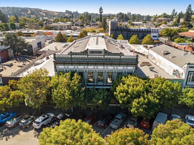
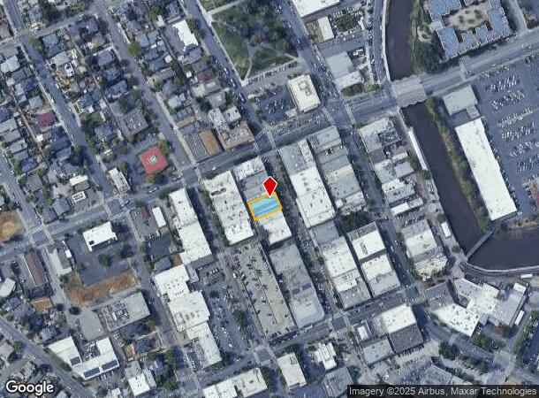
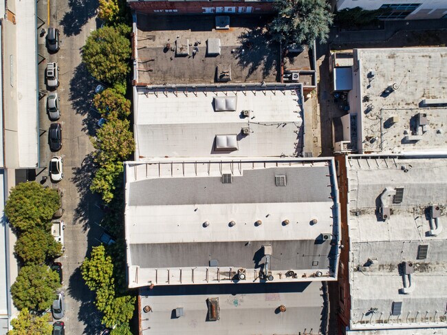
Property Record
145 Kentucky St, Petaluma, CA 94952
Current Lease Availabilities
NEARBY LISTINGS FOR SALE OR LEASE
Property Detail
145 Kentucky St
Santa Rosa, CA
Petaluma
006-363-014
MAP 192 PG 494 LOT 323
Storesoffices
Sonoma
X
California
06097C0982G
323
2024
0.14 AC
2025
Petaluma/Cotati/Rohnert
150701
North Bay/Santa Rosa
12,000 SF
DEMOGRAPHICS near 145 Kentucky St
1 Mile
3 Mile
5 Mile
2024 Total Population
16,125
63,186
67,401
2029 Population
15,965
62,296
66,251
Pop Growth 2024-2029
(0.99%)
(1.41%)
(1.71%)
Average Age
43
43
44
2024 Total Households
6,671
24,571
26,286
HH Growth 2024-2029
(1.00%)
(1.40%)
(1.72%)
Median Household Inc
$103,514
$110,652
$110,105
Avg Household Size
2.30
2.50
2.50
2024 Avg HH Vehicles
2.00
2.00
2.00
Median Home Value
$826,192
$783,765
$793,718
Median Year Built
1962
1979
1979
Nearby Places
Map Layers
Map Styles
 Street
 Aerial
- Restaurants
- Banks
- Shops
- Fitness
- Groceries
PUBLIC TRANSPORTATION
COMMUTER RAIL
DRIVE
WALK
Distance
2 min
10 min
0.5 mi
DRIVE
WALK
Distance
8 min
3.1 mi
AIRPORT
Charles M Schulz - Sonoma County
DRIVE
WALK
Distance
Charles M Schulz - Sonoma County
33 min
24.7 mi
Freight Ports
Port of Richmond
DRIVE
WALK
Distance
Port of Richmond
47 min
33.3 mi
Nearby Properties
Address
Land Use
TOTAL SIZE
Lot Size
Zoning
Address
Land Use
TOTAL SIZE
Lot Size
Zoning
458,444 SF
32.23 AC
CITYPE
Address
Land Use
TOTAL SIZE
Lot Size
Zoning
0.76 AC
ML
Address
Land Use
TOTAL SIZE
Lot Size
Zoning
231,609 SF
8.05 AC
Address
Land Use
TOTAL SIZE
Lot Size
Zoning
121,876 SF
16.14 AC
Address
Land Use
TOTAL SIZE
Lot Size
Zoning
5.03 AC
CITYPE
Address
Land Use
TOTAL SIZE
Lot Size
Zoning
150,025 SF
1.48 AC
Address
Land Use
TOTAL SIZE
Lot Size
Zoning
134,732 SF
2.05 AC
Address
Land Use
TOTAL SIZE
Lot Size
Zoning
165,541 SF
12.61 AC
Address
Land Use
TOTAL SIZE
Lot Size
Zoning
149,242 SF
5.40 AC
CITYPE
Address
Land Use
TOTAL SIZE
Lot Size
Zoning
137,270 SF
10.04 AC
Address
Land Use
TOTAL SIZE
Lot Size
Zoning
94,107 SF
2.66 AC
Address
Land Use
TOTAL SIZE
Lot Size
Zoning
89,944 SF
14.63 AC
CITYPE
Address
Land Use
TOTAL SIZE
Lot Size
Zoning
170,524 SF
14.53 AC
Address
Land Use
TOTAL SIZE
Lot Size
Zoning
1.18 AC
Address
Land Use
TOTAL SIZE
Lot Size
Zoning
5.89 AC
PCD
Address
Land Use
TOTAL SIZE
Lot Size
Zoning
98,382 SF
6.83 AC
SP
Address
Land Use
TOTAL SIZE
Lot Size
Zoning
151,942 SF
5.85 AC
Address
Land Use
TOTAL SIZE
Lot Size
Zoning
80,392 SF
7.13 AC
Address
Land Use
TOTAL SIZE
Lot Size
Zoning
145,152 SF
8.39 AC
Address
Land Use
TOTAL SIZE
Lot Size
Zoning
109,993 SF
2.31 AC
Address
Land Use
TOTAL SIZE
Lot Size
Zoning
195,837 SF
16.32 AC
PCD
Address
Land Use
TOTAL SIZE
Lot Size
Zoning
85,582 SF
2.61 AC
CITYPE
Address
Land Use
TOTAL SIZE
Lot Size
Zoning
Address
Land Use
TOTAL SIZE
Lot Size
Zoning
165,000 SF
9.99 AC
Address
Land Use
TOTAL SIZE
Lot Size
Zoning
71,220 SF
7.31 AC
CITYPE
Address
Land Use
TOTAL SIZE
Lot Size
Zoning
138,520 SF
10.36 AC
ML
Address
Land Use
TOTAL SIZE
Lot Size
Zoning
0.96 AC
MG
Address
Land Use
TOTAL SIZE
Lot Size
Zoning
70,110 SF
1.11 AC
CITYPE
Address
Land Use
TOTAL SIZE
Lot Size
Zoning
10,000 SF
16.50 AC
The World's #1 Commercial Real Estate Marketplace
Connect with us
© 2025 CoStar Group
The information above has been obtained from sources believed reliable. While we do not doubt its accuracy we have not verified it and make no guarantee, warranty or representation about it. It is your responsibility to independently confirm its accuracy and completeness. Any projections, opinions, assumptions, or estimates used are for example only and do not represent the current or future performance of the property. The value of this transaction to you depends on tax and other factors which should be evaluated by your tax, financial, and legal advisors. You and your advisors should conduct a careful, independent investigation of the property to determine to your satisfaction the suitability of the property for your needs.