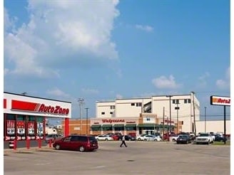
Property Record
145 N Buckman St, Shepherdsville, KY 40165

NEARBY LISTINGS FOR SALE OR LEASE
Property Detail
145 N Buckman St
Louisville-Jefferson County, KY-IN
LT 1 MINOR CONSOLIDATION PLAT
420299
Bullitt
Commercialnec
Kentucky
X
1
21029C0177G
0.82 AC
2024
Bullitt County
2024
Louisville
020704
DEMOGRAPHICS near 145 N Buckman St
1 Mile
3 Mile
5 Mile
2024 Total Population
5,678
18,447
28,575
2029 Population
5,886
19,260
29,892
Pop Growth 2024-2029
+ 3.66%
+ 4.41%
+ 4.61%
Average Age
36
38
41
2024 Total Households
2,230
7,094
11,004
HH Growth 2024-2029
+ 3.45%
+ 4.33%
+ 4.53%
Median Household Inc
$42,899
$57,291
$62,506
Avg Household Size
2.50
2.60
2.60
2024 Avg HH Vehicles
2.00
2.00
2.00
Median Home Value
$156,739
$168,034
$188,648
Median Year Built
1993
1992
1990
Nearby Places
Map Layers
Map Styles
 Street
 Aerial
- Restaurants
- Banks
- Shops
- Fitness
- Groceries
PUBLIC TRANSPORTATION
AIRPORT
Louisville Muhammad Ali International
DRIVE
WALK
Distance
Louisville Muhammad Ali International
23 min
15.8 mi
Nearby Properties
Address
Land Use
TOTAL SIZE
Lot Size
Zoning
Address
Land Use
TOTAL SIZE
Lot Size
Zoning
Address
Land Use
TOTAL SIZE
Lot Size
Zoning
936,000 SF
51.74 AC
Address
Land Use
TOTAL SIZE
Lot Size
Zoning
Address
Land Use
TOTAL SIZE
Lot Size
Zoning
Address
Land Use
TOTAL SIZE
Lot Size
Zoning
38.03 AC
Address
Land Use
TOTAL SIZE
Lot Size
Zoning
29.43 AC
Address
Land Use
TOTAL SIZE
Lot Size
Zoning
59.47 AC
Address
Land Use
TOTAL SIZE
Lot Size
Zoning
Address
Land Use
TOTAL SIZE
Lot Size
Zoning
Address
Land Use
TOTAL SIZE
Lot Size
Zoning
38.20 AC
Address
Land Use
TOTAL SIZE
Lot Size
Zoning
33.96 AC
Address
Land Use
TOTAL SIZE
Lot Size
Zoning
32.26 AC
Address
Land Use
TOTAL SIZE
Lot Size
Zoning
42.39 AC
Address
Land Use
TOTAL SIZE
Lot Size
Zoning
Address
Land Use
TOTAL SIZE
Lot Size
Zoning
Address
Land Use
TOTAL SIZE
Lot Size
Zoning
Address
Land Use
TOTAL SIZE
Lot Size
Zoning
Address
Land Use
TOTAL SIZE
Lot Size
Zoning
29.46 AC
Address
Land Use
TOTAL SIZE
Lot Size
Zoning
40.82 AC
Address
Land Use
TOTAL SIZE
Lot Size
Zoning
Address
Land Use
TOTAL SIZE
Lot Size
Zoning
Address
Land Use
TOTAL SIZE
Lot Size
Zoning
20.96 AC
Address
Land Use
TOTAL SIZE
Lot Size
Zoning
400,260 SF
32.97 AC
Address
Land Use
TOTAL SIZE
Lot Size
Zoning
25.85 AC
Address
Land Use
TOTAL SIZE
Lot Size
Zoning
27.78 AC
Address
Land Use
TOTAL SIZE
Lot Size
Zoning
Address
Land Use
TOTAL SIZE
Lot Size
Zoning
1,296 SF
44.67 AC
Address
Land Use
TOTAL SIZE
Lot Size
Zoning
Address
Land Use
TOTAL SIZE
Lot Size
Zoning
Address
Land Use
TOTAL SIZE
Lot Size
Zoning
The World's #1 Commercial Real Estate Marketplace
Connect with us
© 2025 CoStar Group
The information above has been obtained from sources believed reliable. While we do not doubt its accuracy we have not verified it and make no guarantee, warranty or representation about it. It is your responsibility to independently confirm its accuracy and completeness. Any projections, opinions, assumptions, or estimates used are for example only and do not represent the current or future performance of the property. The value of this transaction to you depends on tax and other factors which should be evaluated by your tax, financial, and legal advisors. You and your advisors should conduct a careful, independent investigation of the property to determine to your satisfaction the suitability of the property for your needs.