Property Record
145 N Main St, Dublin, PA 18917
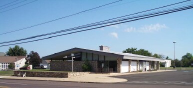

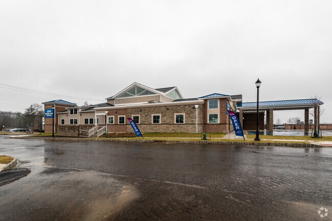

Property Detail
145 N Main St
10-002-038
1.84AC TOT (0.791AC TAX) (1.049AC EX) PARCEL A DUBLIN TOWN CENTER
Hospitalpublic
Bucks
C2
Pennsylvania
B and X Area of moderate flood hazard, usually the area between the limits of the 100-year and 500-year floods.
1.84 AC
2025
Upper Bucks County
2026
Philadelphia
104100
Philadelphia-Camden-Wilmington, PA-NJ-DE-MD
14,601 SF
NEARBY LISTINGS FOR SALE OR LEASE
-
-
View all Dublin listings for sale on LoopNet.com
DEMOGRAPHICS near 145 N Main St
1 mile
3 mile
5 mile
2025 Total Population
5,299
13,326
51,188
2030 Population
5,396
13,447
51,481
Pop Growth 2025-2030
+ 1.83%
+ 0.91%
+ 0.57%
Average Age
40
42
42
2025 Total Households
2,032
4,970
18,967
HH Growth 2025-2030
+ 1.92%
+ 0.93%
+ 0.60%
Median Household Inc
$105,493
$116,410
$122,788
Avg Household Size
2.60
2.70
2.70
2025 Avg HH Vehicles
2.00
2.00
2.00
Median Home Value
$465,824
$538,612
$495,061
Median Year Built
1983
1980
1982
Nearby Places
Map Layers
Map Styles
 Street
 Aerial
Layers
 Traffic
 Biking
Places
Listings with unknown addresses are not visible on the map
- Restaurants
- Banks
- Shops
- Fitness
- Groceries
PUBLIC TRANSPORTATION
AIRPORT
Lehigh Valley International
Drive
Walk
Distance
Lehigh Valley International
47 min
27.1 mi
Trenton Mercer
Drive
Walk
Distance
Trenton Mercer
46 min
27.6 mi
Philadelphia International
Drive
Walk
Distance
Philadelphia International
75 min
48.6 mi
Nearby Properties
Address
Land Use
TOTAL SIZE
Lot Size
Zoning
Address
Land Use
TOTAL SIZE
Lot Size
Zoning
61,589 SF
10.81 AC
C2
Address
Land Use
TOTAL SIZE
Lot Size
Zoning
13,858 SF
9.62 AC
R1
Address
Land Use
TOTAL SIZE
Lot Size
Zoning
132,250 SF
28.32 AC
RR
Address
Land Use
TOTAL SIZE
Lot Size
Zoning
45,960 SF
0.36 AC
C2
Address
Land Use
TOTAL SIZE
Lot Size
Zoning
55,077 SF
7.22 AC
C2
Address
Land Use
TOTAL SIZE
Lot Size
Zoning
12,994 SF
3.89 AC
R2
Address
Land Use
TOTAL SIZE
Lot Size
Zoning
13,600 SF
3.95 AC
R1
Address
Land Use
TOTAL SIZE
Lot Size
Zoning
41,460 SF
4.90 AC
R1
Address
Land Use
TOTAL SIZE
Lot Size
Zoning
35,200 SF
2.54 AC
C2
Address
Land Use
TOTAL SIZE
Lot Size
Zoning
9,680 SF
57.74 AC
Q
Address
Land Use
TOTAL SIZE
Lot Size
Zoning
5,525 SF
2.57 AC
PC2
Address
Land Use
TOTAL SIZE
Lot Size
Zoning
30,295 SF
4.11 AC
I
Address
Land Use
TOTAL SIZE
Lot Size
Zoning
16,520 SF
3.38 AC
R1
Address
Land Use
TOTAL SIZE
Lot Size
Zoning
12,859 SF
2.19 AC
PC2
Address
Land Use
TOTAL SIZE
Lot Size
Zoning
17,200 SF
2.04 AC
R1
Address
Land Use
TOTAL SIZE
Lot Size
Zoning
42,360 SF
4.42 AC
PC2
Address
Land Use
TOTAL SIZE
Lot Size
Zoning
4,344 SF
6.34 AC
HZ2
Address
Land Use
TOTAL SIZE
Lot Size
Zoning
94,838 SF
41.98 AC
I
Address
Land Use
TOTAL SIZE
Lot Size
Zoning
15,603 SF
9.71 AC
R1
Address
Land Use
TOTAL SIZE
Lot Size
Zoning
23,718 SF
23.10 AC
RR
Address
Land Use
TOTAL SIZE
Lot Size
Zoning
10,000 SF
3.20 AC
PC2
Address
Land Use
TOTAL SIZE
Lot Size
Zoning
17,760 SF
1.34 AC
R1
Address
Land Use
TOTAL SIZE
Lot Size
Zoning
2,900 SF
0.08 AC
C2
Address
Land Use
TOTAL SIZE
Lot Size
Zoning
17,010 SF
4.30 AC
AG-RC
Address
Land Use
TOTAL SIZE
Lot Size
Zoning
2,918 SF
1.45 AC
PC2
Address
Land Use
TOTAL SIZE
Lot Size
Zoning
2,759 SF
7.94 AC
IND
Address
Land Use
TOTAL SIZE
Lot Size
Zoning
22,242 SF
1.89 AC
IND
Address
Land Use
TOTAL SIZE
Lot Size
Zoning
4,819 SF
0.23 AC
CC
Address
Land Use
TOTAL SIZE
Lot Size
Zoning
43,408 SF
4.59 AC
IND
The World's #1 Commercial Real Estate Marketplace
Connect with us
© 2026 CoStar Group
The information above has been obtained from sources believed reliable. While we do not doubt its accuracy we have not verified it and make no guarantee, warranty or representation about it. It is your responsibility to independently confirm its accuracy and completeness. Any projections, opinions, assumptions, or estimates used are for example only and do not represent the current or future performance of the property. The value of this transaction to you depends on tax and other factors which should be evaluated by your tax, financial, and legal advisors. You and your advisors should conduct a careful, independent investigation of the property to determine to your satisfaction the suitability of the property for your needs.