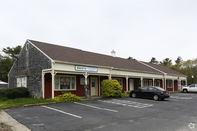
Property Record
145 S Main St, Carver, MA 02330
NEARBY LISTINGS FOR SALE OR LEASE
-
-
View all Carver listings for sale on LoopNet.com
Property Detail
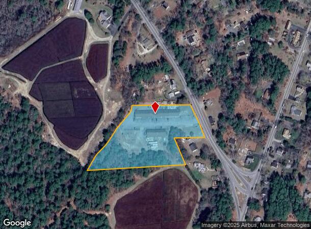
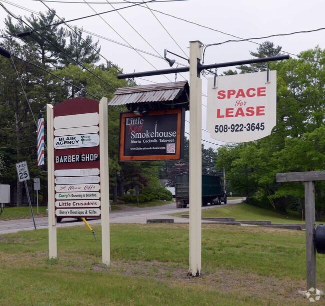
145 S Main St
CARV-000094-000000-000016
Plymouth
Commercialnec
Massachusetts
X
3.83 AC
25023C0459K
Route 3 South
2020
Boston
2025
Boston-Cambridge-Newton, MA-NH
544200
DEMOGRAPHICS near 145 S Main St
1 Mile
3 Mile
5 Mile
2024 Total Population
637
4,253
14,484
2029 Population
634
4,238
14,493
Pop Growth 2024-2029
(0.47%)
(0.35%)
+ 0.06%
Average Age
47
46
45
2024 Total Households
264
1,745
5,797
HH Growth 2024-2029
(0.76%)
(0.46%)
(0.03%)
Median Household Inc
$55,897
$56,077
$67,004
Avg Household Size
2.40
2.40
2.50
2024 Avg HH Vehicles
2.00
2.00
2.00
Median Home Value
$334,694
$337,500
$361,554
Median Year Built
1982
1983
1981
Nearby Places
Map Layers
Map Styles
 Street
 Aerial
- Restaurants
- Banks
- Shops
- Fitness
- Groceries
PUBLIC TRANSPORTATION
COMMUTER RAIL
Wareham Village (CapeFLYER - Cape Cod Regional Transit Authority)
DRIVE
WALK
Distance
Wareham Village (CapeFLYER - Cape Cod Regional Transit Authority)
13 min
7.6 mi
Freight Ports
Port of New Bedford Harbor
DRIVE
WALK
Distance
Port of New Bedford Harbor
30 min
22.1 mi
Nearby Properties
Address
Land Use
TOTAL SIZE
Lot Size
Zoning
Address
Land Use
TOTAL SIZE
Lot Size
Zoning
1,913 AC
RA
Address
Land Use
TOTAL SIZE
Lot Size
Zoning
95,790 SF
60.72 AC
A/R
Address
Land Use
TOTAL SIZE
Lot Size
Zoning
36,492 SF
5.68 AC
Address
Land Use
TOTAL SIZE
Lot Size
Zoning
2,274 SF
1.58 AC
Address
Land Use
TOTAL SIZE
Lot Size
Zoning
198.71 AC
TC
Address
Land Use
TOTAL SIZE
Lot Size
Zoning
10 AC
IA
Address
Land Use
TOTAL SIZE
Lot Size
Zoning
67,000 SF
6.01 AC
Address
Land Use
TOTAL SIZE
Lot Size
Zoning
497.03 AC
TC
Address
Land Use
TOTAL SIZE
Lot Size
Zoning
69 AC
TC
Address
Land Use
TOTAL SIZE
Lot Size
Zoning
102.09 AC
IA
Address
Land Use
TOTAL SIZE
Lot Size
Zoning
6,090 SF
55.32 AC
IA
Address
Land Use
TOTAL SIZE
Lot Size
Zoning
60,795 SF
37.44 AC
Address
Land Use
TOTAL SIZE
Lot Size
Zoning
123.40 AC
RA
Address
Land Use
TOTAL SIZE
Lot Size
Zoning
26,284 SF
19 AC
Address
Land Use
TOTAL SIZE
Lot Size
Zoning
98.21 AC
RA
Address
Land Use
TOTAL SIZE
Lot Size
Zoning
1,620 SF
31.28 AC
TC
Address
Land Use
TOTAL SIZE
Lot Size
Zoning
14,400 SF
10.40 AC
CG
Address
Land Use
TOTAL SIZE
Lot Size
Zoning
20,010 SF
4.60 AC
I
Address
Land Use
TOTAL SIZE
Lot Size
Zoning
Address
Land Use
TOTAL SIZE
Lot Size
Zoning
3,600 SF
1.30 AC
GC
Address
Land Use
TOTAL SIZE
Lot Size
Zoning
237.51 AC
RA
Address
Land Use
TOTAL SIZE
Lot Size
Zoning
Address
Land Use
TOTAL SIZE
Lot Size
Zoning
85.62 AC
RA
Address
Land Use
TOTAL SIZE
Lot Size
Zoning
Address
Land Use
TOTAL SIZE
Lot Size
Zoning
538.19 AC
IA
Address
Land Use
TOTAL SIZE
Lot Size
Zoning
14 AC
Address
Land Use
TOTAL SIZE
Lot Size
Zoning
9,095 SF
2.22 AC
CG
Address
Land Use
TOTAL SIZE
Lot Size
Zoning
149.05 AC
Address
Land Use
TOTAL SIZE
Lot Size
Zoning
3,378 SF
11.81 AC
Address
Land Use
TOTAL SIZE
Lot Size
Zoning
45.31 AC
The World's #1 Commercial Real Estate Marketplace
Connect with us
© 2026 CoStar Group
The information above has been obtained from sources believed reliable. While we do not doubt its accuracy we have not verified it and make no guarantee, warranty or representation about it. It is your responsibility to independently confirm its accuracy and completeness. Any projections, opinions, assumptions, or estimates used are for example only and do not represent the current or future performance of the property. The value of this transaction to you depends on tax and other factors which should be evaluated by your tax, financial, and legal advisors. You and your advisors should conduct a careful, independent investigation of the property to determine to your satisfaction the suitability of the property for your needs.