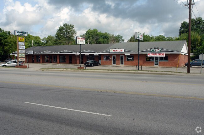
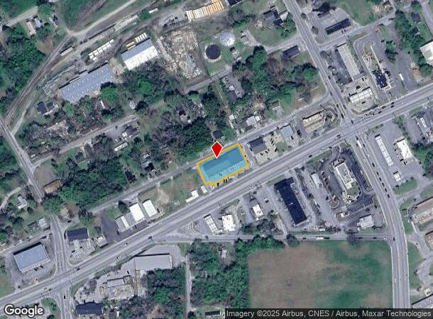
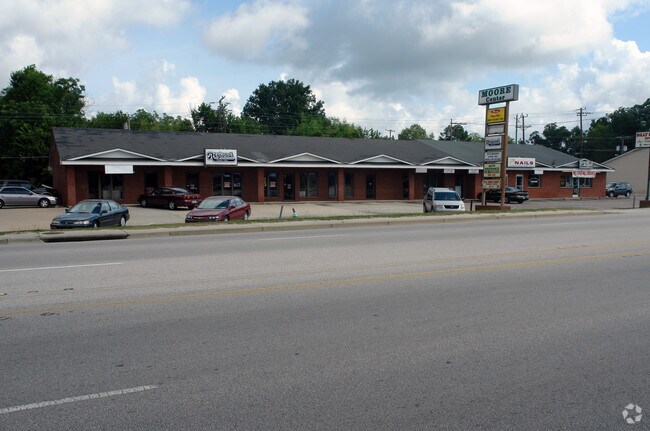
Property Record
145 Highway 15-401 Byp W, Bennettsville, SC 29512
NEARBY LISTINGS FOR SALE OR LEASE
Property Detail
145 Highway 15-401 Byp W
0390603015
145 HWY 15-401 BYPASS WEST
Miscellaneous
Marlboro
X
South Carolina
45031C0075C
0.55 AC
2024
South Carolina Rural Areas
2024
Other Market Areas
960201
Bennettsville, SC
9,752 SF
DEMOGRAPHICS near 145 Highway 15-401 Byp W
1 Mile
3 Mile
5 Mile
2024 Total Population
3,444
11,125
14,462
2029 Population
3,362
10,808
14,008
Pop Growth 2024-2029
(2.38%)
(2.85%)
(3.14%)
Average Age
42
42
42
2024 Total Households
1,469
4,225
5,290
HH Growth 2024-2029
(2.52%)
(2.79%)
(3.08%)
Median Household Inc
$22,846
$33,452
$34,188
Avg Household Size
2.20
2.20
2.20
2024 Avg HH Vehicles
1.00
2.00
2.00
Median Home Value
$60,947
$73,891
$73,471
Median Year Built
1970
1975
1977
Nearby Places
- Restaurants
- Banks
- Shops
- Fitness
- Groceries
SALE & LEASE HISTORY
LISTING DATE
SALE/LEASE

Apr 06, 2018
For Lease
Nearby Properties
Address
Land Use
TOTAL SIZE
Lot Size
Zoning
Address
Land Use
TOTAL SIZE
Lot Size
Zoning
13.96 AC
Address
Land Use
TOTAL SIZE
Lot Size
Zoning
30.57 AC
Address
Land Use
TOTAL SIZE
Lot Size
Zoning
Address
Land Use
TOTAL SIZE
Lot Size
Zoning
Address
Land Use
TOTAL SIZE
Lot Size
Zoning
19.50 AC
Address
Land Use
TOTAL SIZE
Lot Size
Zoning
Address
Land Use
TOTAL SIZE
Lot Size
Zoning
Address
Land Use
TOTAL SIZE
Lot Size
Zoning
38.96 AC
Address
Land Use
TOTAL SIZE
Lot Size
Zoning
61,975 SF
7.35 AC
Address
Land Use
TOTAL SIZE
Lot Size
Zoning
Address
Land Use
TOTAL SIZE
Lot Size
Zoning
Address
Land Use
TOTAL SIZE
Lot Size
Zoning
Address
Land Use
TOTAL SIZE
Lot Size
Zoning
Address
Land Use
TOTAL SIZE
Lot Size
Zoning
144.33 AC
Address
Land Use
TOTAL SIZE
Lot Size
Zoning
Address
Land Use
TOTAL SIZE
Lot Size
Zoning
Address
Land Use
TOTAL SIZE
Lot Size
Zoning
4.59 AC
Address
Land Use
TOTAL SIZE
Lot Size
Zoning
Address
Land Use
TOTAL SIZE
Lot Size
Zoning
6.99 AC
Address
Land Use
TOTAL SIZE
Lot Size
Zoning
31.49 AC
Address
Land Use
TOTAL SIZE
Lot Size
Zoning
6,720 SF
0.63 AC
Address
Land Use
TOTAL SIZE
Lot Size
Zoning
2,668 SF
0.83 AC
Address
Land Use
TOTAL SIZE
Lot Size
Zoning
Address
Land Use
TOTAL SIZE
Lot Size
Zoning
Address
Land Use
TOTAL SIZE
Lot Size
Zoning
846.50 AC
Address
Land Use
TOTAL SIZE
Lot Size
Zoning
Address
Land Use
TOTAL SIZE
Lot Size
Zoning
1,540 SF
0.43 AC
Address
Land Use
TOTAL SIZE
Lot Size
Zoning
Address
Land Use
TOTAL SIZE
Lot Size
Zoning
2.66 AC
Address
Land Use
TOTAL SIZE
Lot Size
Zoning
The World's #1 Commercial Real Estate Marketplace
Connect with us
© 2025 CoStar Group
The information above has been obtained from sources believed reliable. While we do not doubt its accuracy we have not verified it and make no guarantee, warranty or representation about it. It is your responsibility to independently confirm its accuracy and completeness. Any projections, opinions, assumptions, or estimates used are for example only and do not represent the current or future performance of the property. The value of this transaction to you depends on tax and other factors which should be evaluated by your tax, financial, and legal advisors. You and your advisors should conduct a careful, independent investigation of the property to determine to your satisfaction the suitability of the property for your needs.