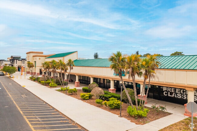
Property Record
1450 57Th St W, Bradenton, FL 34209


NEARBY LISTINGS FOR SALE OR LEASE
Property Detail
1450 57Th St W
North Port-Sarasota-Bradenton, FL
Southwood Village Corrected
59703-4000-5
COM AT THE SW COR OF THE NW1/4 OF THE SW1/4 SEC 14, TWN 35S RNG 17E, MANATEE COUNTY FL; TH N 88 DEG 39 MIN E, ALG THE S LN OF SD NW1/4 OF THE SW1/4 A DIST OF 671.45 FT FOR THE POB;
Commercialacreage
Manatee
X
Florida
12115C0050F
v001
2024
2.16 AC
2025
Manatee
000311
Tampa/St Petersburg
DEMOGRAPHICS near 1450 57Th St W
1 Mile
3 Mile
5 Mile
2024 Total Population
23,148
104,183
190,834
2029 Population
27,244
121,517
222,465
Pop Growth 2024-2029
+ 17.69%
+ 16.64%
+ 16.58%
Average Age
44
44
45
2024 Total Households
10,079
44,082
80,686
HH Growth 2024-2029
+ 16.68%
+ 15.95%
+ 15.89%
Median Household Inc
$40,591
$44,707
$51,127
Avg Household Size
2.20
2.20
2.20
2024 Avg HH Vehicles
1.00
1.00
2.00
Median Home Value
$90,309
$154,722
$221,194
Median Year Built
1974
1977
1980
Nearby Places
Map Layers
Map Styles
 Street
 Aerial
- Restaurants
- Banks
- Shops
- Fitness
- Groceries
PUBLIC TRANSPORTATION
AIRPORT
Sarasota/Bradenton International
DRIVE
WALK
Distance
Sarasota/Bradenton International
7 min
3.7 mi
Freight Ports
Port Manatee
DRIVE
WALK
Distance
Port Manatee
27 min
15.7 mi
SALE & LEASE HISTORY
LISTING DATE
SALE/LEASE

Sep 25, 2016
For Lease
Sep 05, 2017
For Lease
Oct 17, 2022
For Sale
Oct 10, 2016
For Lease
Nearby Properties
Address
Land Use
TOTAL SIZE
Lot Size
Zoning
Address
Land Use
TOTAL SIZE
Lot Size
Zoning
623,436 SF
88.25 AC
PD-R,MP-I
Address
Land Use
TOTAL SIZE
Lot Size
Zoning
437,460 SF
46.14 AC
PD-R
Address
Land Use
TOTAL SIZE
Lot Size
Zoning
456,263 SF
28.02 AC
BR_R-3
Address
Land Use
TOTAL SIZE
Lot Size
Zoning
314,018 SF
28.20 AC
BR_R-3
Address
Land Use
TOTAL SIZE
Lot Size
Zoning
645,805 SF
91.21 AC
PD-PI
Address
Land Use
TOTAL SIZE
Lot Size
Zoning
507,194 SF
8.49 AC
Address
Land Use
TOTAL SIZE
Lot Size
Zoning
247,280 SF
17.72 AC
PD-R
Address
Land Use
TOTAL SIZE
Lot Size
Zoning
294,609 SF
19.15 AC
RMF9
Address
Land Use
TOTAL SIZE
Lot Size
Zoning
117,547 SF
11.64 AC
MP-I
Address
Land Use
TOTAL SIZE
Lot Size
Zoning
153,663 SF
110.35 AC
MP-I
Address
Land Use
TOTAL SIZE
Lot Size
Zoning
375,171 SF
20 AC
PD-MU
Address
Land Use
TOTAL SIZE
Lot Size
Zoning
214,906 SF
20.71 AC
BR_R-1
Address
Land Use
TOTAL SIZE
Lot Size
Zoning
500,923 SF
47.91 AC
Address
Land Use
TOTAL SIZE
Lot Size
Zoning
223,974 SF
17.41 AC
BR_R-2
Address
Land Use
TOTAL SIZE
Lot Size
Zoning
397,863 SF
21.60 AC
GC GENERA
Address
Land Use
TOTAL SIZE
Lot Size
Zoning
335,019 SF
32.58 AC
BR_R-3
Address
Land Use
TOTAL SIZE
Lot Size
Zoning
247,592 SF
13.39 AC
GC,RMF-6
Address
Land Use
TOTAL SIZE
Lot Size
Zoning
198,036 SF
8.32 AC
GC GENERA
Address
Land Use
TOTAL SIZE
Lot Size
Zoning
331,144 SF
40.48 AC
PD-PI
Address
Land Use
TOTAL SIZE
Lot Size
Zoning
115,400 SF
22.55 AC
LM LIGHT M
Address
Land Use
TOTAL SIZE
Lot Size
Zoning
159,960 SF
11.30 AC
RMF-9 MULT
Address
Land Use
TOTAL SIZE
Lot Size
Zoning
185,617 SF
13.68 AC
BR_R-2
Address
Land Use
TOTAL SIZE
Lot Size
Zoning
359,950 SF
34.91 AC
LM LIGHT M
Address
Land Use
TOTAL SIZE
Lot Size
Zoning
214,350 SF
16.07 AC
LM LIGHT M
Address
Land Use
TOTAL SIZE
Lot Size
Zoning
587,374 SF
57.83 AC
HC,GC
Address
Land Use
TOTAL SIZE
Lot Size
Zoning
163,394 SF
15.49 AC
PD-MU
Address
Land Use
TOTAL SIZE
Lot Size
Zoning
179,650 SF
10.63 AC
RMF-9 MULT
Address
Land Use
TOTAL SIZE
Lot Size
Zoning
179,042 SF
6.60 AC
PD-MU
Address
Land Use
TOTAL SIZE
Lot Size
Zoning
318,009 SF
34.60 AC
LM LIGHT M
Address
Land Use
TOTAL SIZE
Lot Size
Zoning
901,196 SF
48.54 AC
LM LIGHT M
The World's #1 Commercial Real Estate Marketplace
Connect with us
© 2025 CoStar Group
The information above has been obtained from sources believed reliable. While we do not doubt its accuracy we have not verified it and make no guarantee, warranty or representation about it. It is your responsibility to independently confirm its accuracy and completeness. Any projections, opinions, assumptions, or estimates used are for example only and do not represent the current or future performance of the property. The value of this transaction to you depends on tax and other factors which should be evaluated by your tax, financial, and legal advisors. You and your advisors should conduct a careful, independent investigation of the property to determine to your satisfaction the suitability of the property for your needs.