Property Record
1450 E Santa Fe St, Gardner, KS 66030
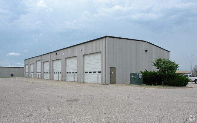

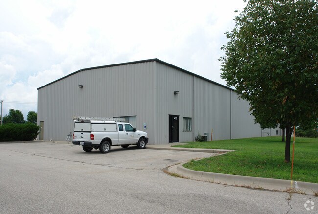
Property Detail
1450 E Santa Fe St
Kansas City, MO-KS
GARDNER BUSINESS PARK 3RD PLAT LT 2 GAC 286 2 2
CP28720000-0002
Johnson
Warehouse
Kansas
M-1
2
0
1.31 AC
2025
Olathe
053705
Kansas City
10,312 SF
NEARBY LISTINGS FOR SALE OR LEASE
DEMOGRAPHICS near 1450 E Santa Fe St
1 mile
3 mile
5 mile
2025 Total Population
4,748
24,689
37,462
2030 Population
4,962
25,625
39,103
Pop Growth 2025-2030
+ 4.51%
+ 3.79%
+ 4.38%
Average Age
35
36
37
2025 Total Households
1,703
8,379
12,748
HH Growth 2025-2030
+ 4.52%
+ 4.03%
+ 4.64%
Median Household Inc
$67,272
$87,927
$98,102
Avg Household Size
2.80
2.80
2.80
2025 Avg HH Vehicles
2.00
2.00
2.00
Median Home Value
$185,325
$303,479
$334,312
Median Year Built
1997
2000
2002
Nearby Places
Map Layers
Map Styles
 Street
 Aerial
Layers
 Traffic
 Biking
Places
Listings with unknown addresses are not visible on the map
- Restaurants
- Banks
- Shops
- Fitness
- Groceries
PUBLIC TRANSPORTATION
AIRPORT
Kansas City International
Drive
Walk
Distance
Kansas City International
57 min
45.5 mi
Nearby Properties
Address
Land Use
TOTAL SIZE
Lot Size
Zoning
Address
Land Use
TOTAL SIZE
Lot Size
Zoning
287,502 SF
80.54 AC
PEC3
Address
Land Use
TOTAL SIZE
Lot Size
Zoning
1,060,732 SF
57.62 AC
MP-2
Address
Land Use
TOTAL SIZE
Lot Size
Zoning
1,005,940 SF
66.67 AC
L-P
Address
Land Use
TOTAL SIZE
Lot Size
Zoning
345,346 SF
73.42 AC
R-1
Address
Land Use
TOTAL SIZE
Lot Size
Zoning
952,060 SF
55.73 AC
RUR
Address
Land Use
TOTAL SIZE
Lot Size
Zoning
71,086 SF
22.76 AC
R-3
Address
Land Use
TOTAL SIZE
Lot Size
Zoning
790,120 SF
38.55 AC
RUR
Address
Land Use
TOTAL SIZE
Lot Size
Zoning
750,100 SF
39.48 AC
RUR
Address
Land Use
TOTAL SIZE
Lot Size
Zoning
746,120 SF
PEC3
Address
Land Use
TOTAL SIZE
Lot Size
Zoning
206,145 SF
55.77 AC
Address
Land Use
TOTAL SIZE
Lot Size
Zoning
648,070 SF
33.46 AC
MP-1
Address
Land Use
TOTAL SIZE
Lot Size
Zoning
522,478 SF
45.72 AC
PEC3
Address
Land Use
TOTAL SIZE
Lot Size
Zoning
569,960 SF
26.86 AC
M-2
Address
Land Use
TOTAL SIZE
Lot Size
Zoning
565,272 SF
24.79 AC
RUR
Address
Land Use
TOTAL SIZE
Lot Size
Zoning
320,835 SF
57.95 AC
M-2
Address
Land Use
TOTAL SIZE
Lot Size
Zoning
106,819 SF
14.43 AC
PEC3
Address
Land Use
TOTAL SIZE
Lot Size
Zoning
331,712 SF
PEC3
Address
Land Use
TOTAL SIZE
Lot Size
Zoning
141,329 SF
20.88 AC
R-1
Address
Land Use
TOTAL SIZE
Lot Size
Zoning
1,107,600 SF
50.97 AC
MP-1
Address
Land Use
TOTAL SIZE
Lot Size
Zoning
11,271 SF
4.26 AC
PEC3
Address
Land Use
TOTAL SIZE
Lot Size
Zoning
73,451 SF
14.39 AC
R-1
Address
Land Use
TOTAL SIZE
Lot Size
Zoning
33,045 SF
15.25 AC
CP-2
Address
Land Use
TOTAL SIZE
Lot Size
Zoning
212,032 SF
9.53 AC
RUR
Address
Land Use
TOTAL SIZE
Lot Size
Zoning
158.84 AC
RUR
Address
Land Use
TOTAL SIZE
Lot Size
Zoning
821,570 SF
44.78 AC
M-2
Address
Land Use
TOTAL SIZE
Lot Size
Zoning
88,250 SF
9.82 AC
PEC3
Address
Land Use
TOTAL SIZE
Lot Size
Zoning
73,451 SF
12.58 AC
A
Address
Land Use
TOTAL SIZE
Lot Size
Zoning
189,334 SF
12.19 AC
PEC3
The World's #1 Commercial Real Estate Marketplace
Connect with us
© 2026 CoStar Group
The information above has been obtained from sources believed reliable. While we do not doubt its accuracy we have not verified it and make no guarantee, warranty or representation about it. It is your responsibility to independently confirm its accuracy and completeness. Any projections, opinions, assumptions, or estimates used are for example only and do not represent the current or future performance of the property. The value of this transaction to you depends on tax and other factors which should be evaluated by your tax, financial, and legal advisors. You and your advisors should conduct a careful, independent investigation of the property to determine to your satisfaction the suitability of the property for your needs.