Property Record
1450 E Yuma Palms Pky, Yuma, AZ 85365
Save to a Folder
{{folder.Name}}
{{folder.ListingIds.length}} Properties
{{folder.ListingIds.length}} Property
Create a New Folder
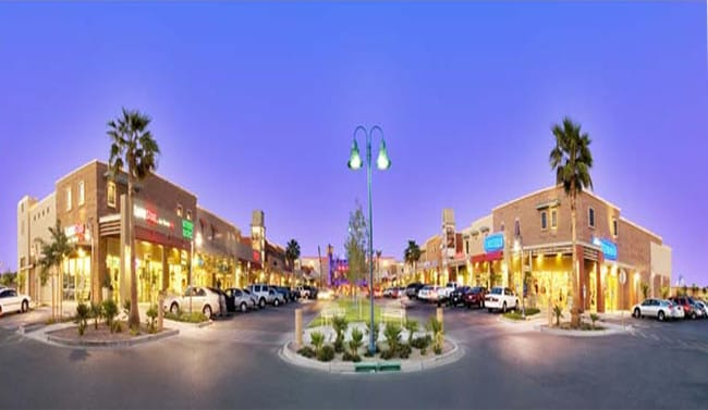
Property Detail
1450 E Yuma Palms Pky
665-23-060
SUBDIVISION: YUMA PALMS REGIONAL CENTER LOT: 3 SECTION: 27 TOWNSHIP: 08S RANGE: 23W DESC: AMENDED PER 20/59-61
Regionalshoppingcenterormallwithanchorstore
Yuma
B-2
Arizona
C and X Area of minimal flood hazard, usually depicted on FIRMs as above the 500-year flood level.
3
2025
11.18 AC
2026
Yuma & El Centro
010913
Other Market Areas
141,161 SF
Yuma, AZ
NEARBY LISTINGS FOR SALE OR LEASE
DEMOGRAPHICS near 1450 E Yuma Palms Pky
1 mile
3 mile
5 mile
2025 Total Population
1,340
61,048
102,732
2030 Population
1,453
65,984
110,525
Pop Growth 2025-2030
+ 8.43%
+ 8.09%
+ 7.59%
Average Age
39
38
38
2025 Total Households
490
23,096
36,765
HH Growth 2025-2030
+ 8.98%
+ 9.17%
+ 8.72%
Median Household Inc
$45,500
$52,588
$59,308
Avg Household Size
2.70
2.50
2.70
2025 Avg HH Vehicles
2.00
2.00
2.00
Median Home Value
$231,034
$205,328
$224,452
Median Year Built
1982
1979
1986
Nearby Places
Map Layers
Map Styles
 Street
 Aerial
Layers
 Traffic
 Biking
Places
Listings with unknown addresses are not visible on the map
- Restaurants
- Banks
- Shops
- Fitness
- Groceries
PUBLIC TRANSPORTATION
COMMUTER RAIL
Yuma Amtrak (Sunset Limited - Amtrak, Texas Eagle - Amtrak)
Drive
Walk
Distance
Yuma Amtrak (Sunset Limited - Amtrak, Texas Eagle - Amtrak)
5 min
1.9 mi
AIRPORT
Yuma International
Drive
Walk
Distance
Yuma International
12 min
5.0 mi
Freight Ports
Port of San Diego
Drive
Walk
Distance
Port of San Diego
193 min
172.4 mi
Nearby Properties
Address
Land Use
TOTAL SIZE
Lot Size
Zoning
Address
Land Use
TOTAL SIZE
Lot Size
Zoning
159,906 SF
3.19 AC
OT
Address
Land Use
TOTAL SIZE
Lot Size
Zoning
112,343 SF
3.13 AC
OT
Address
Land Use
TOTAL SIZE
Lot Size
Zoning
197,031 SF
28.76 AC
B-2
Address
Land Use
TOTAL SIZE
Lot Size
Zoning
406,808 SF
28.05 AC
R-3
Address
Land Use
TOTAL SIZE
Lot Size
Zoning
206,107 SF
21.96 AC
B-2
Address
Land Use
TOTAL SIZE
Lot Size
Zoning
107,310 SF
4.37 AC
OT
Address
Land Use
TOTAL SIZE
Lot Size
Zoning
61,000 SF
36.50 AC
B-2
Address
Land Use
TOTAL SIZE
Lot Size
Zoning
42,529 SF
1.29 AC
OT
Address
Land Use
TOTAL SIZE
Lot Size
Zoning
15,815 SF
4.40 AC
LI
Address
Land Use
TOTAL SIZE
Lot Size
Zoning
212,439 SF
20.28 AC
B-1
Address
Land Use
TOTAL SIZE
Lot Size
Zoning
407,940 SF
24.04 AC
HI
Address
Land Use
TOTAL SIZE
Lot Size
Zoning
51,586 SF
6.71 AC
B-2
Address
Land Use
TOTAL SIZE
Lot Size
Zoning
62,393 SF
2.83 AC
OT
Address
Land Use
TOTAL SIZE
Lot Size
Zoning
119,714 SF
6.75 AC
C-2
Address
Land Use
TOTAL SIZE
Lot Size
Zoning
95,263 SF
5.46 AC
B-2
Address
Land Use
TOTAL SIZE
Lot Size
Zoning
114,420 SF
6.13 AC
B-2
Address
Land Use
TOTAL SIZE
Lot Size
Zoning
50,918 SF
3.85 AC
TR
Address
Land Use
TOTAL SIZE
Lot Size
Zoning
77,301 SF
2.25 AC
B-2
Address
Land Use
TOTAL SIZE
Lot Size
Zoning
132,480 SF
23.73 AC
LI
Address
Land Use
TOTAL SIZE
Lot Size
Zoning
157,234 SF
5.71 AC
R-1-6
Address
Land Use
TOTAL SIZE
Lot Size
Zoning
68,961 SF
3.23 AC
B-2
Address
Land Use
TOTAL SIZE
Lot Size
Zoning
168,098 SF
8.77 AC
R-3
Address
Land Use
TOTAL SIZE
Lot Size
Zoning
66,490 SF
2.85 AC
Address
Land Use
TOTAL SIZE
Lot Size
Zoning
48,251 SF
5.26 AC
B-2
Address
Land Use
TOTAL SIZE
Lot Size
Zoning
302,392 SF
16.80 AC
R-3
Address
Land Use
TOTAL SIZE
Lot Size
Zoning
165,296 SF
12.44 AC
R-3
Address
Land Use
TOTAL SIZE
Lot Size
Zoning
33,765 SF
2.81 AC
B-2
Address
Land Use
TOTAL SIZE
Lot Size
Zoning
90,280 SF
2.98 AC
B-2
The World's #1 Commercial Real Estate Marketplace
Connect with us
© 2026 CoStar Group
The information above has been obtained from sources believed reliable. While we do not doubt its accuracy we have not verified it and make no guarantee, warranty or representation about it. It is your responsibility to independently confirm its accuracy and completeness. Any projections, opinions, assumptions, or estimates used are for example only and do not represent the current or future performance of the property. The value of this transaction to you depends on tax and other factors which should be evaluated by your tax, financial, and legal advisors. You and your advisors should conduct a careful, independent investigation of the property to determine to your satisfaction the suitability of the property for your needs.