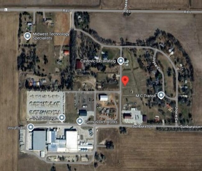
Property Record
1450 Girmus Dr, Mead, NE 68041


This Property Is For Sale
Current Lease Availabilities
NEARBY LISTINGS FOR SALE OR LEASE
Property Detail
1450 Girmus Dr
Omaha-Council Bluffs, NE-IA
Mead-Girmus Subdivision
002662510
LOT 3 GIRMUS SUBDIVISION 2-14-8 (3.02 ACRES); MAP NUMBER: 2951-02-0-08011-000-2510
Residentialacreage
Saunders
X
Nebraska
31155C0400D
3
2024
3.02 AC
2025
Saunders County
968400
Omaha/Council Bluffs
DEMOGRAPHICS near 1450 Girmus Dr
1 Mile
3 Mile
5 Mile
2024 Total Population
613
818
1,278
2029 Population
633
844
1,328
Pop Growth 2024-2029
+ 3.26%
+ 3.18%
+ 3.91%
Average Age
40
40
40
2024 Total Households
226
302
472
HH Growth 2024-2029
+ 3.54%
+ 3.31%
+ 3.81%
Median Household Inc
$62,419
$62,500
$64,453
Avg Household Size
2.70
2.70
2.70
2024 Avg HH Vehicles
2.00
2.00
2.00
Median Home Value
$208,621
$207,143
$209,402
Median Year Built
1954
1954
1954
Nearby Places
Map Layers
Map Styles
 Street
 Aerial
- Restaurants
- Banks
- Shops
- Fitness
- Groceries
PUBLIC TRANSPORTATION
AIRPORT
Lincoln
DRIVE
WALK
Distance
Lincoln
49 min
39.5 mi
Freight Ports
Tulsa Port Of Catoosa
DRIVE
WALK
Distance
Tulsa Port Of Catoosa
498 min
412.1 mi
Nearby Properties
Address
Land Use
TOTAL SIZE
Lot Size
Zoning
Address
Land Use
TOTAL SIZE
Lot Size
Zoning
3,712 SF
40.15 AC
AGRICULTUR
Address
Land Use
TOTAL SIZE
Lot Size
Zoning
179.62 AC
COMMERCIAL
Address
Land Use
TOTAL SIZE
Lot Size
Zoning
49,000 SF
9.03 AC
COMMERCIAL
Address
Land Use
TOTAL SIZE
Lot Size
Zoning
8,450 SF
63.28 AC
INDUSTRIAL
Address
Land Use
TOTAL SIZE
Lot Size
Zoning
196.40 AC
AGRICULTUR
Address
Land Use
TOTAL SIZE
Lot Size
Zoning
154.52 AC
AGRICULTUR
Address
Land Use
TOTAL SIZE
Lot Size
Zoning
154.78 AC
AGRICULTUR
Address
Land Use
TOTAL SIZE
Lot Size
Zoning
0.85 AC
COMMERCIAL
Address
Land Use
TOTAL SIZE
Lot Size
Zoning
115.91 AC
AGRICULTUR
Address
Land Use
TOTAL SIZE
Lot Size
Zoning
7,000 SF
7.73 AC
SINGLE-FAM
Address
Land Use
TOTAL SIZE
Lot Size
Zoning
2,474 SF
3.38 AC
AGRICULTUR
Address
Land Use
TOTAL SIZE
Lot Size
Zoning
76.31 AC
AGRICULTUR
Address
Land Use
TOTAL SIZE
Lot Size
Zoning
956 SF
57.35 AC
COMMERCIAL
Address
Land Use
TOTAL SIZE
Lot Size
Zoning
1,750 SF
17.03 AC
COMMERCIAL
Address
Land Use
TOTAL SIZE
Lot Size
Zoning
97.75 AC
AGRICULTUR
Address
Land Use
TOTAL SIZE
Lot Size
Zoning
7,000 SF
1.01 AC
SINGLE-FAM
Address
Land Use
TOTAL SIZE
Lot Size
Zoning
80 AC
AGRICULTUR
Address
Land Use
TOTAL SIZE
Lot Size
Zoning
1,992 SF
74.47 AC
AGRICULTUR
Address
Land Use
TOTAL SIZE
Lot Size
Zoning
6.01 AC
COMMERCIAL
Address
Land Use
TOTAL SIZE
Lot Size
Zoning
75.11 AC
AGRICULTUR
Address
Land Use
TOTAL SIZE
Lot Size
Zoning
4,000 SF
3.39 AC
COMMERCIAL
Address
Land Use
TOTAL SIZE
Lot Size
Zoning
8,245 SF
2.13 AC
COMMERCIAL
Address
Land Use
TOTAL SIZE
Lot Size
Zoning
1,344 SF
60.21 AC
AGRICULTUR
Address
Land Use
TOTAL SIZE
Lot Size
Zoning
11,300 SF
1.75 AC
COMMERCIAL
Address
Land Use
TOTAL SIZE
Lot Size
Zoning
8,820 SF
2.56 AC
COMMERCIAL
Address
Land Use
TOTAL SIZE
Lot Size
Zoning
8,640 SF
3.62 AC
COMMERCIAL
Address
Land Use
TOTAL SIZE
Lot Size
Zoning
5,760 SF
2.29 AC
COMMERCIAL
Address
Land Use
TOTAL SIZE
Lot Size
Zoning
2,958 SF
0.25 AC
COMMERCIAL
The World's #1 Commercial Real Estate Marketplace
Connect with us
© 2026 CoStar Group
The information above has been obtained from sources believed reliable. While we do not doubt its accuracy we have not verified it and make no guarantee, warranty or representation about it. It is your responsibility to independently confirm its accuracy and completeness. Any projections, opinions, assumptions, or estimates used are for example only and do not represent the current or future performance of the property. The value of this transaction to you depends on tax and other factors which should be evaluated by your tax, financial, and legal advisors. You and your advisors should conduct a careful, independent investigation of the property to determine to your satisfaction the suitability of the property for your needs.