Property Record
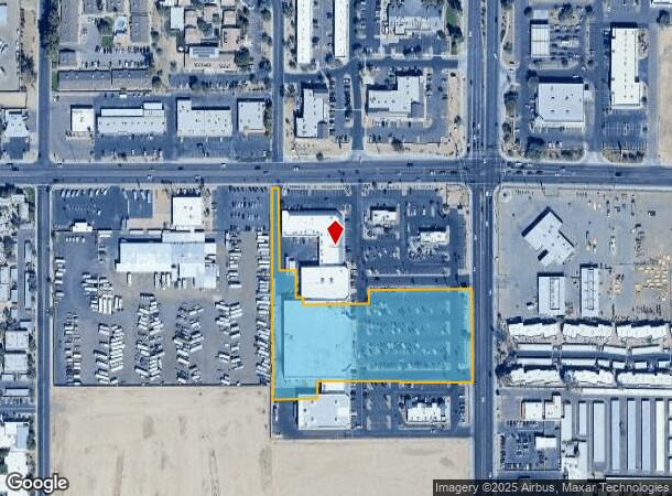
1450 N Dysart Rd, Avondale, AZ 85323


NEARBY LISTINGS FOR SALE OR LEASE
Property Detail
1450 N Dysart Rd
500-10-008F
PT NE4 SEC DAF COM NE COR SEC TH S 615.56F ALG E LN SEC TH W 40F TO TPOB TH CONT W 212.00F TH N 3.57F W 247.41F S 48.17F W 133.18F N 619.78F E 20F S 242.13F E 51.26F S 77.82F E 21.58F S 23.68F E 194.46F N 41.25F E 305F S 273F ALG W R/W LN OF DYSART R
Regionalshoppingcenterormallwithanchorstore
Maricopa
X
Arizona
04013C2155M
3.73 AC
2025
Goodyear
2025
Phoenix
061200
Phoenix-Mesa-Scottsdale, AZ
42,452 SF
DEMOGRAPHICS near 1450 N Dysart Rd
1 Mile
3 Mile
5 Mile
2024 Total Population
10,988
88,854
218,685
2029 Population
11,939
96,587
238,289
Pop Growth 2024-2029
+ 8.65%
+ 8.70%
+ 8.96%
Average Age
34
35
36
2024 Total Households
3,399
27,980
69,952
HH Growth 2024-2029
+ 8.77%
+ 8.88%
+ 9.18%
Median Household Inc
$48,258
$73,401
$83,550
Avg Household Size
3.10
3.10
3.10
2024 Avg HH Vehicles
2.00
2.00
2.00
Median Home Value
$237,821
$325,435
$356,461
Median Year Built
1985
2002
2004
Nearby Places
Map Layers
Map Styles
 Street
 Aerial
- Restaurants
- Banks
- Shops
- Fitness
- Groceries
PUBLIC TRANSPORTATION
AIRPORT
Phoenix Sky Harbor International
DRIVE
WALK
Distance
Phoenix Sky Harbor International
30 min
22.3 mi
SALE & LEASE HISTORY
LISTING DATE
SALE/LEASE

Feb 08, 2017
For Lease
Nearby Properties
Address
Land Use
TOTAL SIZE
Lot Size
Zoning
Address
Land Use
TOTAL SIZE
Lot Size
Zoning
16.70 AC
Address
Land Use
TOTAL SIZE
Lot Size
Zoning
76,301 SF
15.91 AC
Address
Land Use
TOTAL SIZE
Lot Size
Zoning
12.04 AC
Address
Land Use
TOTAL SIZE
Lot Size
Zoning
12.80 AC
Address
Land Use
TOTAL SIZE
Lot Size
Zoning
206.08 AC
PAD
Address
Land Use
TOTAL SIZE
Lot Size
Zoning
49,475 SF
5.70 AC
PAD
Address
Land Use
TOTAL SIZE
Lot Size
Zoning
370,726 SF
23.41 AC
PAD
Address
Land Use
TOTAL SIZE
Lot Size
Zoning
324,374 SF
18.26 AC
PAD
Address
Land Use
TOTAL SIZE
Lot Size
Zoning
487,354 SF
188.22 AC
PAD
Address
Land Use
TOTAL SIZE
Lot Size
Zoning
90,008 SF
20.42 AC
M-H
Address
Land Use
TOTAL SIZE
Lot Size
Zoning
418,000 SF
23.58 AC
I-1
Address
Land Use
TOTAL SIZE
Lot Size
Zoning
563,328 SF
24.43 AC
C2
Address
Land Use
TOTAL SIZE
Lot Size
Zoning
177,052 SF
2.69 AC
THEBLVDD
Address
Land Use
TOTAL SIZE
Lot Size
Zoning
401,714 SF
100.01 AC
PAD
Address
Land Use
TOTAL SIZE
Lot Size
Zoning
1,126,656 SF
35.76 AC
I1
Address
Land Use
TOTAL SIZE
Lot Size
Zoning
901,699 SF
49.92 AC
I1
Address
Land Use
TOTAL SIZE
Lot Size
Zoning
287,294 SF
67.46 AC
PAD
Address
Land Use
TOTAL SIZE
Lot Size
Zoning
301,329 SF
50.60 AC
AG
Address
Land Use
TOTAL SIZE
Lot Size
Zoning
855,336 SF
45.11 AC
Address
Land Use
TOTAL SIZE
Lot Size
Zoning
802,671 SF
48.81 AC
I1
Address
Land Use
TOTAL SIZE
Lot Size
Zoning
320,888 SF
31.41 AC
C-G
Address
Land Use
TOTAL SIZE
Lot Size
Zoning
369,413 SF
16.39 AC
THEBLVDD
Address
Land Use
TOTAL SIZE
Lot Size
Zoning
790,980 SF
42.95 AC
I1
Address
Land Use
TOTAL SIZE
Lot Size
Zoning
222,900 SF
15.99 AC
Address
Land Use
TOTAL SIZE
Lot Size
Zoning
355,597 SF
14.83 AC
PAD
Address
Land Use
TOTAL SIZE
Lot Size
Zoning
663,150 SF
34.49 AC
Address
Land Use
TOTAL SIZE
Lot Size
Zoning
450,619 SF
28.95 AC
I2
Address
Land Use
TOTAL SIZE
Lot Size
Zoning
353,155 SF
16.80 AC
M-H
Address
Land Use
TOTAL SIZE
Lot Size
Zoning
340,061 SF
15.50 AC
M-H
Address
Land Use
TOTAL SIZE
Lot Size
Zoning
328,244 SF
18.44 AC
PAD
The World's #1 Commercial Real Estate Marketplace
Connect with us
© 2025 CoStar Group
The information above has been obtained from sources believed reliable. While we do not doubt its accuracy we have not verified it and make no guarantee, warranty or representation about it. It is your responsibility to independently confirm its accuracy and completeness. Any projections, opinions, assumptions, or estimates used are for example only and do not represent the current or future performance of the property. The value of this transaction to you depends on tax and other factors which should be evaluated by your tax, financial, and legal advisors. You and your advisors should conduct a careful, independent investigation of the property to determine to your satisfaction the suitability of the property for your needs.