Property Record
1450 Raleigh Rd, Chapel Hill, NC 27517


NEARBY LISTINGS FOR SALE OR LEASE
Property Detail
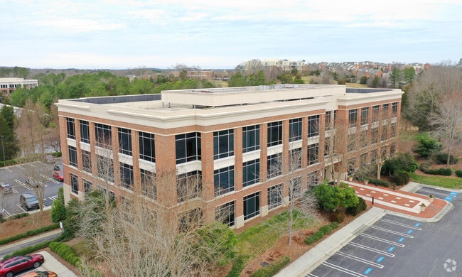
1450 Raleigh Rd
9798529521
Meadowmont
Officebuilding
7 MEADOWMONT P85/154
X
Orange
3710979800L
North Carolina
2025
7.09 AC
2025
Orange County
012201
Raleigh/Durham
60,012 SF
Durham-Chapel Hill, NC
DEMOGRAPHICS near 1450 Raleigh Rd
1 Mile
3 Mile
5 Mile
2024 Total Population
5,842
49,446
127,996
2029 Population
5,741
47,820
125,250
Pop Growth 2024-2029
(1.73%)
(3.29%)
(2.15%)
Average Age
42
35
38
2024 Total Households
2,725
17,922
52,981
HH Growth 2024-2029
(1.21%)
(3.22%)
(2.00%)
Median Household Inc
$99,631
$76,848
$84,993
Avg Household Size
2.10
2.20
2.20
2024 Avg HH Vehicles
2.00
2.00
2.00
Median Home Value
$631,579
$462,455
$439,267
Median Year Built
2000
1990
1991
Nearby Places
Map Layers
Map Styles
 Street
 Aerial
- Restaurants
- Banks
- Shops
- Fitness
- Groceries
PUBLIC TRANSPORTATION
AIRPORT
Raleigh-Durham International
DRIVE
WALK
Distance
Raleigh-Durham International
25 min
15.2 mi
SALE & LEASE HISTORY
LISTING DATE
SALE/LEASE

Jul 10, 2017
For Lease
Jan 24, 2019
For Lease
Nearby Properties
Address
Land Use
TOTAL SIZE
Lot Size
Zoning
Address
Land Use
TOTAL SIZE
Lot Size
Zoning
104,541 SF
404.01 AC
Address
Land Use
TOTAL SIZE
Lot Size
Zoning
215,860 SF
12.28 AC
Address
Land Use
TOTAL SIZE
Lot Size
Zoning
264,710 SF
32.50 AC
R1
Address
Land Use
TOTAL SIZE
Lot Size
Zoning
116,223 SF
34.65 AC
Address
Land Use
TOTAL SIZE
Lot Size
Zoning
244,609 SF
2.72 AC
Address
Land Use
TOTAL SIZE
Lot Size
Zoning
193,344 SF
10.96 AC
MU(D)
Address
Land Use
TOTAL SIZE
Lot Size
Zoning
575,091 SF
3.21 AC
Address
Land Use
TOTAL SIZE
Lot Size
Zoning
81,191 SF
12.33 AC
OI4
Address
Land Use
TOTAL SIZE
Lot Size
Zoning
55,318 SF
9.05 AC
R4
Address
Land Use
TOTAL SIZE
Lot Size
Zoning
2,748 SF
17.80 AC
R-5-CZD
Address
Land Use
TOTAL SIZE
Lot Size
Zoning
238,990 SF
2.43 AC
Address
Land Use
TOTAL SIZE
Lot Size
Zoning
9,423 SF
43.95 AC
PDR 6.800
Address
Land Use
TOTAL SIZE
Lot Size
Zoning
54,220 SF
41.04 AC
R-1
Address
Land Use
TOTAL SIZE
Lot Size
Zoning
287,718 SF
4.97 AC
Address
Land Use
TOTAL SIZE
Lot Size
Zoning
150,677 SF
2.93 AC
Address
Land Use
TOTAL SIZE
Lot Size
Zoning
280,771 SF
6.14 AC
RC(D)
Address
Land Use
TOTAL SIZE
Lot Size
Zoning
9,696 SF
20.94 AC
RS-M(D)
Address
Land Use
TOTAL SIZE
Lot Size
Zoning
144,619 SF
3.22 AC
Address
Land Use
TOTAL SIZE
Lot Size
Zoning
38,300 SF
3.95 AC
MU(D)
Address
Land Use
TOTAL SIZE
Lot Size
Zoning
111,512 SF
5.17 AC
OI(D)
Address
Land Use
TOTAL SIZE
Lot Size
Zoning
135,540 SF
4.34 AC
Address
Land Use
TOTAL SIZE
Lot Size
Zoning
6,846 SF
19.50 AC
RS-M(D)
Address
Land Use
TOTAL SIZE
Lot Size
Zoning
30,300 SF
13.83 AC
Address
Land Use
TOTAL SIZE
Lot Size
Zoning
121,500 SF
37.15 AC
Address
Land Use
TOTAL SIZE
Lot Size
Zoning
361,420 SF
1.68 AC
Address
Land Use
TOTAL SIZE
Lot Size
Zoning
28,272 SF
21.12 AC
OI2R4
Address
Land Use
TOTAL SIZE
Lot Size
Zoning
24,820 SF
1 AC
Address
Land Use
TOTAL SIZE
Lot Size
Zoning
143,750 SF
1.32 AC
OI3OI4
Address
Land Use
TOTAL SIZE
Lot Size
Zoning
174,922 SF
4.59 AC
OI4
Address
Land Use
TOTAL SIZE
Lot Size
Zoning
313,583 SF
2.93 AC
The World's #1 Commercial Real Estate Marketplace
Connect with us
© 2025 CoStar Group
The information above has been obtained from sources believed reliable. While we do not doubt its accuracy we have not verified it and make no guarantee, warranty or representation about it. It is your responsibility to independently confirm its accuracy and completeness. Any projections, opinions, assumptions, or estimates used are for example only and do not represent the current or future performance of the property. The value of this transaction to you depends on tax and other factors which should be evaluated by your tax, financial, and legal advisors. You and your advisors should conduct a careful, independent investigation of the property to determine to your satisfaction the suitability of the property for your needs.