Property Record
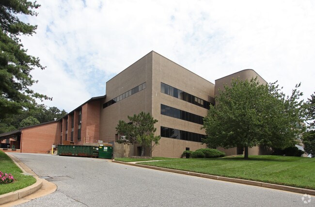
1450 S Rolling Rd, Halethorpe, MD 21227


Property Detail
1450 S Rolling Rd
13-2200001264
30.19 AC PAR EXE
Federalproperty
Baltimore
0-2
Maryland
C and X Area of minimal flood hazard, usually depicted on FIRMs as above the 500-year flood level.
2200001
2024
30.13 AC
2025
Catonsville
430600
Baltimore
158,446 SF
Baltimore-Columbia-Towson, MD
NEARBY LISTINGS FOR SALE OR LEASE
DEMOGRAPHICS near 1450 S Rolling Rd
1 mile
3 mile
5 mile
2025 Total Population
5,698
64,729
237,575
2030 Population
5,638
64,833
238,017
Pop Growth 2025-2030
(1.05%)
+ 0.16%
+ 0.19%
Average Age
39
39
39
2025 Total Households
2,151
23,277
88,243
HH Growth 2025-2030
(1.21%)
(0.11%)
+ 0.04%
Median Household Inc
$118,654
$101,472
$84,335
Avg Household Size
2.50
2.50
2.60
2025 Avg HH Vehicles
2.00
2.00
2.00
Median Home Value
$306,848
$366,790
$340,174
Median Year Built
1962
1966
1963
Nearby Places
Map Layers
Map Styles
 Street
 Aerial
Layers
 Traffic
 Biking
Places
Listings with unknown addresses are not visible on the map
- Restaurants
- Banks
- Shops
- Fitness
- Groceries
PUBLIC TRANSPORTATION
COMMUTER RAIL
St Denis Marc Nb (CAMDEN - WASHINGTON - Maryland Transit Administration)
Drive
Walk
Distance
St Denis Marc Nb (CAMDEN - WASHINGTON - Maryland Transit Administration)
7 min
2.5 mi
Halethorpe Marc Sb (PENN - WASHINGTON - Maryland Transit Administration)
Drive
Walk
Distance
Halethorpe Marc Sb (PENN - WASHINGTON - Maryland Transit Administration)
7 min
2.6 mi
AIRPORT
Baltimore/Washington International Thurgood Marshall
Drive
Walk
Distance
Baltimore/Washington International Thurgood Marshall
11 min
6.6 mi
Freight Ports
Port of Baltimore
Drive
Walk
Distance
Port of Baltimore
17 min
9.7 mi
SALE & LEASE HISTORY
LISTING DATE
SALE/LEASE

Sep 24, 2016
For Lease
Feb 11, 2019
For Lease
Nearby Properties
Address
Land Use
TOTAL SIZE
Lot Size
Zoning
Address
Land Use
TOTAL SIZE
Lot Size
Zoning
2,182,087 SF
95.52 AC
DR5.5
Address
Land Use
TOTAL SIZE
Lot Size
Zoning
98,318 SF
175.16 AC
OT
Address
Land Use
TOTAL SIZE
Lot Size
Zoning
332,190 SF
21.80 AC
W1-BW
Address
Land Use
TOTAL SIZE
Lot Size
Zoning
454,684 SF
6.88 AC
W1B
Address
Land Use
TOTAL SIZE
Lot Size
Zoning
315,055 SF
9.60 AC
ML
Address
Land Use
TOTAL SIZE
Lot Size
Zoning
231,128 SF
8.30 AC
W1-BW
Address
Land Use
TOTAL SIZE
Lot Size
Zoning
88,254 SF
105.20 AC
DR2
Address
Land Use
TOTAL SIZE
Lot Size
Zoning
207,168 SF
63.84 AC
DR3.5
Address
Land Use
TOTAL SIZE
Lot Size
Zoning
132,552 SF
47.72 AC
RED
Address
Land Use
TOTAL SIZE
Lot Size
Zoning
184,317 SF
16.23 AC
MH
Address
Land Use
TOTAL SIZE
Lot Size
Zoning
185,652 SF
18.76 AC
W1
Address
Land Use
TOTAL SIZE
Lot Size
Zoning
41.14 AC
W1-BW
Address
Land Use
TOTAL SIZE
Lot Size
Zoning
40.17 AC
DR16
Address
Land Use
TOTAL SIZE
Lot Size
Zoning
48,300 SF
30.96 AC
ML
Address
Land Use
TOTAL SIZE
Lot Size
Zoning
43,456 SF
7.20 AC
RA15
Address
Land Use
TOTAL SIZE
Lot Size
Zoning
116,600 SF
8.97 AC
C4
Address
Land Use
TOTAL SIZE
Lot Size
Zoning
197,754 SF
12.63 AC
DR5.5
Address
Land Use
TOTAL SIZE
Lot Size
Zoning
338,255 SF
42.87 AC
W1-BW
Address
Land Use
TOTAL SIZE
Lot Size
Zoning
194,652 SF
20.49 AC
W1-BW
Address
Land Use
TOTAL SIZE
Lot Size
Zoning
145,226 SF
9.24 AC
W1
Address
Land Use
TOTAL SIZE
Lot Size
Zoning
148,500 SF
5.10 AC
Address
Land Use
TOTAL SIZE
Lot Size
Zoning
21.46 AC
ML
Address
Land Use
TOTAL SIZE
Lot Size
Zoning
15.08 AC
DR105
Address
Land Use
TOTAL SIZE
Lot Size
Zoning
102,705 SF
9.84 AC
R12
Address
Land Use
TOTAL SIZE
Lot Size
Zoning
86,587 SF
9.86 AC
W1-BW
Address
Land Use
TOTAL SIZE
Lot Size
Zoning
132,000 SF
29.26 AC
ML
Address
Land Use
TOTAL SIZE
Lot Size
Zoning
164,346 SF
6.50 AC
W1-BW
Address
Land Use
TOTAL SIZE
Lot Size
Zoning
210,000 SF
11.11 AC
MH
Address
Land Use
TOTAL SIZE
Lot Size
Zoning
656,963 SF
30.41 AC
ML
Address
Land Use
TOTAL SIZE
Lot Size
Zoning
443,645 SF
12.28 AC
The World's #1 Commercial Real Estate Marketplace
Connect with us
© 2026 CoStar Group
The information above has been obtained from sources believed reliable. While we do not doubt its accuracy we have not verified it and make no guarantee, warranty or representation about it. It is your responsibility to independently confirm its accuracy and completeness. Any projections, opinions, assumptions, or estimates used are for example only and do not represent the current or future performance of the property. The value of this transaction to you depends on tax and other factors which should be evaluated by your tax, financial, and legal advisors. You and your advisors should conduct a careful, independent investigation of the property to determine to your satisfaction the suitability of the property for your needs.