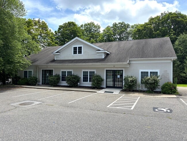
Property Record
14 Mansfield Grove Rd, East Haven, CT 06512
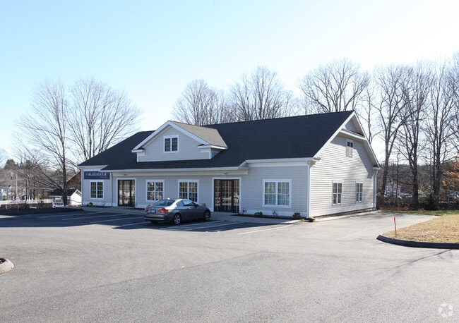

This Property Is For Sale
NEARBY LISTINGS FOR SALE OR LEASE
Property Detail
14 Mansfield Grove Rd
EHAV-000080-000422-000014
New Haven
Sfr
Connecticut
X
Southbury
09009C0576J
Westchester/So Connecticut
576 SF
New Haven, CT
DEMOGRAPHICS near 14 Mansfield Grove Rd
1 Mile
3 Mile
5 Mile
2024 Total Population
1,370
12,378
36,622
2029 Population
1,370
12,368
36,550
Pop Growth 2024-2029
0.00%
(0.08%)
(0.20%)
Average Age
42
42
46
2024 Total Households
480
4,386
14,800
HH Growth 2024-2029
0.00%
(0.16%)
(0.49%)
Median Household Inc
$138,586
$133,955
$111,310
Avg Household Size
2.80
2.80
2.40
2024 Avg HH Vehicles
2.00
2.00
2.00
Median Home Value
$381,930
$413,376
$382,944
Median Year Built
1978
1982
1978
Nearby Places
Map Layers
Map Styles
 Street
 Aerial
- Restaurants
- Banks
- Shops
- Fitness
- Groceries
PUBLIC TRANSPORTATION
COMMUTER RAIL
Branford (Commuter Rail - Shore Line East, Shore Line East - Shore Line East)
DRIVE
WALK
Distance
Branford (Commuter Rail - Shore Line East, Shore Line East - Shore Line East)
9 min
4.3 mi
New Haven Union Station (Hartford Line - CONN DOT)
DRIVE
WALK
Distance
New Haven Union Station (Hartford Line - CONN DOT)
12 min
6.7 mi
AIRPORT
Tweed/New Haven
DRIVE
WALK
Distance
Tweed/New Haven
8 min
2.8 mi
Freight Ports
Port of New Haven
DRIVE
WALK
Distance
Port of New Haven
11 min
5.2 mi
Nearby Properties
Address
Land Use
TOTAL SIZE
Lot Size
Zoning
Address
Land Use
TOTAL SIZE
Lot Size
Zoning
8,655 SF
107.61 AC
AIRPOR
Address
Land Use
TOTAL SIZE
Lot Size
Zoning
17,462 SF
86.34 AC
PARK
Address
Land Use
TOTAL SIZE
Lot Size
Zoning
197.78 AC
LI-3
Address
Land Use
TOTAL SIZE
Lot Size
Zoning
7.72 AC
RA-1
Address
Land Use
TOTAL SIZE
Lot Size
Zoning
1,932 SF
64.06 AC
PARK
Address
Land Use
TOTAL SIZE
Lot Size
Zoning
16.50 AC
Address
Land Use
TOTAL SIZE
Lot Size
Zoning
35 AC
RA-1
Address
Land Use
TOTAL SIZE
Lot Size
Zoning
96,449 SF
1.67 AC
RS2
Address
Land Use
TOTAL SIZE
Lot Size
Zoning
48,726 SF
9.46 AC
Address
Land Use
TOTAL SIZE
Lot Size
Zoning
19.26 AC
R-2
Address
Land Use
TOTAL SIZE
Lot Size
Zoning
9.34 AC
CA-1
Address
Land Use
TOTAL SIZE
Lot Size
Zoning
105,998 SF
13.68 AC
PDD
Address
Land Use
TOTAL SIZE
Lot Size
Zoning
10,892 SF
5.05 AC
Address
Land Use
TOTAL SIZE
Lot Size
Zoning
2,816 SF
PDD 11
Address
Land Use
TOTAL SIZE
Lot Size
Zoning
19.50 AC
Address
Land Use
TOTAL SIZE
Lot Size
Zoning
34,341 SF
5.65 AC
Address
Land Use
TOTAL SIZE
Lot Size
Zoning
109,119 SF
CA-1
Address
Land Use
TOTAL SIZE
Lot Size
Zoning
14,508 SF
14 AC
Address
Land Use
TOTAL SIZE
Lot Size
Zoning
5,089 SF
25.20 AC
R18
Address
Land Use
TOTAL SIZE
Lot Size
Zoning
66,116 SF
2.05 AC
CB-1
Address
Land Use
TOTAL SIZE
Lot Size
Zoning
124,472 SF
16.60 AC
Address
Land Use
TOTAL SIZE
Lot Size
Zoning
6,480 SF
15.94 AC
Address
Land Use
TOTAL SIZE
Lot Size
Zoning
14,030 SF
13.20 AC
Address
Land Use
TOTAL SIZE
Lot Size
Zoning
3.63 AC
RA-1
Address
Land Use
TOTAL SIZE
Lot Size
Zoning
3,588 SF
15.80 AC
Address
Land Use
TOTAL SIZE
Lot Size
Zoning
7.10 AC
CA-1
Address
Land Use
TOTAL SIZE
Lot Size
Zoning
206,954 SF
14.23 AC
LI-3
Address
Land Use
TOTAL SIZE
Lot Size
Zoning
8.72 AC
Address
Land Use
TOTAL SIZE
Lot Size
Zoning
10.70 AC
Address
Land Use
TOTAL SIZE
Lot Size
Zoning
87,643 SF
4.51 AC
CB-2
The World's #1 Commercial Real Estate Marketplace
Connect with us
© 2026 CoStar Group
The information above has been obtained from sources believed reliable. While we do not doubt its accuracy we have not verified it and make no guarantee, warranty or representation about it. It is your responsibility to independently confirm its accuracy and completeness. Any projections, opinions, assumptions, or estimates used are for example only and do not represent the current or future performance of the property. The value of this transaction to you depends on tax and other factors which should be evaluated by your tax, financial, and legal advisors. You and your advisors should conduct a careful, independent investigation of the property to determine to your satisfaction the suitability of the property for your needs.