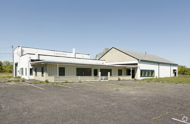
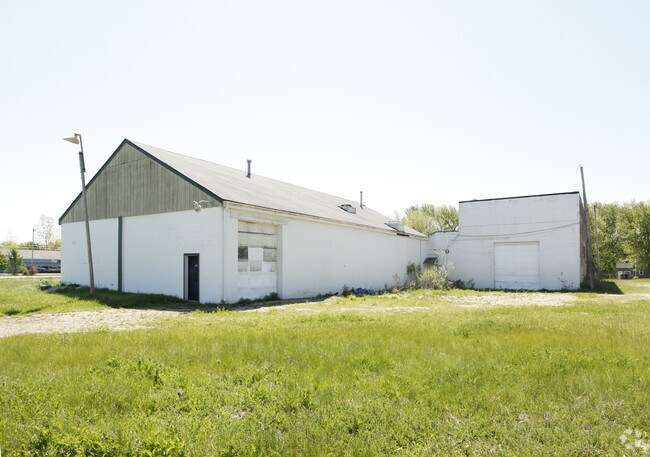
Property Record
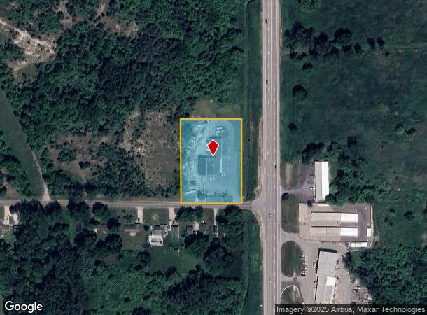
14500 S Us Highway 27, Dewitt, MI 48820
NEARBY LISTINGS FOR SALE OR LEASE
-
-
View all Dewitt listings for sale on LoopNet.com
Property Detail
14500 S Us Highway 27
050-021-100-051-00
COMM AT A PT 330 FT S OF THE NE COR OF SEC 21, TH S 660 FT, W 1320 FT, N 660 FT TH E 1320 FT TO THE POB BEING A PART OF THE
Warehouse
Clinton
AE
Michigan
26065C0020D
1.98 AC
0
Outlying Clinton County
2025
West Michigan
010201
Lansing-East Lansing, MI
9,160 SF
DEMOGRAPHICS near 14500 S Us Highway 27
1 Mile
3 Mile
5 Mile
2024 Total Population
2,714
18,902
76,848
2029 Population
2,808
19,398
77,505
Pop Growth 2024-2029
+ 3.46%
+ 2.62%
+ 0.85%
Average Age
42
41
39
2024 Total Households
1,047
7,606
33,158
HH Growth 2024-2029
+ 3.44%
+ 2.60%
+ 0.73%
Median Household Inc
$76,802
$74,140
$60,152
Avg Household Size
2.40
2.40
2.20
2024 Avg HH Vehicles
2.00
2.00
2.00
Median Home Value
$225,269
$221,832
$176,443
Median Year Built
1988
1982
1971
Nearby Places
Map Layers
Map Styles
 Street
 Aerial
- Restaurants
- Banks
- Shops
- Fitness
- Groceries
PUBLIC TRANSPORTATION
COMMUTER RAIL
DRIVE
WALK
Distance
15 min
9.6 mi
AIRPORT
Capital Region International
DRIVE
WALK
Distance
Capital Region International
13 min
5.8 mi
Nearby Properties
Address
Land Use
TOTAL SIZE
Lot Size
Zoning
Address
Land Use
TOTAL SIZE
Lot Size
Zoning
2,137 SF
12.72 AC
H LT IN
Address
Land Use
TOTAL SIZE
Lot Size
Zoning
142,152 SF
47.56 AC
B4
Address
Land Use
TOTAL SIZE
Lot Size
Zoning
4,312 SF
30.47 AC
M3
Address
Land Use
TOTAL SIZE
Lot Size
Zoning
5,180 SF
16.94 AC
M2
Address
Land Use
TOTAL SIZE
Lot Size
Zoning
3,252 SF
10.16 AC
M3
Address
Land Use
TOTAL SIZE
Lot Size
Zoning
2,092 SF
152.25 AC
MHP
Address
Land Use
TOTAL SIZE
Lot Size
Zoning
4,976 SF
6.23 AC
MF-N
Address
Land Use
TOTAL SIZE
Lot Size
Zoning
80,562 SF
1.05 AC
PD
Address
Land Use
TOTAL SIZE
Lot Size
Zoning
8,270 SF
13.15 AC
M3
Address
Land Use
TOTAL SIZE
Lot Size
Zoning
61,106 SF
0.47 AC
Address
Land Use
TOTAL SIZE
Lot Size
Zoning
20,000 SF
25.53 AC
BC
Address
Land Use
TOTAL SIZE
Lot Size
Zoning
4,590 SF
69.64 AC
MHP
Address
Land Use
TOTAL SIZE
Lot Size
Zoning
16,600 SF
19.22 AC
IL
Address
Land Use
TOTAL SIZE
Lot Size
Zoning
14,276 SF
6.42 AC
M3
Address
Land Use
TOTAL SIZE
Lot Size
Zoning
207,565 SF
11.50 AC
BC
Address
Land Use
TOTAL SIZE
Lot Size
Zoning
10,992 SF
10.43 AC
M3
Address
Land Use
TOTAL SIZE
Lot Size
Zoning
56,579 SF
8.48 AC
BSC
Address
Land Use
TOTAL SIZE
Lot Size
Zoning
4,464 SF
8.29 AC
MF
Address
Land Use
TOTAL SIZE
Lot Size
Zoning
86,211 SF
32.56 AC
BC
Address
Land Use
TOTAL SIZE
Lot Size
Zoning
58.89 AC
B4
Address
Land Use
TOTAL SIZE
Lot Size
Zoning
39,372 SF
5.86 AC
BSC
Address
Land Use
TOTAL SIZE
Lot Size
Zoning
19,000 SF
CB
Address
Land Use
TOTAL SIZE
Lot Size
Zoning
6,041 SF
A
Address
Land Use
TOTAL SIZE
Lot Size
Zoning
30.54 AC
B4
Address
Land Use
TOTAL SIZE
Lot Size
Zoning
21,453 SF
3.10 AC
B4
Address
Land Use
TOTAL SIZE
Lot Size
Zoning
49,500 SF
4.38 AC
IL
Address
Land Use
TOTAL SIZE
Lot Size
Zoning
13,923 SF
3.21 AC
IL
Address
Land Use
TOTAL SIZE
Lot Size
Zoning
24,707 SF
5.13 AC
F COMME
Address
Land Use
TOTAL SIZE
Lot Size
Zoning
40.53 AC
A RESID
Address
Land Use
TOTAL SIZE
Lot Size
Zoning
24.27 AC
B4
The World's #1 Commercial Real Estate Marketplace
Connect with us
© 2025 CoStar Group
The information above has been obtained from sources believed reliable. While we do not doubt its accuracy we have not verified it and make no guarantee, warranty or representation about it. It is your responsibility to independently confirm its accuracy and completeness. Any projections, opinions, assumptions, or estimates used are for example only and do not represent the current or future performance of the property. The value of this transaction to you depends on tax and other factors which should be evaluated by your tax, financial, and legal advisors. You and your advisors should conduct a careful, independent investigation of the property to determine to your satisfaction the suitability of the property for your needs.