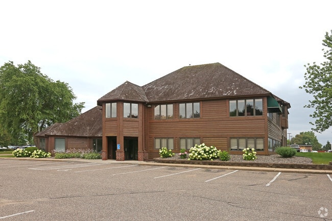
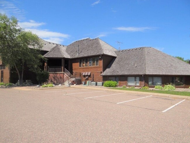
Property Record
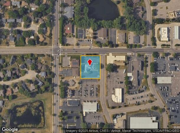
14501 Granada Dr, Saint Paul, MN 55124
Current Lease Availabilities
NEARBY LISTINGS FOR SALE OR LEASE
Property Detail
14501 Granada Dr
Minneapolis-St. Paul-Bloomington, MN-WI
Valley Commercial Park 2Nd
01-81201-15-001
VALLEY COMMERCIAL PARK 2ND 10 2 CIC #428 DENLAW CONDOMINIUM UNIT #1
Commercialnec
Dakota
X
Minnesota
27037C0201E
1
2024
0.91 AC
2024
Burnsville/Eagan/Apple Vy
060811
Minneapolis/St Paul
1,901 SF
DEMOGRAPHICS near 14501 Granada Dr
1 Mile
3 Mile
5 Mile
2024 Total Population
11,167
91,949
210,576
2029 Population
11,441
93,825
215,275
Pop Growth 2024-2029
+ 2.45%
+ 2.04%
+ 2.23%
Average Age
43
40
39
2024 Total Households
4,371
34,131
78,985
HH Growth 2024-2029
+ 2.59%
+ 2.17%
+ 2.33%
Median Household Inc
$81,144
$96,914
$98,156
Avg Household Size
2.40
2.60
2.60
2024 Avg HH Vehicles
2.00
2.00
2.00
Median Home Value
$301,714
$328,228
$331,699
Median Year Built
1982
1987
1988
Nearby Places
Map Layers
Map Styles
 Street
 Aerial
- Restaurants
- Banks
- Shops
- Fitness
- Groceries
PUBLIC TRANSPORTATION
AIRPORT
Minneapolis-St Paul International/Wold-Chamberlain
DRIVE
WALK
Distance
Minneapolis-St Paul International/Wold-Chamberlain
19 min
11.4 mi
Nearby Properties
Address
Land Use
TOTAL SIZE
Lot Size
Zoning
Address
Land Use
TOTAL SIZE
Lot Size
Zoning
339,871 SF
26.64 AC
Address
Land Use
TOTAL SIZE
Lot Size
Zoning
525,323 SF
8.09 AC
Address
Land Use
TOTAL SIZE
Lot Size
Zoning
519,392 SF
17.66 AC
Address
Land Use
TOTAL SIZE
Lot Size
Zoning
124,880 SF
20.24 AC
Address
Land Use
TOTAL SIZE
Lot Size
Zoning
435,642 SF
12.28 AC
Address
Land Use
TOTAL SIZE
Lot Size
Zoning
413,138 SF
11.86 AC
Address
Land Use
TOTAL SIZE
Lot Size
Zoning
312,292 SF
4.77 AC
Address
Land Use
TOTAL SIZE
Lot Size
Zoning
98,397 SF
12.42 AC
Address
Land Use
TOTAL SIZE
Lot Size
Zoning
24,750 SF
14.36 AC
Address
Land Use
TOTAL SIZE
Lot Size
Zoning
269,828 SF
3.58 AC
Address
Land Use
TOTAL SIZE
Lot Size
Zoning
419,750 SF
13.83 AC
Address
Land Use
TOTAL SIZE
Lot Size
Zoning
374,415 SF
20.10 AC
Address
Land Use
TOTAL SIZE
Lot Size
Zoning
361,645 SF
75.60 AC
Address
Land Use
TOTAL SIZE
Lot Size
Zoning
277,504 SF
5.27 AC
Address
Land Use
TOTAL SIZE
Lot Size
Zoning
351,484 SF
57.09 AC
Address
Land Use
TOTAL SIZE
Lot Size
Zoning
Address
Land Use
TOTAL SIZE
Lot Size
Zoning
289,168 SF
11.73 AC
Address
Land Use
TOTAL SIZE
Lot Size
Zoning
278,440 SF
13.61 AC
Address
Land Use
TOTAL SIZE
Lot Size
Zoning
273,843 SF
17.55 AC
Address
Land Use
TOTAL SIZE
Lot Size
Zoning
193,413 SF
2.95 AC
Address
Land Use
TOTAL SIZE
Lot Size
Zoning
207,187 SF
2.45 AC
Address
Land Use
TOTAL SIZE
Lot Size
Zoning
190,865 SF
3.67 AC
Address
Land Use
TOTAL SIZE
Lot Size
Zoning
241,204 SF
14.54 AC
Address
Land Use
TOTAL SIZE
Lot Size
Zoning
232,598 SF
3.61 AC
Address
Land Use
TOTAL SIZE
Lot Size
Zoning
181,880 SF
3.23 AC
Address
Land Use
TOTAL SIZE
Lot Size
Zoning
179,476 SF
2.46 AC
Address
Land Use
TOTAL SIZE
Lot Size
Zoning
168,324 SF
2.66 AC
Address
Land Use
TOTAL SIZE
Lot Size
Zoning
134,140 SF
6.39 AC
The World's #1 Commercial Real Estate Marketplace
Connect with us
© 2025 CoStar Group
The information above has been obtained from sources believed reliable. While we do not doubt its accuracy we have not verified it and make no guarantee, warranty or representation about it. It is your responsibility to independently confirm its accuracy and completeness. Any projections, opinions, assumptions, or estimates used are for example only and do not represent the current or future performance of the property. The value of this transaction to you depends on tax and other factors which should be evaluated by your tax, financial, and legal advisors. You and your advisors should conduct a careful, independent investigation of the property to determine to your satisfaction the suitability of the property for your needs.