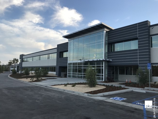
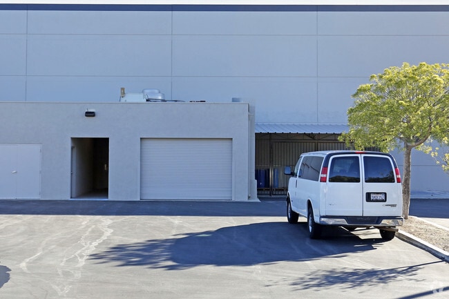
Property Record
14501 Princeton Ave, Moorpark, CA 93021

NEARBY LISTINGS FOR SALE OR LEASE
Property Detail
14501 Princeton Ave
513-0-010-305
Rancho Simi
Industrialgeneral
PR APN 5130010255
X
Ventura
06111C0836E
California
2024
8.25 AC
2025
Moorpark/Simi Val
007614
Los Angeles
186,344 SF
Oxnard-Thousand Oaks-Ventura, CA
DEMOGRAPHICS near 14501 Princeton Ave
1 mile
3 mile
5 mile
2024 Total Population
6,384
33,094
74,315
2029 Population
6,281
32,462
72,979
Pop Growth 2024-2029
(1.61%)
(1.91%)
(1.80%)
Average Age
39
40
42
2024 Total Households
2,013
10,447
25,396
HH Growth 2024-2029
(1.69%)
(2.11%)
(1.94%)
Median Household Inc
$120,775
$124,671
$121,467
Avg Household Size
3.10
3.10
2.80
2024 Avg HH Vehicles
2.00
2.00
2.00
Median Home Value
$699,753
$747,424
$770,792
Median Year Built
1983
1985
1985
Nearby Places
Map Layers
Map Styles
 Street
 Aerial
Transit
 Traffic
 Biking
Places
Listings with unknown addresses are not visible on the map
- Restaurants
- Banks
- Shops
- Fitness
- Groceries
PUBLIC TRANSPORTATION
COMMUTER RAIL
Moorpark (Ventura County Line - Southern California Regional Rail Authority (Metrolink))
Drive
Walk
Distance
Moorpark (Ventura County Line - Southern California Regional Rail Authority (Metrolink))
7 min
2.1 mi
AIRPORT
Bob Hope
Drive
Walk
Distance
Bob Hope
43 min
32.4 mi
Los Angeles International
Drive
Walk
Distance
Los Angeles International
62 min
48.3 mi
Freight Ports
The Port of Hueneme
Drive
Walk
Distance
The Port of Hueneme
42 min
25.0 mi
SALE & LEASE HISTORY
LISTING DATE
SALE/LEASE

Sep 25, 2016
For Lease
Sep 24, 2016
For Sale
Sep 24, 2016
For Sale
Sep 13, 2017
For Lease
Apr 12, 2018
For Lease
Nearby Properties
Address
Land Use
TOTAL SIZE
Lot Size
Zoning
Address
Land Use
TOTAL SIZE
Lot Size
Zoning
321,174 SF
14.21 AC
Address
Land Use
TOTAL SIZE
Lot Size
Zoning
68,205 SF
11.95 AC
M1
Address
Land Use
TOTAL SIZE
Lot Size
Zoning
152,456 SF
7.89 AC
RPD15
Address
Land Use
TOTAL SIZE
Lot Size
Zoning
134,520 SF
6.50 AC
RPD15
Address
Land Use
TOTAL SIZE
Lot Size
Zoning
62,274 SF
11.78 AC
M-1
Address
Land Use
TOTAL SIZE
Lot Size
Zoning
Address
Land Use
TOTAL SIZE
Lot Size
Zoning
Address
Land Use
TOTAL SIZE
Lot Size
Zoning
17,165 SF
11.52 AC
Address
Land Use
TOTAL SIZE
Lot Size
Zoning
127,176 SF
6.87 AC
Address
Land Use
TOTAL SIZE
Lot Size
Zoning
160,008 SF
40.68 AC
Address
Land Use
TOTAL SIZE
Lot Size
Zoning
134,726 SF
6.01 AC
M1
Address
Land Use
TOTAL SIZE
Lot Size
Zoning
1,332 SF
6.08 AC
Address
Land Use
TOTAL SIZE
Lot Size
Zoning
162,556 SF
6.21 AC
M1
Address
Land Use
TOTAL SIZE
Lot Size
Zoning
14,708 SF
16.08 AC
M-1
Address
Land Use
TOTAL SIZE
Lot Size
Zoning
12,748 SF
6.42 AC
Address
Land Use
TOTAL SIZE
Lot Size
Zoning
12,507 SF
9.05 AC
Address
Land Use
TOTAL SIZE
Lot Size
Zoning
63.14 AC
RE5AC
Address
Land Use
TOTAL SIZE
Lot Size
Zoning
44,840 SF
1.98 AC
RPD15
Address
Land Use
TOTAL SIZE
Lot Size
Zoning
12.24 AC
Address
Land Use
TOTAL SIZE
Lot Size
Zoning
43,525 SF
3.13 AC
RPD1
Address
Land Use
TOTAL SIZE
Lot Size
Zoning
24,849 SF
7.22 AC
Address
Land Use
TOTAL SIZE
Lot Size
Zoning
Address
Land Use
TOTAL SIZE
Lot Size
Zoning
143 SF
7.84 AC
RPD15
Address
Land Use
TOTAL SIZE
Lot Size
Zoning
95,711 SF
7.24 AC
Address
Land Use
TOTAL SIZE
Lot Size
Zoning
11,736 SF
4.08 AC
RPD5
Address
Land Use
TOTAL SIZE
Lot Size
Zoning
129,541 SF
6.08 AC
Address
Land Use
TOTAL SIZE
Lot Size
Zoning
48,586 SF
5.15 AC
Address
Land Use
TOTAL SIZE
Lot Size
Zoning
7,102 SF
4.98 AC
MULT
Address
Land Use
TOTAL SIZE
Lot Size
Zoning
14,618 SF
1.27 AC
Address
Land Use
TOTAL SIZE
Lot Size
Zoning
41,230 SF
3.37 AC
The World's #1 Commercial Real Estate Marketplace
Connect with us
© 2026 CoStar Group
The information above has been obtained from sources believed reliable. While we do not doubt its accuracy we have not verified it and make no guarantee, warranty or representation about it. It is your responsibility to independently confirm its accuracy and completeness. Any projections, opinions, assumptions, or estimates used are for example only and do not represent the current or future performance of the property. The value of this transaction to you depends on tax and other factors which should be evaluated by your tax, financial, and legal advisors. You and your advisors should conduct a careful, independent investigation of the property to determine to your satisfaction the suitability of the property for your needs.