Property Record
1451 E Southport Rd, Indianapolis, IN 46227

NEARBY LISTINGS FOR SALE OR LEASE
Property Detail
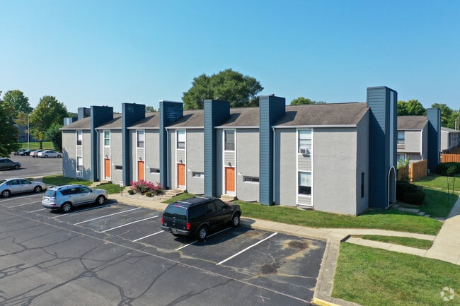
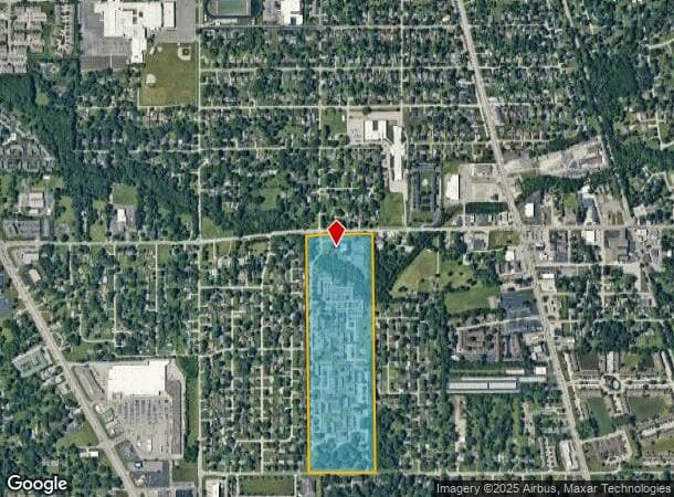
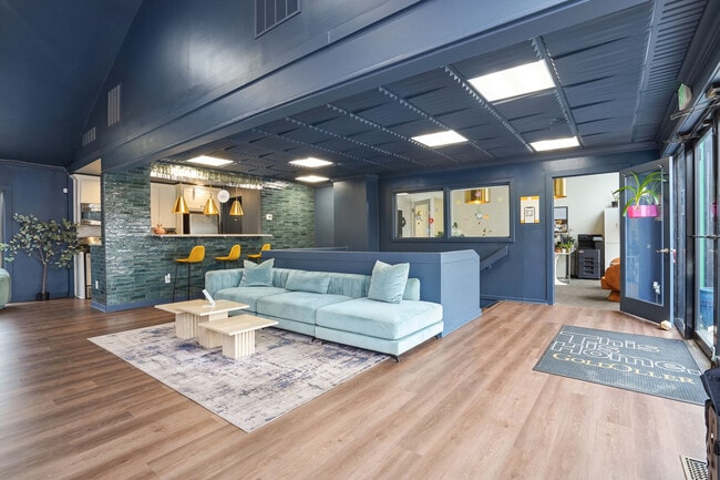
1451 E Southport Rd
Indianapolis-Carmel-Anderson, IN
Tuscan Point Apts
49-15-18-113-002.000-500
PT NW1/4 S18 T14 R4 BEG 749.1FT W OF SE COR W723.69FT N 2663.35FT E 727.69FT S 2665.77FT TOBEG 44.43AC
Apartment
Marion
2023
Indiana
2024
44.43 AC
381004
South Perry
3,782 SF
Indianapolis
DEMOGRAPHICS near 1451 E Southport Rd
1 Mile
3 Mile
5 Mile
2024 Total Population
10,830
89,735
209,714
2029 Population
10,654
88,968
210,313
Pop Growth 2024-2029
(1.63%)
(0.85%)
+ 0.29%
Average Age
37
38
38
2024 Total Households
4,384
35,246
82,381
HH Growth 2024-2029
(1.71%)
(0.79%)
+ 0.38%
Median Household Inc
$62,615
$62,437
$65,942
Avg Household Size
2.40
2.50
2.50
2024 Avg HH Vehicles
2.00
2.00
2.00
Median Home Value
$190,982
$192,126
$189,329
Median Year Built
1965
1975
1979
Nearby Places
Map Layers
Map Styles
 Street
 Aerial
- Restaurants
- Banks
- Shops
- Fitness
- Groceries
PUBLIC TRANSPORTATION
COMMUTER RAIL
Indianapolis (Cardinal - Amtrak)
DRIVE
WALK
Distance
Indianapolis (Cardinal - Amtrak)
13 min
7.8 mi
AIRPORT
Indianapolis International
DRIVE
WALK
Distance
Indianapolis International
30 min
17.4 mi
Freight Ports
Port of Toledo
DRIVE
WALK
Distance
Port of Toledo
281 min
235.1 mi
SALE & LEASE HISTORY
LISTING DATE
SALE/LEASE

Feb 04, 2019
For Sale
Nearby Properties
Address
Land Use
TOTAL SIZE
Lot Size
Zoning
Address
Land Use
TOTAL SIZE
Lot Size
Zoning
295,161 SF
70.54 AC
Address
Land Use
TOTAL SIZE
Lot Size
Zoning
56,520 SF
35.65 AC
Address
Land Use
TOTAL SIZE
Lot Size
Zoning
5,576 SF
14.15 AC
ZO01
Address
Land Use
TOTAL SIZE
Lot Size
Zoning
3,286 SF
26.39 AC
Address
Land Use
TOTAL SIZE
Lot Size
Zoning
19,927 SF
28.82 AC
ZO01
Address
Land Use
TOTAL SIZE
Lot Size
Zoning
6,786 SF
45.81 AC
Address
Land Use
TOTAL SIZE
Lot Size
Zoning
21,784 SF
30.75 AC
ZO01
Address
Land Use
TOTAL SIZE
Lot Size
Zoning
2,911 SF
24.62 AC
ZO01
Address
Land Use
TOTAL SIZE
Lot Size
Zoning
23,040 SF
9.28 AC
ZO01
Address
Land Use
TOTAL SIZE
Lot Size
Zoning
4,478 SF
12.05 AC
Address
Land Use
TOTAL SIZE
Lot Size
Zoning
226,129 SF
18.69 AC
ZO01
Address
Land Use
TOTAL SIZE
Lot Size
Zoning
3,818 SF
15.24 AC
Address
Land Use
TOTAL SIZE
Lot Size
Zoning
1,102 SF
9.98 AC
Address
Land Use
TOTAL SIZE
Lot Size
Zoning
155,088 SF
20.85 AC
ZO01
Address
Land Use
TOTAL SIZE
Lot Size
Zoning
3,935 SF
36.09 AC
ZO01
Address
Land Use
TOTAL SIZE
Lot Size
Zoning
3,793 SF
23.47 AC
ZO01
Address
Land Use
TOTAL SIZE
Lot Size
Zoning
2,320 SF
7.92 AC
ZO01
Address
Land Use
TOTAL SIZE
Lot Size
Zoning
4,476 SF
12.18 AC
Address
Land Use
TOTAL SIZE
Lot Size
Zoning
1,925 SF
29.98 AC
Address
Land Use
TOTAL SIZE
Lot Size
Zoning
3,337 SF
21.53 AC
ZO01
Address
Land Use
TOTAL SIZE
Lot Size
Zoning
3,296 SF
21 AC
Address
Land Use
TOTAL SIZE
Lot Size
Zoning
3,202 SF
18.62 AC
ZO01
Address
Land Use
TOTAL SIZE
Lot Size
Zoning
3,701 SF
26 AC
ZO01
Address
Land Use
TOTAL SIZE
Lot Size
Zoning
108,092 SF
23.62 AC
ZO01
Address
Land Use
TOTAL SIZE
Lot Size
Zoning
73,680 SF
5.62 AC
ZO01
Address
Land Use
TOTAL SIZE
Lot Size
Zoning
3,168 SF
8.62 AC
Address
Land Use
TOTAL SIZE
Lot Size
Zoning
5,665 SF
25.25 AC
ZO01
Address
Land Use
TOTAL SIZE
Lot Size
Zoning
1,960 SF
23.76 AC
Address
Land Use
TOTAL SIZE
Lot Size
Zoning
39,618 SF
8.17 AC
ZO01
The World's #1 Commercial Real Estate Marketplace
Connect with us
© 2026 CoStar Group
The information above has been obtained from sources believed reliable. While we do not doubt its accuracy we have not verified it and make no guarantee, warranty or representation about it. It is your responsibility to independently confirm its accuracy and completeness. Any projections, opinions, assumptions, or estimates used are for example only and do not represent the current or future performance of the property. The value of this transaction to you depends on tax and other factors which should be evaluated by your tax, financial, and legal advisors. You and your advisors should conduct a careful, independent investigation of the property to determine to your satisfaction the suitability of the property for your needs.