Property Record
14510 45Th St Ne, Saint Michael, MN 55376


NEARBY LISTINGS FOR SALE OR LEASE
-
-
View all Saint Michael listings for sale on LoopNet.com
Property Detail
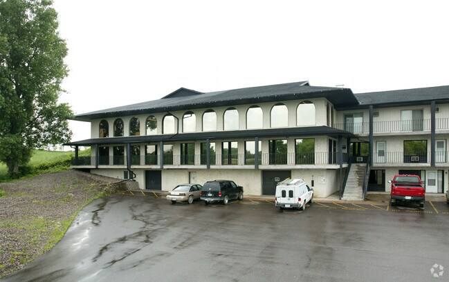
14510 45Th St Ne
Minneapolis-St. Paul-Bloomington, MN-WI
Unplatted Land St Michael2
114-800-092100
SECT-09 TWP-120 RANGE-023 UNPLATTED LAND ST MICHAEL2 W3A OF SW1/4 OF NE1/4 & W1/2 OF NE1/4 OF SW1/4 N OF HWY & E1/2 OF NW1/4
Officebuilding
Wright
2025
Minnesota
2025
44.90 AC
100806
Wright County
6,243 SF
Minneapolis/St Paul
DEMOGRAPHICS near 14510 45Th St Ne
1 Mile
3 Mile
5 Mile
2024 Total Population
2,456
21,836
63,205
2029 Population
2,723
23,529
69,230
Pop Growth 2024-2029
+ 10.87%
+ 7.75%
+ 9.53%
Average Age
38
36
36
2024 Total Households
813
7,283
21,256
HH Growth 2024-2029
+ 10.95%
+ 7.92%
+ 9.59%
Median Household Inc
$124,007
$118,736
$120,668
Avg Household Size
3.00
3.00
2.90
2024 Avg HH Vehicles
2.00
2.00
2.00
Median Home Value
$372,863
$357,118
$341,621
Median Year Built
2002
2002
2002
Nearby Places
Map Layers
Map Styles
 Street
 Aerial
- Restaurants
- Banks
- Shops
- Fitness
- Groceries
PUBLIC TRANSPORTATION
COMMUTER RAIL
Elk River Station (Northstar Corridor - Northstar Commuter Rail)
DRIVE
WALK
Distance
Elk River Station (Northstar Corridor - Northstar Commuter Rail)
14 min
8.5 mi
AIRPORT
Minneapolis-St Paul International/Wold-Chamberlain
DRIVE
WALK
Distance
Minneapolis-St Paul International/Wold-Chamberlain
52 min
40.0 mi
Freight Ports
Port Milwaukee
DRIVE
WALK
Distance
Port Milwaukee
404 min
365.1 mi
Nearby Properties
Address
Land Use
TOTAL SIZE
Lot Size
Zoning
Address
Land Use
TOTAL SIZE
Lot Size
Zoning
706,604 SF
30.67 AC
Address
Land Use
TOTAL SIZE
Lot Size
Zoning
3.32 AC
Address
Land Use
TOTAL SIZE
Lot Size
Zoning
8.10 AC
Address
Land Use
TOTAL SIZE
Lot Size
Zoning
401,188 SF
20.74 AC
Address
Land Use
TOTAL SIZE
Lot Size
Zoning
16.17 AC
Address
Land Use
TOTAL SIZE
Lot Size
Zoning
40,984 SF
34.62 AC
Address
Land Use
TOTAL SIZE
Lot Size
Zoning
299,904 SF
18.63 AC
Address
Land Use
TOTAL SIZE
Lot Size
Zoning
Address
Land Use
TOTAL SIZE
Lot Size
Zoning
267,924 SF
13.88 AC
Address
Land Use
TOTAL SIZE
Lot Size
Zoning
58.85 AC
Address
Land Use
TOTAL SIZE
Lot Size
Zoning
Address
Land Use
TOTAL SIZE
Lot Size
Zoning
212,224 SF
12.84 AC
Address
Land Use
TOTAL SIZE
Lot Size
Zoning
31,553 SF
41.63 AC
Address
Land Use
TOTAL SIZE
Lot Size
Zoning
Address
Land Use
TOTAL SIZE
Lot Size
Zoning
14.07 AC
Address
Land Use
TOTAL SIZE
Lot Size
Zoning
Address
Land Use
TOTAL SIZE
Lot Size
Zoning
7,932 SF
13.29 AC
Address
Land Use
TOTAL SIZE
Lot Size
Zoning
21,935 SF
4.15 AC
Address
Land Use
TOTAL SIZE
Lot Size
Zoning
Address
Land Use
TOTAL SIZE
Lot Size
Zoning
Address
Land Use
TOTAL SIZE
Lot Size
Zoning
16.09 AC
Address
Land Use
TOTAL SIZE
Lot Size
Zoning
154,800 SF
8.74 AC
Address
Land Use
TOTAL SIZE
Lot Size
Zoning
12.34 AC
Address
Land Use
TOTAL SIZE
Lot Size
Zoning
16.21 AC
Address
Land Use
TOTAL SIZE
Lot Size
Zoning
Address
Land Use
TOTAL SIZE
Lot Size
Zoning
Address
Land Use
TOTAL SIZE
Lot Size
Zoning
15,560 SF
59.44 AC
Address
Land Use
TOTAL SIZE
Lot Size
Zoning
12,250 SF
20.65 AC
Address
Land Use
TOTAL SIZE
Lot Size
Zoning
78,708 SF
7.71 AC
The World's #1 Commercial Real Estate Marketplace
Connect with us
© 2025 CoStar Group
The information above has been obtained from sources believed reliable. While we do not doubt its accuracy we have not verified it and make no guarantee, warranty or representation about it. It is your responsibility to independently confirm its accuracy and completeness. Any projections, opinions, assumptions, or estimates used are for example only and do not represent the current or future performance of the property. The value of this transaction to you depends on tax and other factors which should be evaluated by your tax, financial, and legal advisors. You and your advisors should conduct a careful, independent investigation of the property to determine to your satisfaction the suitability of the property for your needs.