Property Record
14520 Ronald W Reagan Blvd, Cedar Park, TX 78641
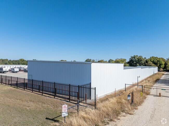

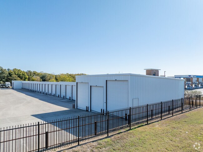
Property Detail
14520 Ronald W Reagan Blvd
R031485
AW0016 AW0016 - ANDERSON, J.D. SUR., ACRES 6.695
Commercialnec
Williamson
AE The base floodplain where base flood elevations are provided. AE Zones are now used on new format FIRMs instead of A1-A30 Zones.
Texas
2024
6.70 AC
2025
Round Rock
020310
Austin
31,321 SF
Austin-Round Rock-San Marcos, TX
NEARBY LISTINGS FOR SALE OR LEASE
DEMOGRAPHICS near 14520 Ronald W Reagan Blvd
1 mile
3 mile
5 mile
2025 Total Population
5,093
63,953
199,244
2030 Population
5,916
72,810
227,015
Pop Growth 2025-2030
+ 16.16%
+ 13.85%
+ 13.94%
Average Age
36
36
37
2025 Total Households
1,686
21,995
68,838
HH Growth 2025-2030
+ 16.55%
+ 14.39%
+ 14.45%
Median Household Inc
$145,116
$138,211
$140,949
Avg Household Size
3.00
2.90
2.90
2025 Avg HH Vehicles
2.00
2.00
2.00
Median Home Value
$634,872
$537,388
$552,480
Median Year Built
2011
2010
2008
Nearby Places
Map Layers
Map Styles
 Street
 Aerial
Transit
 Traffic
 Biking
Places
Listings with unknown addresses are not visible on the map
- Restaurants
- Banks
- Shops
- Fitness
- Groceries
PUBLIC TRANSPORTATION
AIRPORT
Austin-Bergstrom International
Drive
Walk
Distance
Austin-Bergstrom International
50 min
36.0 mi
Freight Ports
Calhoun Port
Drive
Walk
Distance
Calhoun Port
216 min
179.4 mi
Nearby Properties
Address
Land Use
TOTAL SIZE
Lot Size
Zoning
Address
Land Use
TOTAL SIZE
Lot Size
Zoning
338,919 SF
42.88 AC
Address
Land Use
TOTAL SIZE
Lot Size
Zoning
277,152 SF
45.29 AC
Address
Land Use
TOTAL SIZE
Lot Size
Zoning
350,637 SF
10.36 AC
Address
Land Use
TOTAL SIZE
Lot Size
Zoning
313,727 SF
6.64 AC
Address
Land Use
TOTAL SIZE
Lot Size
Zoning
1 SF
138.94 AC
Address
Land Use
TOTAL SIZE
Lot Size
Zoning
329,104 SF
19.97 AC
Address
Land Use
TOTAL SIZE
Lot Size
Zoning
181,000 SF
30.14 AC
Address
Land Use
TOTAL SIZE
Lot Size
Zoning
310,297 SF
15.01 AC
Address
Land Use
TOTAL SIZE
Lot Size
Zoning
333,388 SF
14.04 AC
Address
Land Use
TOTAL SIZE
Lot Size
Zoning
330,685 SF
20.17 AC
Address
Land Use
TOTAL SIZE
Lot Size
Zoning
255,253 SF
26.57 AC
Address
Land Use
TOTAL SIZE
Lot Size
Zoning
335,765 SF
4.10 AC
Address
Land Use
TOTAL SIZE
Lot Size
Zoning
223,681 SF
7.78 AC
Address
Land Use
TOTAL SIZE
Lot Size
Zoning
250,556 SF
17.51 AC
Address
Land Use
TOTAL SIZE
Lot Size
Zoning
289,565 SF
14.35 AC
Address
Land Use
TOTAL SIZE
Lot Size
Zoning
205,563 SF
18.24 AC
4-GR
Address
Land Use
TOTAL SIZE
Lot Size
Zoning
180,799 SF
22.90 AC
Address
Land Use
TOTAL SIZE
Lot Size
Zoning
246,581 SF
16.75 AC
Address
Land Use
TOTAL SIZE
Lot Size
Zoning
117,076 SF
15.51 AC
Address
Land Use
TOTAL SIZE
Lot Size
Zoning
195,426 SF
12.11 AC
Address
Land Use
TOTAL SIZE
Lot Size
Zoning
249,862 SF
16.14 AC
Address
Land Use
TOTAL SIZE
Lot Size
Zoning
316,408 SF
15 AC
Address
Land Use
TOTAL SIZE
Lot Size
Zoning
149,429 SF
16.98 AC
Address
Land Use
TOTAL SIZE
Lot Size
Zoning
151,181 SF
6 AC
Address
Land Use
TOTAL SIZE
Lot Size
Zoning
89,872 SF
45.29 AC
Address
Land Use
TOTAL SIZE
Lot Size
Zoning
86,764 SF
Address
Land Use
TOTAL SIZE
Lot Size
Zoning
251,691 SF
14.73 AC
Address
Land Use
TOTAL SIZE
Lot Size
Zoning
72,489 SF
8.99 AC
Address
Land Use
TOTAL SIZE
Lot Size
Zoning
166,265 SF
15.29 AC
3-PD
Address
Land Use
TOTAL SIZE
Lot Size
Zoning
37.81 AC
The World's #1 Commercial Real Estate Marketplace
Connect with us
© 2026 CoStar Group
The information above has been obtained from sources believed reliable. While we do not doubt its accuracy we have not verified it and make no guarantee, warranty or representation about it. It is your responsibility to independently confirm its accuracy and completeness. Any projections, opinions, assumptions, or estimates used are for example only and do not represent the current or future performance of the property. The value of this transaction to you depends on tax and other factors which should be evaluated by your tax, financial, and legal advisors. You and your advisors should conduct a careful, independent investigation of the property to determine to your satisfaction the suitability of the property for your needs.