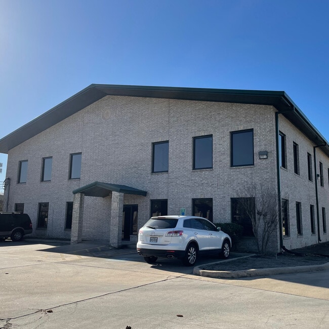
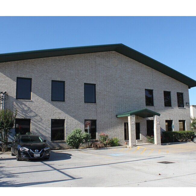
Property Record
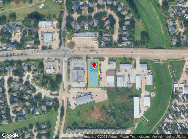
14525 Fm 529 Rd, Houston, TX 77095
Current Lease Availabilities
NEARBY LISTINGS FOR SALE OR LEASE
Property Detail
14525 Fm 529 Rd
1227440010001
Fm 529 Fourteen Five Twenty-Five
Officebuilding
RES A BLK 1 FM 529 FOURTEEN FIVE TWENTY-FIVE
X
Harris
48201C0420P
Texas
2024
0.86 AC
2025
FM 1960/Hwy 249
540602
Houston
13,050 SF
Houston-The Woodlands-Sugar Land, TX
DEMOGRAPHICS near 14525 Fm 529 Rd
1 Mile
3 Mile
5 Mile
2024 Total Population
12,512
121,823
269,896
2029 Population
12,670
123,045
272,560
Pop Growth 2024-2029
+ 1.26%
+ 1.00%
+ 0.99%
Average Age
38
37
37
2024 Total Households
4,200
42,629
91,788
HH Growth 2024-2029
+ 1.26%
+ 1.00%
+ 0.94%
Median Household Inc
$84,668
$73,041
$80,023
Avg Household Size
2.90
2.80
2.90
2024 Avg HH Vehicles
2.00
2.00
2.00
Median Home Value
$209,751
$227,769
$230,958
Median Year Built
1988
1991
1994
Nearby Places
- Restaurants
- Banks
- Shops
- Fitness
- Groceries
PUBLIC TRANSPORTATION
AIRPORT
George Bush Intcntl/Houston
DRIVE
WALK
Distance
George Bush Intcntl/Houston
33 min
25.1 mi
William P Hobby
DRIVE
WALK
Distance
William P Hobby
52 min
33.6 mi
Freight Ports
Port of Houston
DRIVE
WALK
Distance
Port of Houston
43 min
29.3 mi
Nearby Properties
Address
Land Use
TOTAL SIZE
Lot Size
Zoning
Address
Land Use
TOTAL SIZE
Lot Size
Zoning
625,701 SF
52.20 AC
Address
Land Use
TOTAL SIZE
Lot Size
Zoning
697,158 SF
Address
Land Use
TOTAL SIZE
Lot Size
Zoning
664,361 SF
39.18 AC
Address
Land Use
TOTAL SIZE
Lot Size
Zoning
380,959 SF
21.43 AC
Address
Land Use
TOTAL SIZE
Lot Size
Zoning
386,642 SF
14.45 AC
Address
Land Use
TOTAL SIZE
Lot Size
Zoning
466,299 SF
23.82 AC
Address
Land Use
TOTAL SIZE
Lot Size
Zoning
120.78 AC
Address
Land Use
TOTAL SIZE
Lot Size
Zoning
373,516 SF
18.63 AC
Address
Land Use
TOTAL SIZE
Lot Size
Zoning
266,802 SF
3.14 AC
Address
Land Use
TOTAL SIZE
Lot Size
Zoning
358,713 SF
19.91 AC
Address
Land Use
TOTAL SIZE
Lot Size
Zoning
320,084 SF
8.01 AC
Address
Land Use
TOTAL SIZE
Lot Size
Zoning
471,800 SF
27.03 AC
Address
Land Use
TOTAL SIZE
Lot Size
Zoning
307,698 SF
13.12 AC
Address
Land Use
TOTAL SIZE
Lot Size
Zoning
387,245 SF
18.18 AC
Address
Land Use
TOTAL SIZE
Lot Size
Zoning
408,144 SF
26.13 AC
Address
Land Use
TOTAL SIZE
Lot Size
Zoning
392,185 SF
30.73 AC
Address
Land Use
TOTAL SIZE
Lot Size
Zoning
402,712 SF
25.64 AC
Address
Land Use
TOTAL SIZE
Lot Size
Zoning
491,051 SF
50 AC
Address
Land Use
TOTAL SIZE
Lot Size
Zoning
388,223 SF
14.99 AC
Address
Land Use
TOTAL SIZE
Lot Size
Zoning
384,280 SF
27.19 AC
Address
Land Use
TOTAL SIZE
Lot Size
Zoning
363,896 SF
21.69 AC
Address
Land Use
TOTAL SIZE
Lot Size
Zoning
371,729 SF
18.73 AC
Address
Land Use
TOTAL SIZE
Lot Size
Zoning
364,057 SF
22.03 AC
Address
Land Use
TOTAL SIZE
Lot Size
Zoning
112,440 SF
8.02 AC
Address
Land Use
TOTAL SIZE
Lot Size
Zoning
301,102 SF
12.58 AC
Address
Land Use
TOTAL SIZE
Lot Size
Zoning
327,674 SF
15.32 AC
Address
Land Use
TOTAL SIZE
Lot Size
Zoning
342,196 SF
15.13 AC
Address
Land Use
TOTAL SIZE
Lot Size
Zoning
493,233 SF
25.82 AC
Address
Land Use
TOTAL SIZE
Lot Size
Zoning
232,717 SF
10.21 AC
Address
Land Use
TOTAL SIZE
Lot Size
Zoning
292,466 SF
12.18 AC
The World's #1 Commercial Real Estate Marketplace
Connect with us
© 2025 CoStar Group
The information above has been obtained from sources believed reliable. While we do not doubt its accuracy we have not verified it and make no guarantee, warranty or representation about it. It is your responsibility to independently confirm its accuracy and completeness. Any projections, opinions, assumptions, or estimates used are for example only and do not represent the current or future performance of the property. The value of this transaction to you depends on tax and other factors which should be evaluated by your tax, financial, and legal advisors. You and your advisors should conduct a careful, independent investigation of the property to determine to your satisfaction the suitability of the property for your needs.